

New Swell Fills in Today from SSW & NW

Image: James Grenz
Alerts (as of 1:00 a.m.)
There are no weather alerts posted at this time.
**Click directly on the images below to make them larger. Charts include: Big Island projected winds, tides, swell direction & period and expected wave heights.**
Big Island Surf Forecast
Hilo side: Wave heights are forecast to be knee/shoulder high today.
Kona side: Wave heights are expected to be knee/waist high today. The best breaks could get up to tummy/chest high in the morning. By afternoon, waist/shoulder high waves are expected as the swell peaks.
South: Wave heights are expected to be knee/waist high today. The best breaks could get up to tummy/chest high in the morning. By afternoon, waist/shoulder high waves are expected as the swell peaks.
A fun south-southwest is forecast to fill in Friday from a storm system that recently developed near New Zealand. This swell will begin to ease Sunday into early next week. Another south-southwest is forecast from the 19th to the 21st.
A series of small northerly swells are expected this week. The largest is forecast to fill in Friday. None of these swells are expected to produce High Surf Advisory-level waves.
Keep in mind, surf heights are measured on the face of the wave from trough to crest. Heights vary from beach to beach, and at the same beach, from break to break.
**Click here for your detailed Big Island weather report.**
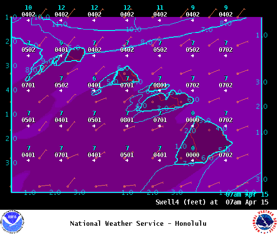
Image: NOAA
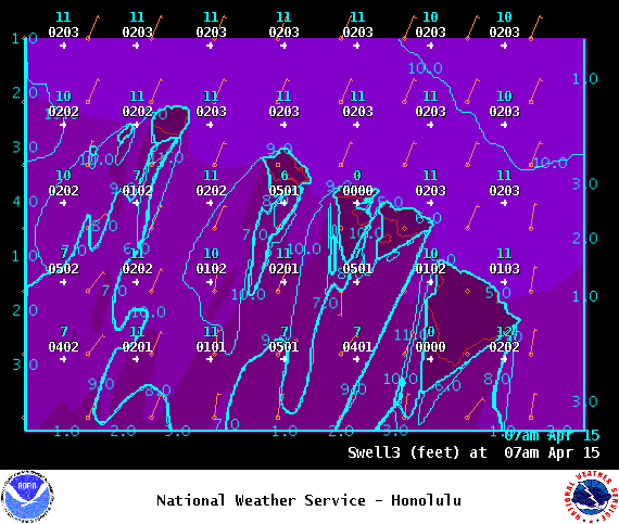
Image: NOAA
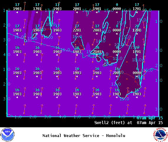
Image: NOAA

Image: NOAA
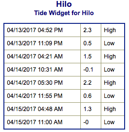
Image: NOAA

Image: NOAA
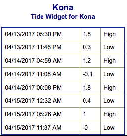
Image: NOAA
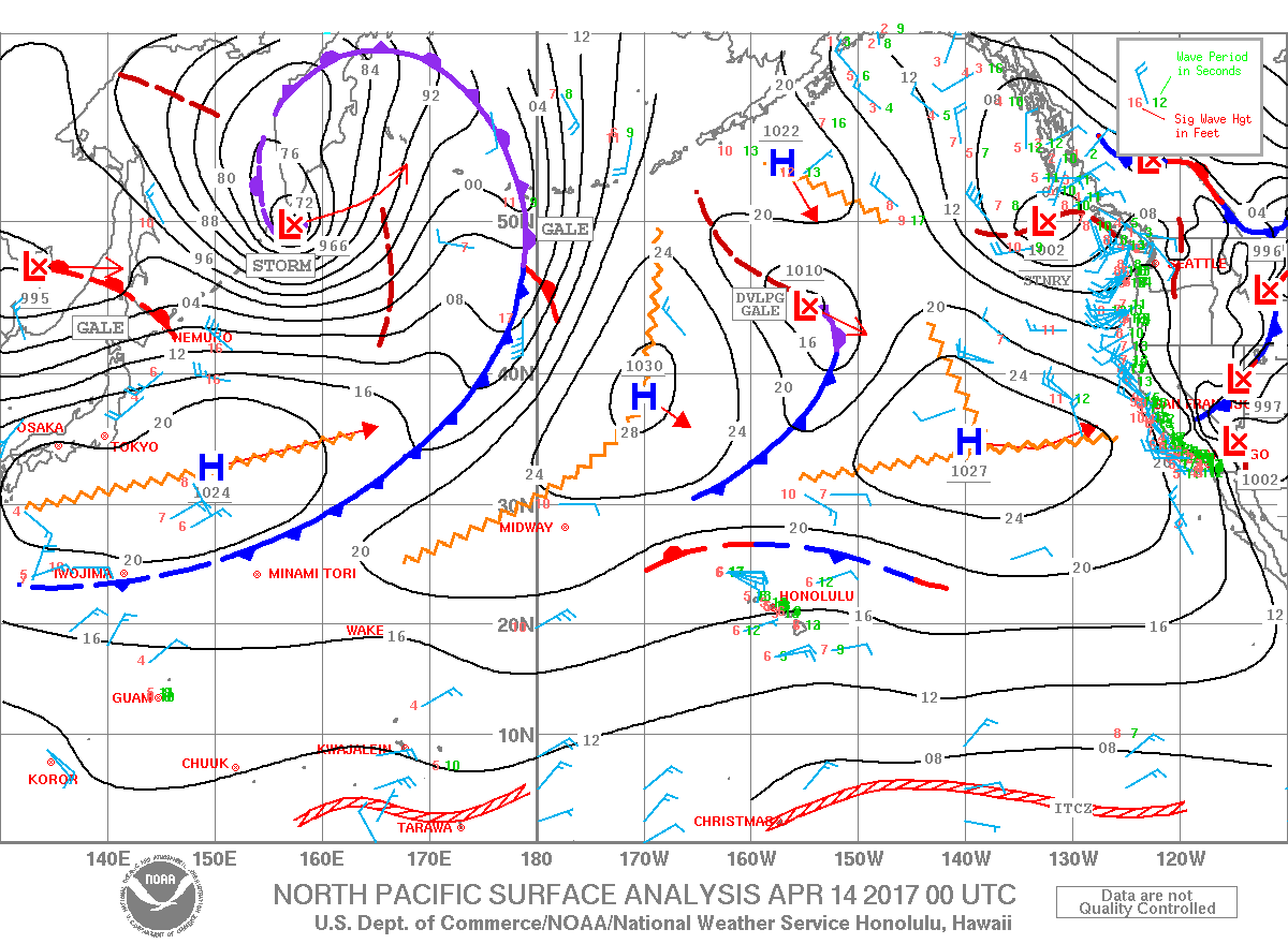
Image: NOAA
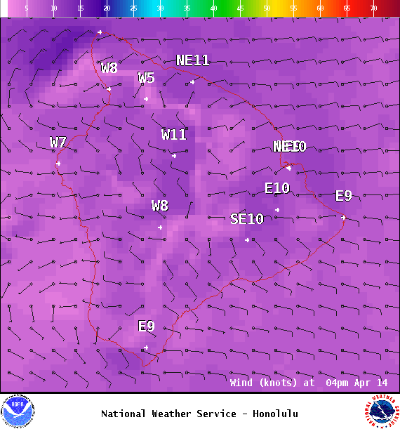
Image: NOAA
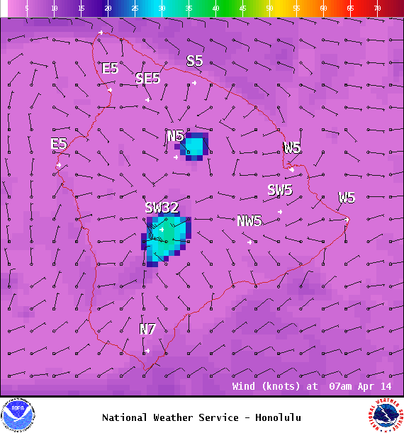
Image: NOAA
Sponsored Content


