

Easing Swells Today, New Swells Expected Soon

Image: James Grenz
Alerts (as of 1:00 a.m.)
There are no weather alerts posted at this time.
**Click directly on the images below to make them larger. Charts include: Big Island projected winds, tides, swell direction & period and expected wave heights.**
Big Island Surf Forecast
Hilo side: Wave heights are forecast to be knee/shoulder high today.
Kona side: Wave heights are expected to be knee/thigh high today or less.
South: Wave heights are expected to be knee/thigh high today or less.
Small south-southwest continues to fade. We may see some better swell near the end of the month around the 24th – 26th and during the last few days of the month.
Our current west-northwest swell is expected to continue fading. A larger west-northwest is lining up for the 19th through the 23rd, peaking Monday/Tuesday.
Keep in mind, surf heights are measured on the face of the wave from trough to crest. Heights vary from beach to beach, and at the same beach, from break to break.
**Click here for your detailed Big Island weather report.**
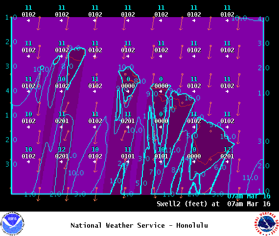
Image: NOAA

Image: NOAA
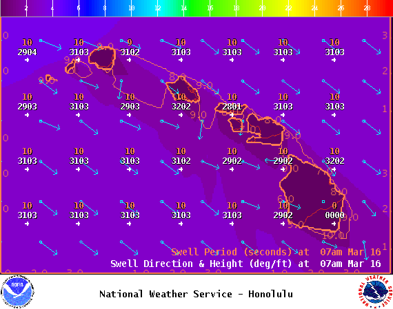
Image: NOAA
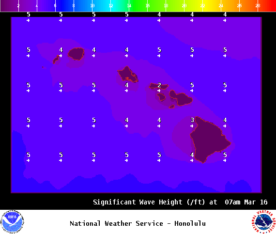
Image: NOAA
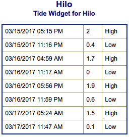
Image: NOAA

Image: NOAA
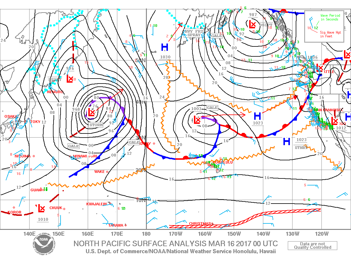
Image: NOAA
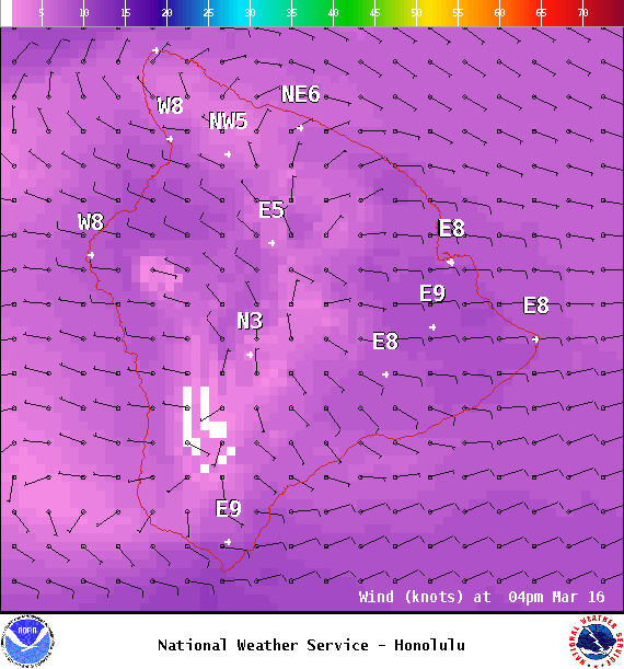
Image: NOAA
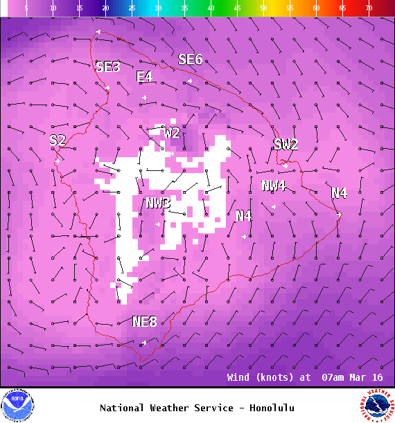
Image: NOAA
Sponsored Content


