

SW & NW Swells Expected for the Weekend

Image: Jeff Hansel
Alerts (as of 1:00 a.m.)
There are no weather alerts posted at this time.
**Click directly on the images below to make them larger. Charts include: Big Island projected winds, tides, swell direction & period and expected wave heights.**
Big Island Surf Forecast
Hilo side: Wave heights are forecast to be shoulder/head high today.
Kona side: Wave heights are expected to be waist/chest high today with shoulder high sets at the best breaks.
South: Wave heights are expected to be waist/chest high today with shoulder high sets at the best breaks.
A moderate northwest is forecast for Sunday with a larger swell on its heels, peaking Monday just below advisory levels and fading Tuesday.
A series of small south swells are also expected through the next week. A south-southwest is expected to peak this weekend and fade early next week.
Keep in mind, surf heights are measured on the face of the wave from trough to crest. Heights vary from beach to beach, and at the same beach, from break to break.
**Click here for your detailed Big Island weather report.**
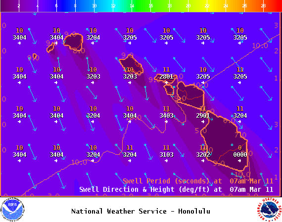
Image: NOAA
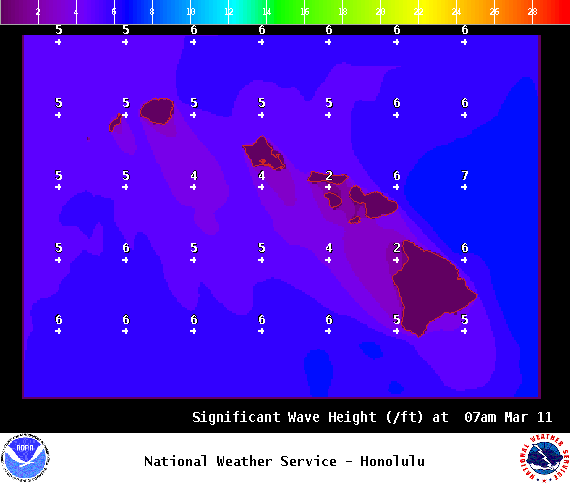
Image: NOAA
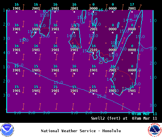
Image: NOAA
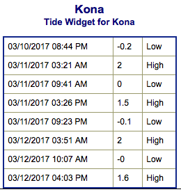
Image: NOAA
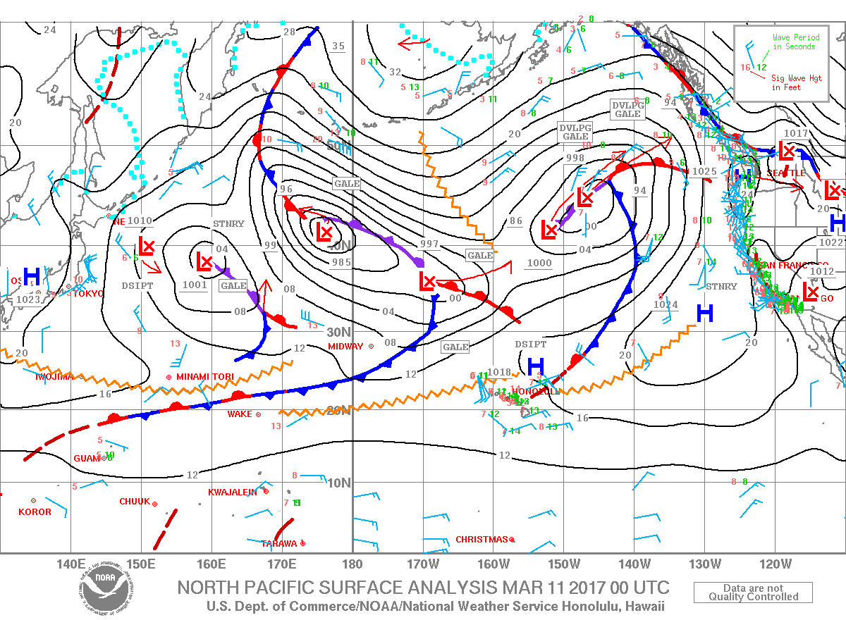
Image: NOAA
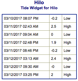
Image: NOAA
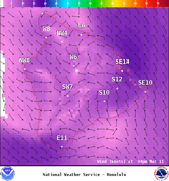
Image: NOAA
Sponsored Content


