

WNW Fading Today, New XL Swell Prompts Warning

Image: James Grenz
Alerts (as of 1:00 a.m.)
Small Craft Advisory: Windward waters of Big Island through 6 a.m. Thursday.
High Surf Warning: North shore of Big Island through 6 a.m. Thursday.
Flash Flood Watch: Through late tonight. A disturbance will strengthen and pass over the islands later today and tonight. While isolated heavy showers could develop over all islands today, the main threat for heavy showers and thunderstorms will be along a band of moisture currently stalled near Maui and the Big Island. This band is expected to move north tonight and Thursday.
**Click directly on the images below to make them larger. Charts include: Big Island projected winds, tides, swell direction & period and expected wave heights.**
Big Island Surf Forecast
Hilo side: Wave heights are forecast to be head high to several feet overhead today.
Kona side: Wave heights are expected to be tummy/chest high today and fading. Small southwest mixes in today with a northwest possibly filling in by sunset.
South: Wave heights are expected to be tummy/chest high today and fading. Small southwest mixes in today.
West-northwest is fading today. New west-northwest is filling in late Wednesday into Thursday. This is expected to be a warning level swell. The northwest shores will feel the effects with a lot of shadowing for the Kona coast.
A small south-southwest is showing through Friday with a slightly bigger swell right on its heels for the weekend.
Keep in mind, surf heights are measured on the face of the wave from trough to crest. Heights vary from beach to beach, and at the same beach, from break to break.
**Click here for your detailed Big Island weather report.**
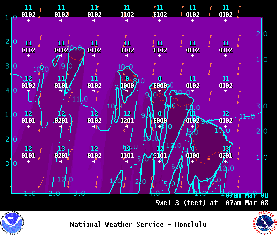
Image: NOAA

Image: NOAA
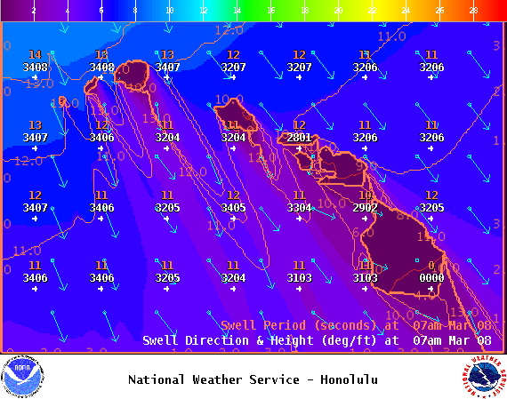
Image: NOAA
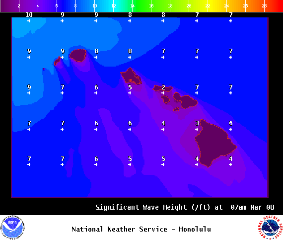
Image: NOAA
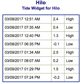
Image: NOAA
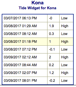
Image: NOAA
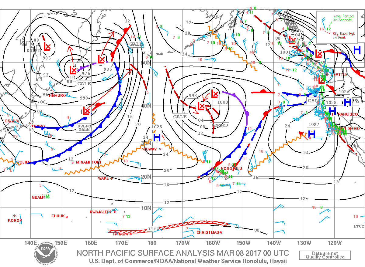
Image: NOAA

Image: NOAA

Image: NOAA
Sponsored Content


