

Long Period Swell Peaks Today for Big Island

Image: James Grenz
Alerts (as of 1:00 a.m.)
There are no weather alerts posted at this time.
**Click directly on the images below to make them larger. Charts include: Big Island projected winds, tides, swell direction & period and expected wave heights.**
Big Island Surf Forecast
Hilo side: Wave heights are forecast to be knee/shoulder high today.
Kona side: Wave heights are expected to be knee/waist high today in the morning and picking up to waist/shoulder high by sunset.
South: Wave heights are expected to be knee/waist high today in the morning and picking up to waist/shoulder high by sunset.
A large long-period northwest swell has been building overnight. This swell is expected to peak today before slowly fading through Monday. A gale north of the area has produced a smaller and shorter-period north swell. That swell is expected to gradually shift out of the north-northeast.
Nothing significant expected out of the South Pacific.
Keep in mind, surf heights are measured on the face of the wave from trough to crest. Heights vary from beach to beach, and at the same beach, from break to break.
**Click here for your detailed Big Island weather report.**
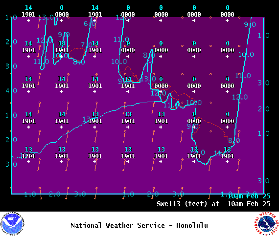
Image: NOAA
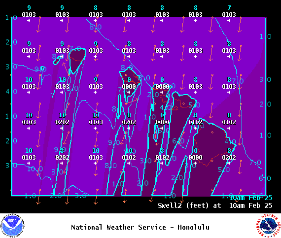
Image: NOAA
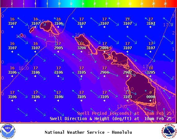
Image: NOAA

Image: NOAA
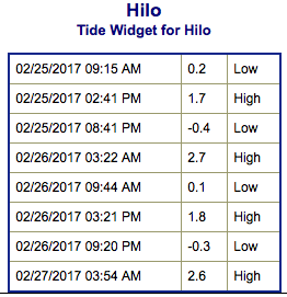
Image: NOAA
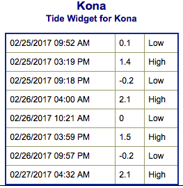
Image: NOAA
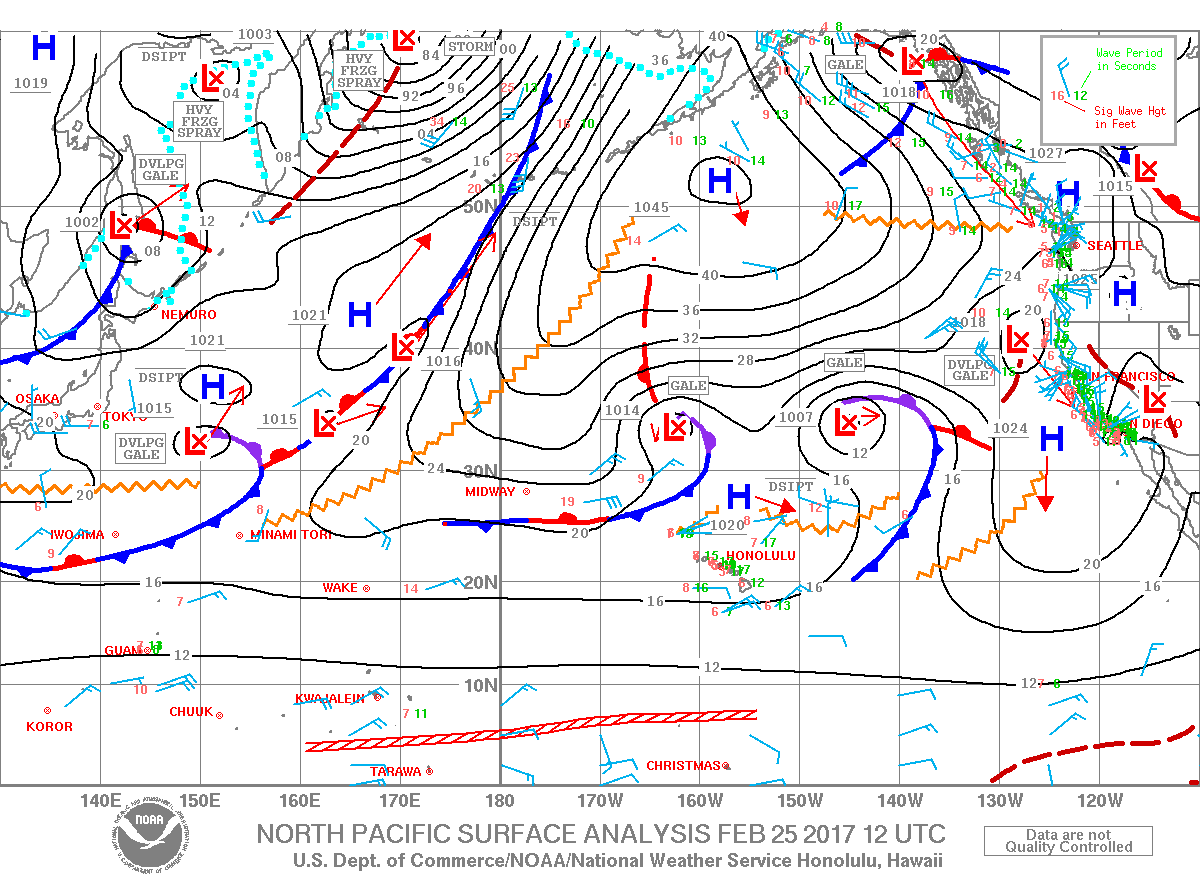
Image: NOAA
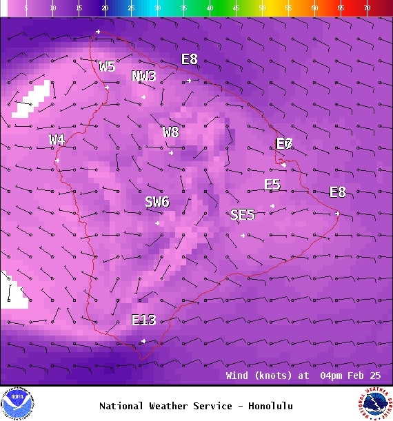
Image: NOAA
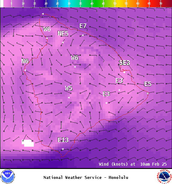
Image: NOAA
Sponsored Content


