

WNW Holds Through Morning, Thursday Swell Expected

Image: James Grenz
Alerts (as of 1:00 a.m.)
Small Craft Advisory: All Hawaii County waters through 6 p.m. Monday.
Gale Warning: ʻAlenuihāhā channel through 6 p.m. Monday.
**Click directly on the images below to make them larger. Charts include: Big Island projected winds, tides, swell direction & period and expected wave heights.**
Big Island Surf Forecast
Hilo side: Wave heights are forecast to be overhead to double overhead today.
Kona side: Wave heights are expected to be knee/thigh high today with occasional plusses.
South: Wave heights are expected to be knee/thigh high today.
Our current northerly swell continues to show Monday and fades Tuesday. On Thursday a west-northwest is expected to build with another forecast for the weekend of March 4th.
Nothing significant expected out of the South Pacific.
Keep in mind, surf heights are measured on the face of the wave from trough to crest. Heights vary from beach to beach, and at the same beach, from break to break.
**Click here for your detailed Big Island weather report.**

Image: NOAA
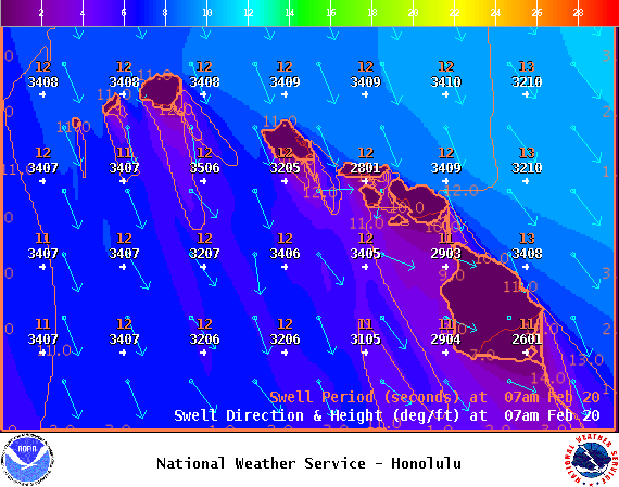
Image: NOAA
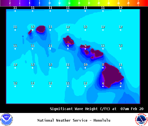
Image: NOAA
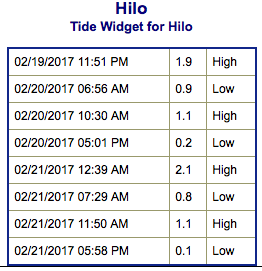
Image: NOAA
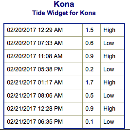
Image: NOAA
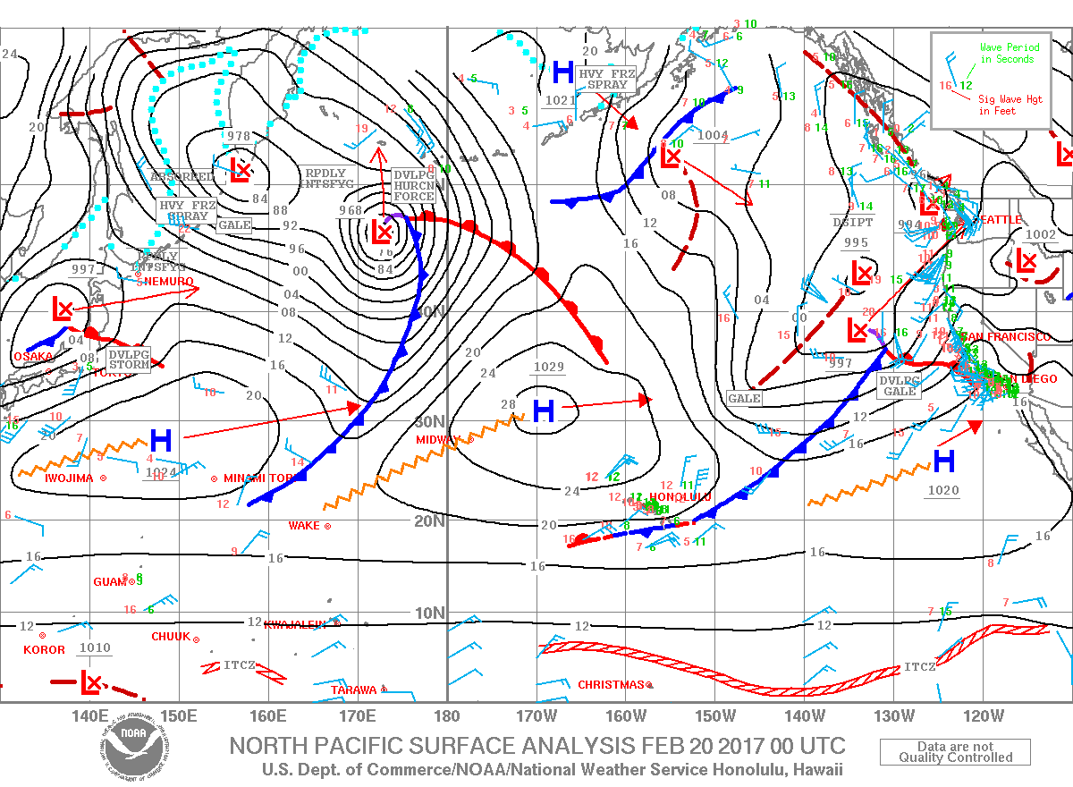
Image: NOAA
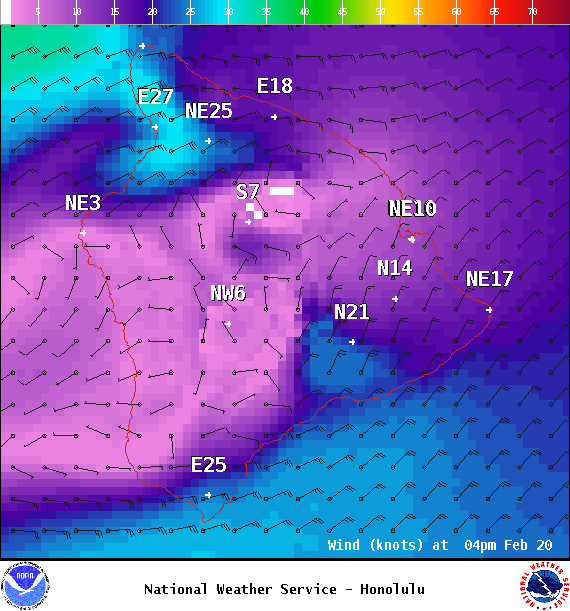
Image: NOAA
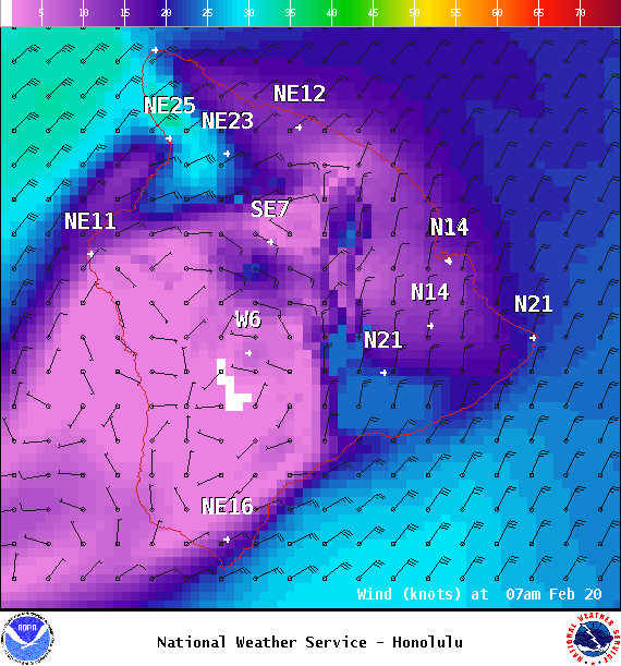
Image: NOAA
Sponsored Content


