

New Swell Fills in for Weekend
 Alerts (as of 1:00 a.m.)
There are no marine alerts posted today.
**Click directly on the images below to make them larger. Charts include: Big Island projected winds, tides, swell direction & period and expected wave heights.**
Big Island Surf Forecast
Hilo side: Wave heights are forecast to be knee/shoulder high today.
Kona side: Wave heights are expected to be waist/head high today and easing.
South: Wave heights are expected to be waist/head high today and easing.
Our current west-northwest is expected to fade through the day.
The next swell is forecast to fill in Friday night and peak Saturday afternoon with advisory level surf expected. A larger northwest swell is forecast for early next week at possibly warning levels.
Nothing significant expected out of the South Pacific but activity is starting to pick up a little bit.
Keep in mind, surf heights are measured on the face of the wave from trough to crest. Heights vary from beach to beach, and at the same beach, from break to break.
**Click here for your detailed Big Island weather report.**
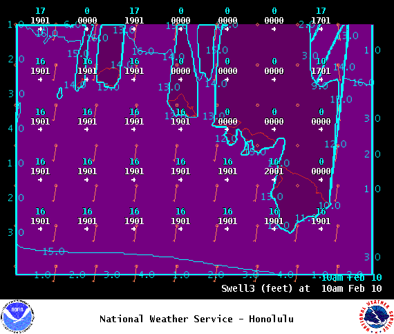
Image: NOAA
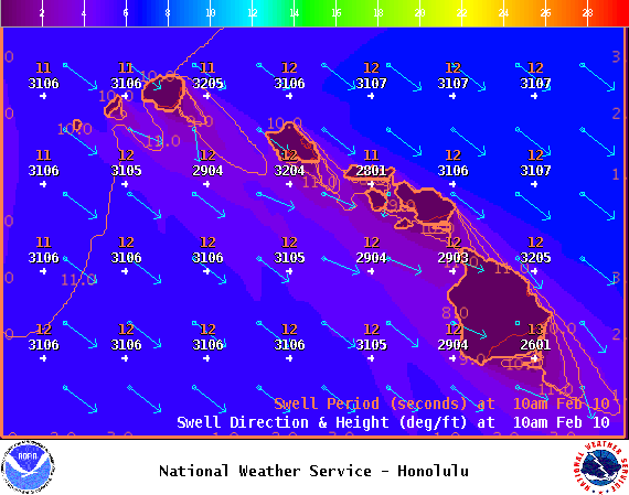
Image: NOAA

Image: NOAA
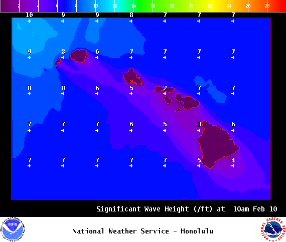
Image: NOAA
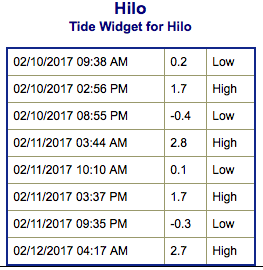
Image: NOAA

Image: NOAA
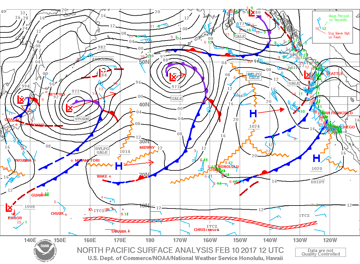
Image: NOAA
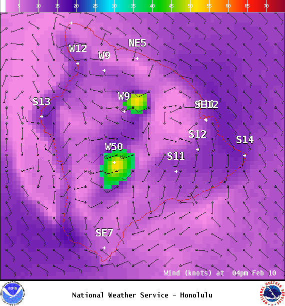
Image: NOAA

Image: NOAA
Sponsored Content


