

Cold Front Expected to Pass Through Today

Image: Janet Coney
Alerts (as of 1:00 a.m.)
Small Craft Advisory: All Big Island coastal waters through 6 p.m. Monday.
High Wind Warning: Summit of Mauna Kea and Mauna Loa. Southwest “Kona” winds will increase reaching 50 to 60 mph in some spots with gusts up to 80 mph.
High Surf Advisory: West shores of Molokai through 6 p.m. Wednesday.
**Click directly on the images below to make them larger. Charts include: Big Island high/low forecasted temperatures, projected winds, chance of cloud cover, projected localized weather conditions, vog/SO2 forecast and expected wave heights.**
Looking Ahead
The cold front passing the Big Island early this morning is forecast to continue moving east today. Cool, north winds will fill in behind the front and spread down to the Big Island by tonight. Trade winds should be back late Wednesday and Thursday but this will be short-lived as another cold front is expected right on the heels of this one for Friday and Saturday.
Today
We have northwest winds today around 10 to 20 mph. High temperatures are forecast from 76° to 81°. Mostly cloudy skies are expected with scattered windward showers and frequent leeward showers in the morning. By afternoon, showers taper off a bit but are still likely. Hazy skies are forecast.
UV index at 9 (“very high” exposure level)
Tonight
Cool north winds are forecast around 15 mph tonight. Mostly cloudy skies are expected with scattered showers for windward spots and isolated showers in leeward areas. Low temperatures from 64° to 69° and feeling cooler. Colder at higher elevations.
Our Big Island Now Weather homepage always includes daily: Sunrise | Sunset | Moonrise | Moonset | Moon Phase | Live Weather Cams | 5-day Forecast | Current Temperature & Conditions
**Click here for your detailed Big Island surf report.**

Image: NOAA

Image: NOAA

Image: NOAA

Image: NOAA

Image: NOAA
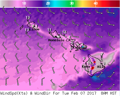
Image: NOAA

Image: NOAA
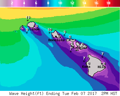
Image: NOAA
Sponsored Content


