

High Surf Advisory for East Facing Shores Today

Image: James Grenz
Alerts (as of 1:00 a.m.)
High Surf Advisory: East shores of Big Island through 6 p.m. Monday.
Small Craft Advisory: All coastal waters and channels through 6 p.m. Monday.
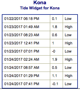
**Click directly on the images below to make them larger. Charts include: Big Island projected winds, tides, swell direction & period and expected wave heights.**
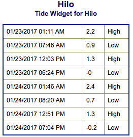 Big Island Surf Forecast
Hilo side: Wave heights are forecast to be overhead today for the best exposures.
Kona side: Wave heights are expected to be knee/thigh high today on the sets at the best exposures and decreasing.
South: Wave heights are expected to be knee/thigh high today on the sets at the best exposures and decreasing.
 Only leftovers expected from our northwest swell. A large west-northwest is forecast to build Tuesday, peak Wednesday and fade after that. Another storm is forecast to generate swell for the weekend of the 28th. Will keep an eye on it.
Advisory level surf is forecast to continue for east facing shores today.
Our current small southwest swell continues Monday but it’s nothing to write home to mom about.
Keep in mind, surf heights are measured on the face of the wave from trough to crest. Heights vary from beach to beach, and at the same beach, from break to break.
**Click here for your detailed Big Island weather report.**
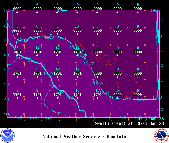
Image: NOAA

Image: NOAA
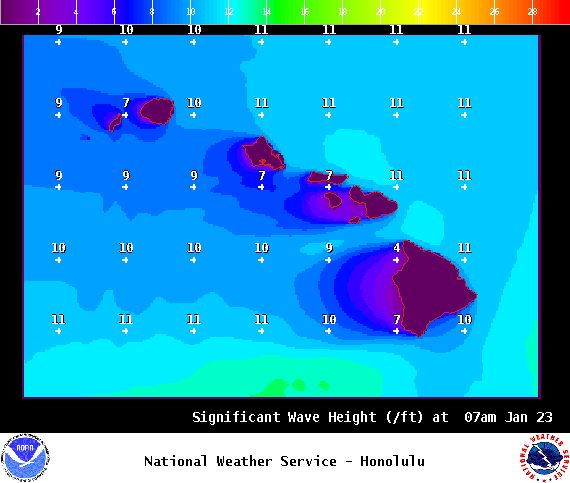
Image: NOAA

Image: NOAA

Image: NOAA

Image: NOAA
Sponsored Content


