

WNW Fading, Trade Swell Builds to Advisory Levels
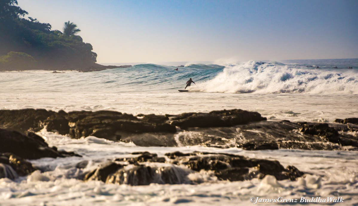
Image: James Grenz
Alerts (as of 1:00 a.m.)
High Wind Watch: In effect from noon Saturday through Saturday night for strong northeasterly winds accompanying a weak front and behind it. Winds will accelerate through mountain passes, at higher elevations and on downsloping leeward sides. The strongest winds will be in the leeward Kohala area, Waimea to Kawaihae corridor, western saddle areas and north of Kailua-Kona.
High Surf Advisory: East shores of Big Island from noon Saturday.
Small Craft Advisory: All coastal waters and channels through noon Saturday.
Gale Warning: In effect from Saturday at noon through Sunday at 6 a.m. for all offshore waters and coastal waters and channels.
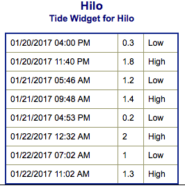
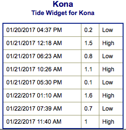
**Click directly on the images below to make them larger. Charts include: Big Island projected winds, tides, swell direction & period and expected wave heights.**
 Big Island Surf Forecast
Hilo side: Wave heights are forecast to be shoulder/head high today for the best exposures.
Kona side: Wave heights are expected to be chest/head high to slightly overhead today on the sets at the best exposures.
South: Wave heights are expected to be chest/head high to slightly overhead today on the sets at the best exposures.
 Our current west-northwest swell is expected to fade over the weekend. Another swell is expected on the 25th as well.
Advisory level surf is forecast for east facing shores over the weekend.
A small southwest swell is forecast for the 22nd through the 24th but only up to knee/waist high.
Keep in mind, surf heights are measured on the face of the wave from trough to crest. Heights vary from beach to beach, and at the same beach, from break to break.
**Click here for your detailed Big Island weather report.**
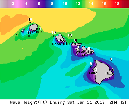
Image: NOAA
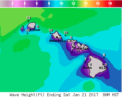
Image: NOAA
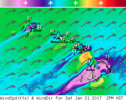
Image: NOAA

Image: NOAA
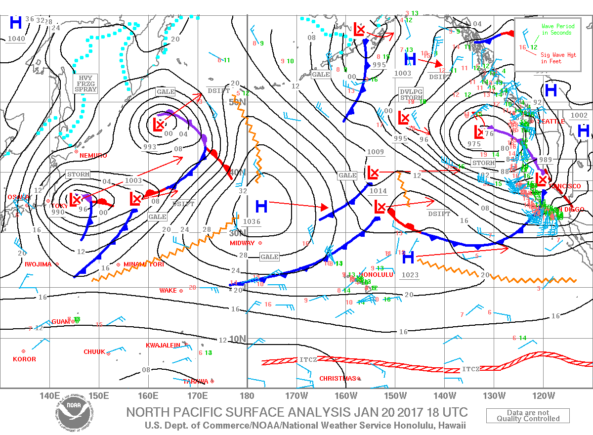
Image: NOAA
Sponsored Content


