

Forecast: Winds Gusting up to 60 mph Over Weekend

Image: James Grenz
Alerts (as of 1:00 a.m.)
High Wind Watch: In effect from noon Saturday through Saturday night for strong northeasterly winds accompanying a weak front and behind it. Winds will accelerate through mountain passes, at higher elevations and on downsloping leeward sides. The strongest winds will be in the leeward Kohala area, Waimea to Kawaihae corridor, western saddle areas and north of Kailua-Kona.
High Surf Advisory: East shores of Big Island from noon Saturday.
Small Craft Advisory: All coastal waters and channels through noon Saturday.
Gale Warning: In effect from Saturday at noon through Sunday at 6 a.m. for all offshore waters and coastal waters and channels.
**Click directly on the images below to make them larger. Charts include: Big Island high/low forecasted temperatures, projected winds, chance of cloud cover, projected localized weather conditions, vog/SO2 forecast and expected wave heights.**
Looking Ahead
Trade winds are forecast to increase as a front approaches the state from the northwest. The front will move across the smaller islands Saturday and stall near the Big Island from late Saturday night into early next week. Very strong and potentially damaging northeast trade winds are expected along and behind the front this weekend, with winds easing early next week.
Today & Sunday
We have northeast winds today from 10 to 15 mph and increasing to 15 to 30 mph with gusts up to 50 mph by the afternoon. High temperatures are forecast from 78° to 83°. Partly cloudy skies are forecast for windward and mauka spots with scattered showers. Partly sunny skies for the Kona side with some clouds building in the afternoon and isolated showers. On Sunday, winds remain strong and shift out of the east while showers become more likely for windward and mauka spots.
UV index at 7 (“very high” exposure level)
Tonight & Sunday Night
Northeast winds 20 to 35 mph tonight with gusts to 60 mph in Kohala, North Kona and parts of Puna and Kau. Occasional windward showers with clearing skies for the leeward side. Low temperatures from 66° to 71°. On Sunday night, winds remain strong but shift out of the east with gusts up to 50 mph. Showers are likely for windward spots.
Our Big Island Now Weather homepage always includes daily: Sunrise | Sunset | Moonrise | Moonset | Moon Phase | Live Weather Cams | 5-day Forecast | Current Temperature & Conditions
**Click here for your detailed Big Island surf report.**
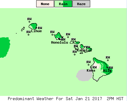
Image: NOAA

Image: NOAA
Image: NOAA
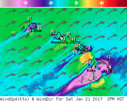
Image: NOAA

Image: NOAA
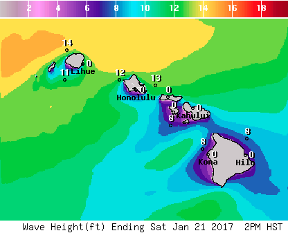
Image: NOAA
Sponsored Content


