

XL Swell Builds Today for Big Island

Image: James Grenz
Alerts (as of 1:00 a.m.)
A High Surf Warning is posted for the west shore of the Big Island from 6 a.m. Friday through 6 a.m. Saturday.
Small Craft Advisory for all island waters through 6 a.m. Saturday.
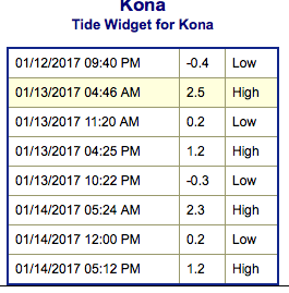
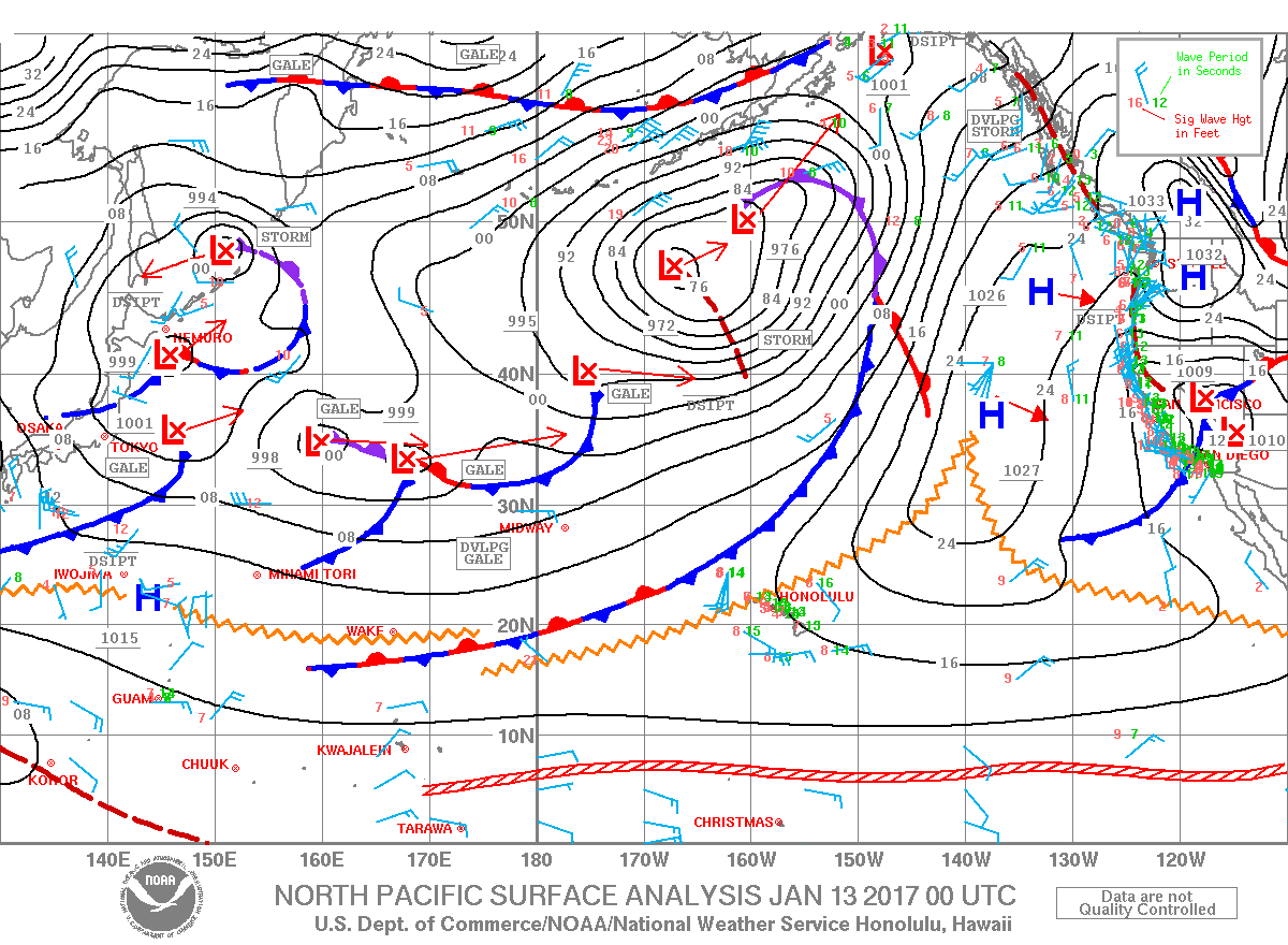
**Click directly on the images below to make them larger. Charts include: Big Island projected winds, tides, swell direction & period and expected wave heights.**
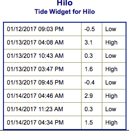 Big Island Surf Forecast
Hilo side: Wave heights are forecast to be chest/head high today for good breaks with sets getting overhead at the best exposures.
Kona side: Wave heights are expected to be knee/waist high today with chest high waves on the sets. West-northwest swell is also mixing in today up to about chest/head high.
South: Wave heights are expected to be knee/waist high today with chest high waves on the sets. West-northwest swell is also mixing in today up to about chest/head high.
 Our current north-northeast swell is fading Friday. Our current northwest swell holds through Friday.
A longer period west-northwest swell is expected to build Friday, peak late Friday night and into Saturday morning up to double overhead at the best breaks.
Our current south-southwest fades Friday and into the weekend.
Keep in mind, surf heights are measured on the face of the wave from trough to crest. Heights vary from beach to beach, and at the same beach, from break to break.
**Click here for your detailed Big Island weather report.**
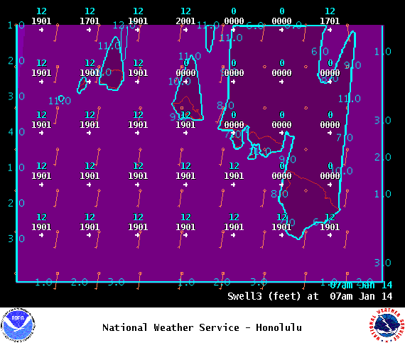
Image: NOAA
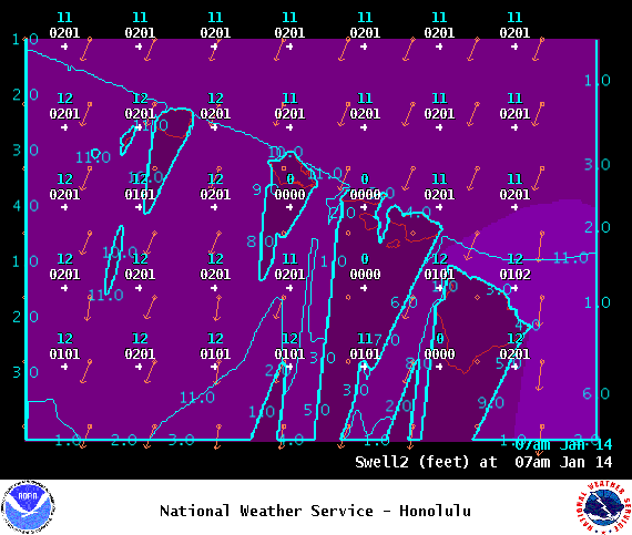
Image: NOAA
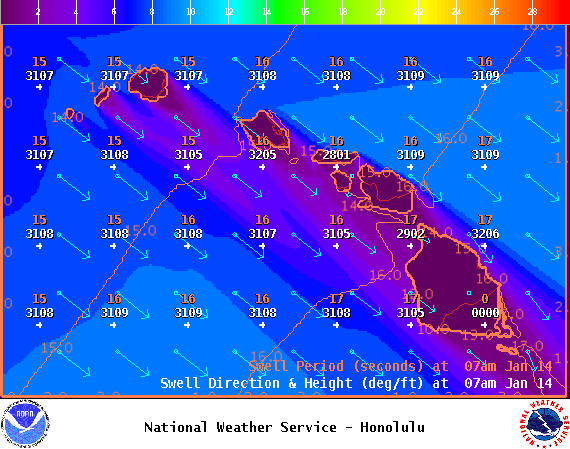
Image: NOAA
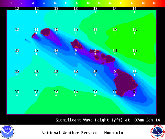
Image: NOAA

Image: NOAA
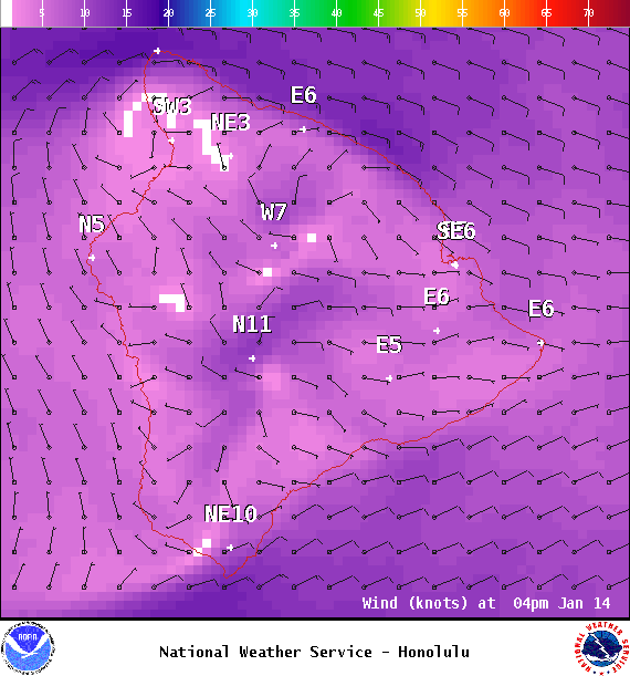
Image: NOAA
Sponsored Content


