High Surf Advisory Posted for Big Island

Image: James Grenz
Alerts (as of 1:00 a.m.)
High Surf Advisory: East and north exposures of Big Island until 6 p.m. Wednesday.
**Click directly on the images below to make them larger. Charts include: Big Island projected winds, tides, swell direction & period and expected wave heights.**
 Big Island Surf Forecast
Hilo side: Wave heights are forecast to be shoulder/head high today for the best breaks.
Kona side: Wave heights are expected to be knee/waist high today in the morning with the best breaks getting up to tummy/chest on the sets.
South: Wave heights are expected to be knee/waist high today in the morning with the best breaks getting up to tummy/chest on the sets. Traces of the northwest swell are also mixing in today.
 Our current south-southwest swell will peak on Wednesday but hold much of its size through Thursday morning before fading Thursday afternoon and Friday. Another swell is lining up for the 11th through 13th.
Two swells are expected soon out of the north-northeast. The first will fill in for the second half of the work week and the second is forecast for the first half of next week.
Keep in mind, surf heights are measured on the face of the wave from trough to crest. Heights vary from beach to beach, and at the same beach, from break to break.
**Click here for your detailed Big Island weather report.**

Image: NOAA

Image: NOAA
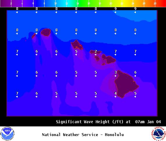
Image: NOAA

Image: NOAA
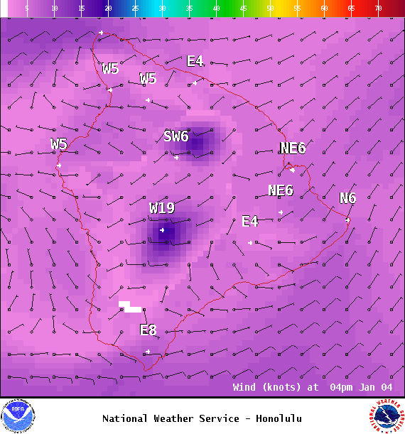
Image: NOAA
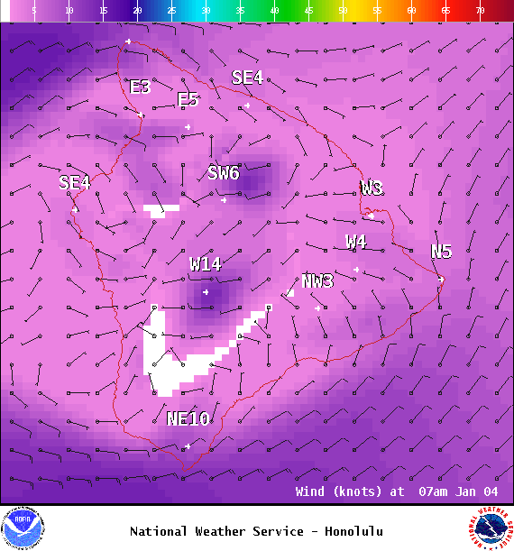
Image: NOAA
Sponsored Content