

Numerous Windward Showers Expected This Morning

Image: James Grenz
Alerts (as of 1:00 a.m.)
Small Craft Advisory: Most coastal waters and channels due to northeast winds 20 to 25 knots. Posted through Friday at 6 p.m.
**Click directly on the images below to make them larger. Charts include: Big Island high/low forecasted temperatures, projected winds, chance of cloud cover, projected localized weather conditions, vog/SO2 forecast and expected wave heights.**
Looking Ahead
Breezy trade winds are forecast through Friday night. Showers are expected to increase and spread eastward and stall near Maui County Saturday night. Winds will focus most showers over our usual windward and mauka areas. Some showers are forecast to pass to leeward sides through Friday night. Enhanced showers are expected Friday night into Saturday. Trade winds will gradually weaken through the weekend.
Today
Mostly cloudy skies are expected today with numerous showers for windward and mauka spots in the morning and scattered showers in the afternoon. Hazy for the Kona side with partly cloudy skies and isolated afternoon showers. High temperatures from 78° to 83°. Winds will be northeast around 15 to 20 mph.
UV index at 3 (“moderate” exposure level)
Tonight
Northeast winds are forecast 15 to 20 mph. Mostly cloudy skies for windward spots with numerous windward showers and scattered showers for the Kona side. Low temperatures from 70° to 75°.
Our Big Island Now Weather homepage always includes daily: Sunrise | Sunset | Moonrise | Moonset | Moon Phase | Live Weather Cams | 5-day Forecast | Current Temperature & Conditions
**Click here for your detailed Big Island surf report.**

Image: NOAA

Image: NOAA

Image: NOAA

Image: NOAA
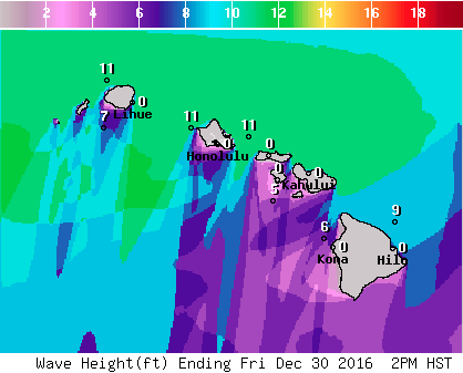
Image: NOAA
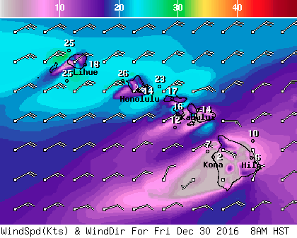
Image: NOAA
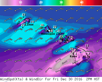
Image: NOAA
Sponsored Content


