

SSW Lingers, NW Swell Builds Today

Image: James Grenz
Alerts (as of 1:00 a.m.)
Small Craft Advisory: Most coastal waters and channels due to northeast winds 20 to 25 knots. Posted through Friday at 6 p.m.
Gale Warning: All offshore waters.
**Click directly on the images below to make them larger. Charts include: Big Island projected winds, tides, swell direction & period and expected wave heights.**
 Big Island Surf Forecast
Hilo side: Wave heights are forecast to be shoulder high to possibly overhead today for the best breaks.
Kona side: Wave heights are expected to be knee/thigh high today. Spots catching the northwest getting up to tummy/chest high on the sets.
South: Wave heights are expected to be down to leftovers today and below waist high. Spots catching the northwest getting up to tummy/chest high on the sets.

Small south-southwest and south-southeast swells are showing over the next few days. Nothing significant is expected out of the SPAC in the near future although a small south swell is forecast for the 31st and 1st with another little bump on the horizon for the 4th.
A new northwest swell is forecast to build late today. A north reinforcement is expected Sunday afternoon and will fade out through the early part of the week. A west-northwest is forecast to filter in Tuesday with another new northwest on its heels for Wednesday.
A trade wind swell will also continue showing today.
Keep in mind, surf heights are measured on the face of the wave from trough to crest. Heights vary from beach to beach, and at the same beach, from break to break.
**Click here for your detailed Big Island weather report.**

Image: NOAA

Image: NOAA
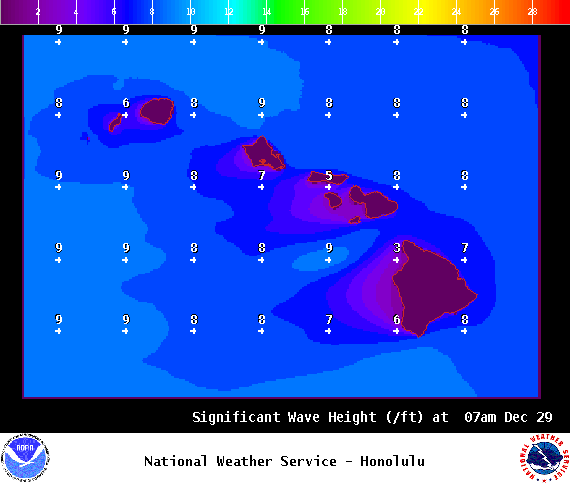
Image: NOAA
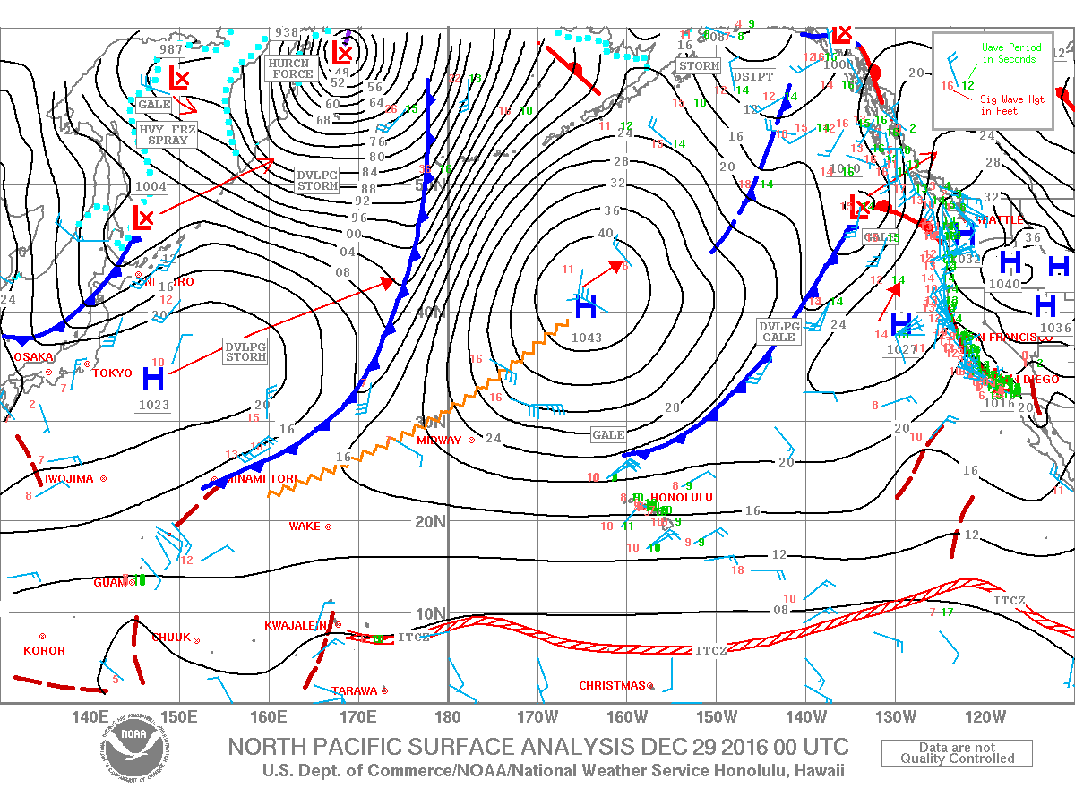
Image: NOAA

Image: NOAA

Image: NOAA
Sponsored Content


