

Big Island Now Christmas Weekend Forecast

Image: Malika Dudley 12/23/16
Alerts (as of 1:00 a.m.)
Small Craft Advisory: North winds 20 to 30 knots in all coastal waters and channels from 6 a.m. Saturday through 6 a.m. Sunday.
**Click directly on the images below to make them larger. Charts include: Big Island high/low forecasted temperatures, projected winds, chance of cloud cover, projected localized weather conditions, vog/SO2 forecast and expected wave heights.**
Looking Ahead
Trade winds are forecast to pick up in speed Christmas Day through Tuesday. Clouds and showers will continue to favor our usual windward and mauka areas. Showers will mainly affect those spots in the overnight and morning hours with some showers passing leeward from time to time on our strong winds. A front could approach the state from the north around Thursday night or Friday.
Today & Sunday
Partly sunny skies are expected today with scattered showers for windward and mauka spots along the Hilo side. Hazy for the Kona side with mostly clear skies in the morning and isolated showers in the afternoon. High temperatures from 78° to 84°. Winds will be east around 15 to 25 mph. On Sunday, winds will pick up out of the east from 15 to 30 mph and gusting up to 40 mph.
UV index at 6 (“high” exposure level)
Tonight & Sunday Night
East winds are forecast 15 to 25 mph. Mostly cloudy skies for windward spots with showers likely and isolated evening showers for the Kona side with clearing as the night goes on. Low temperatures from 68° to 73°. On Sunday night, winds will pick up out of the east from 15 to 30 mph and gusting up to 40 mph.
Our Big Island Now Weather homepage always includes daily: Sunrise | Sunset | Moonrise | Moonset | Moon Phase | Live Weather Cams | 5-day Forecast | Current Temperature & Conditions
**Click here for your detailed Big Island surf report.**

Image: NOAA

Image: NOAA

Image: NOAA

Image: NOAA

Image: NOAA
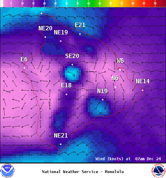
Image: NOAA
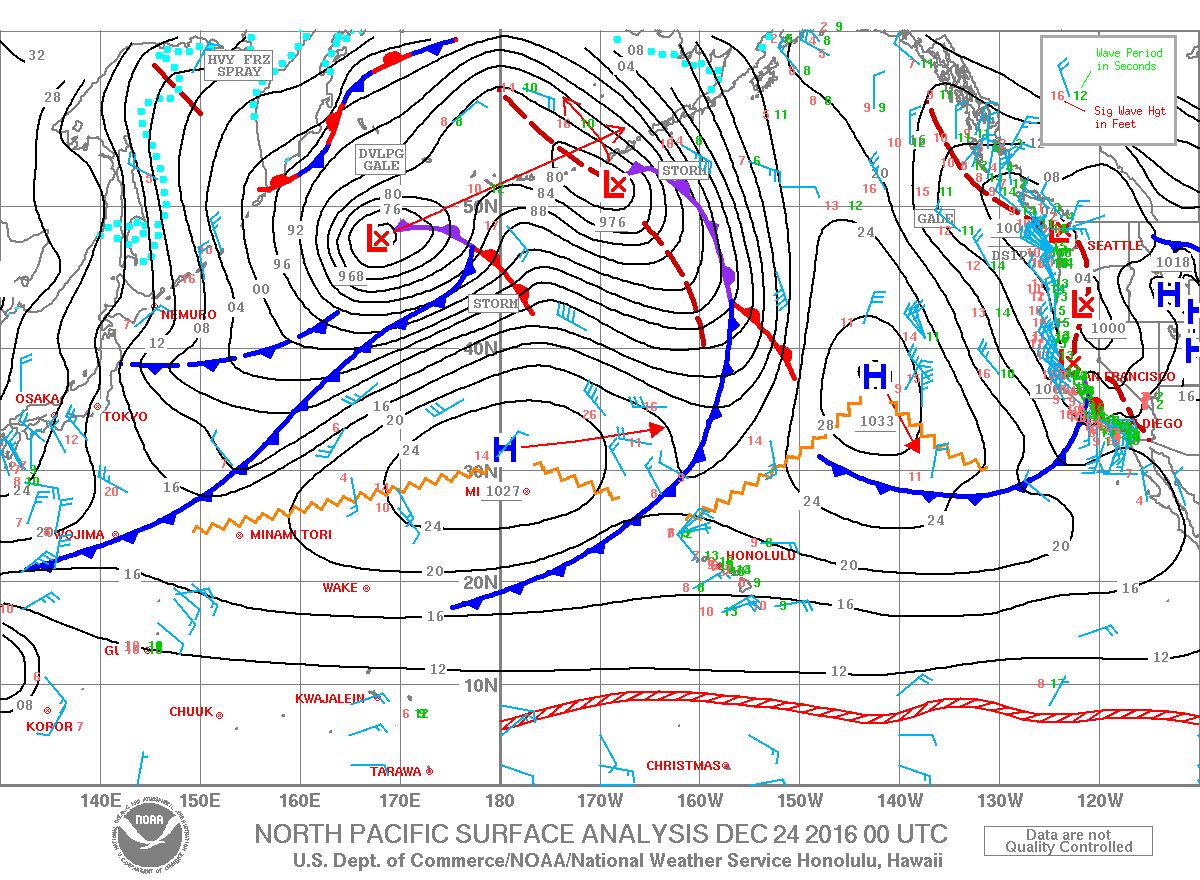
Image: NOAA

Image: NOAA
Sponsored Content


