

Changing Weather This Weekend For Big Island

Image: James Grenz
Alerts (as of 1:00 a.m.)
A High Wind Warning is in effect for the summits of Mauna Kea and Mauna Loa through 6 p.m. Saturday with gusts up to 75 mph expected.
A High Surf Advisory is posted for north and west facing shores of the Big Island through noon Saturday.
Small Craft Advisory posted for windward waters through 6 a.m. Sunday.
Gale Warning in effect for all offshore waters.
**Click directly on the images below to make them larger. Charts include: Big Island high/low forecasted temperatures, projected winds, chance of cloud cover, projected localized weather conditions, vog/SO2 forecast and expected wave heights.**
Looking Ahead
A low north of Kauai will move southwest through Monday, passing just west of Kauai Sunday morning. The disturbance will bring showery weather with a slight chance of thunderstorms today hrough Sunday. Breezy west winds will shift out of the south by tonight. Trade winds are forecast to return on Monday and continue through next week.
Today & Sunday
Partly sunny skies are expected with isolated showers. Windy conditions are forecast with some haze as well due to the direction of these winds. High temperatures from 78° to 83°. Winds will be southwest around 20 to 35 mph. Sunday, rainfall chances and thunderstorm chances increase with the threat for locally heavy rainfall as well winds will veer out of the southeast up to 35 mph gusts.
UV index at 6 (“high” exposure level)
Tonight & Sunday Night
Southwest winds are forecast 15 to 25 mph with gusts to 40 mph. Partly cloudy and becoming mostly cloudy tonight with scattered showers. Isolated showers to start for the Kona side and becoming scattered showers. Low temperatures from 66° to 71°. Sunday night, mostly cloudy skies with numerous showers and a slight chance of thunderstorms. Locally heavy rainfall is possible. Winds will veer out of the southeast and remain breezy around 15 to 25 mph, gusting to 35 mph.
Our Big Island Now Weather homepage always includes daily: Sunrise | Sunset | Moonrise | Moonset | Moon Phase | Live Weather Cams | 5-day Forecast | Current Temperature & Conditions
**Click here for your detailed Big Island surf report.**
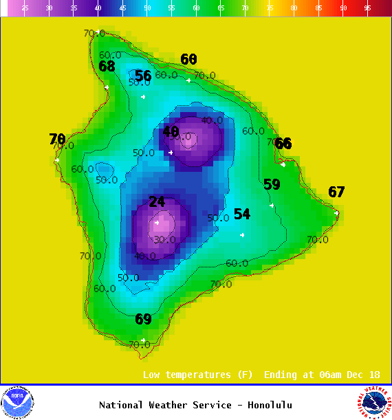
Image: NOAA
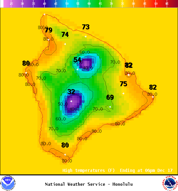
Image: NOAA

Image: NOAA
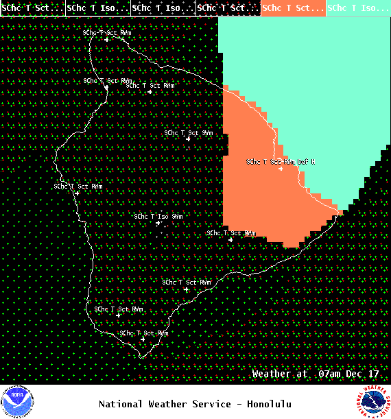
Image: NOAA

Image: NOAA
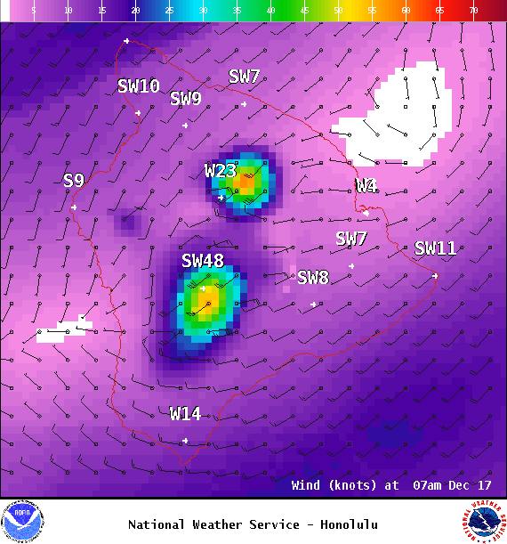
Image: NOAA
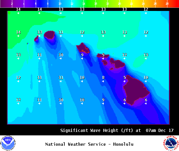
Image: NOAA

Image: NOAA
Sponsored Content


