

Weather Expected to Gradually Improve Today

Image: James Grenz
Alerts (as of 1:00 a.m.)
A Wind Advisory is posted for the summits of Mauna Kea and Mauna Loa through Monday at 6 p.m. Southwest winds of 25 to 45 mph are expected with gusts up to 65 mph.
**Click directly on the images below to make them larger. Charts include: Big Island high/low forecasted temperatures, projected winds, chance of cloud cover, projected localized weather conditions, vog/SO2 forecast and expected wave heights.**
Looking Ahead
A gradual improvement in our weather pattern from west to east is expected over the next few days, as moisture associated with a trough of low pressure moves off to the northeast. Weak high pressure will build in to our north with light northeast trade winds filling in beginning on Monday. Another round of unsettled weather is forecast for later in the week as another trough of low pressure comes near the Hawaiian islands.
Today
Partly sunny skies are expected with chance of showers for windward spots. Kona side is expected to be sunny in the morning with some clouds building in the afternoon. Keep in mind a disturbance that was affecting Maui County last night is expected to dissipate over parts of the northwest coast this morning. Once that clears, conditions will clear up. High temperatures from 78° to 83°. Winds will be variable up to 15 mph.
UV index at 6 (“high” exposure level)
Tonight
Variable winds are forecast up to 15 mph. Mostly cloudy skies with a chance of showers for windward spots and partly cloudy skies with a slight chance of showers for the Kona side. Low temperatures from 68° to 73°.
Our Big Island Now Weather homepage always includes daily: Sunrise | Sunset | Moonrise | Moonset | Moon Phase | Live Weather Cams | 5-day Forecast | Current Temperature & Conditions
**Click here for your detailed Big Island surf report.**
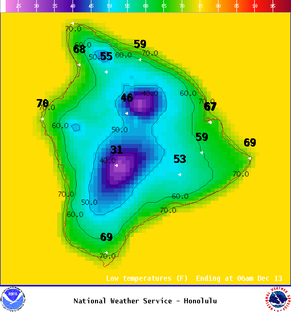
Image: NOAA

Image: NOAA

Image: NOAA

Image: NOAA

Image: NOAA

Image: NOAA

Image: NOAA

Image: NOAA
Sponsored Content


