

SSW and NW Swells Build Today

Image: James Grenz
Alerts (as of 1:00 a.m.)
A Small Craft Advisory is posted for all Hawaii County waters through 6 p.m. Monday.
A High Surf Advisory is posted for east facing shores until 6 p.m. Monday.
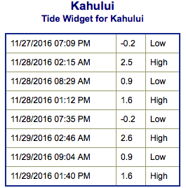
**Click directly on the images below to make them larger. Charts include: Big Island projected winds, tides, swell direction & period and expected wave heights.**
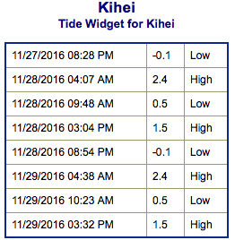 Big Island Surf Forecast
Hilo side: Wave heights are forecast overhead or more today for the best breaks.
Kona side: Wave heights are expected to be knee/waist high today. The best spots could get up to tummy/chest high on the sets.
South: Wave heights are expected to be knee/waist high or more today. Spots that are more open to the wrap will be bigger.
 East-northeast trades are creating a trade wind swell for the Hilo side but will start to back down on Tuesday.
Overlapping northwest swells are expected Monday through Thursday. Kona side will be heavily shadowed from these swells. A solid northwest is expected for December 2.
New south-southwest swell expected to peak Monday and Tuesday with waist to chest high sets at the best breaks. Swell energy starts to fade Wednesday.
Keep in mind, surf heights are measured on the face of the wave from trough to crest. Heights vary from beach to beach, and at the same beach, from break to break.
**Click here for your detailed Big Island weather report.**
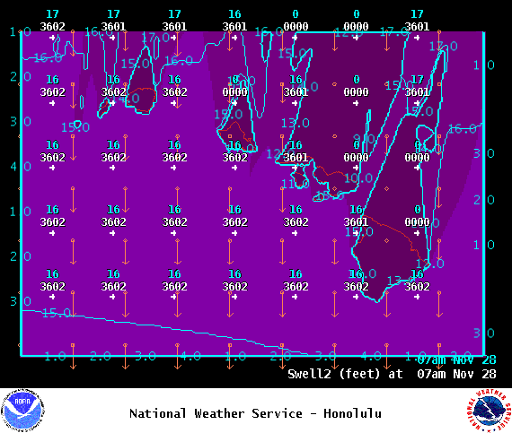
Image: NOAA
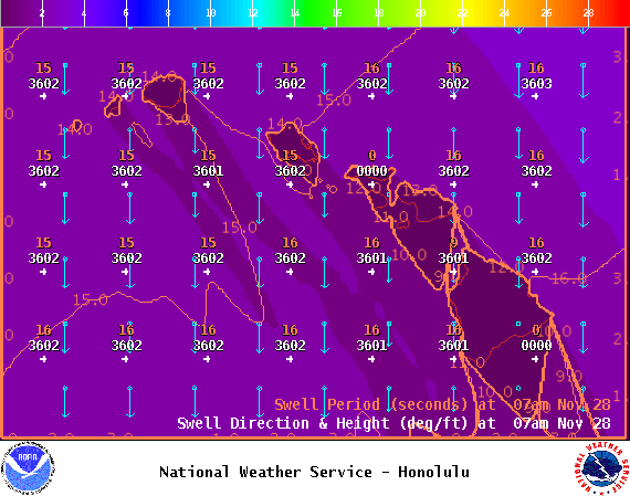
Image: NOAA
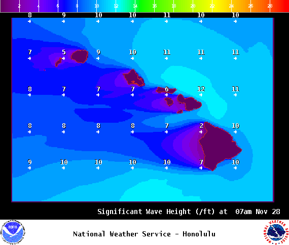
Image: NOAA
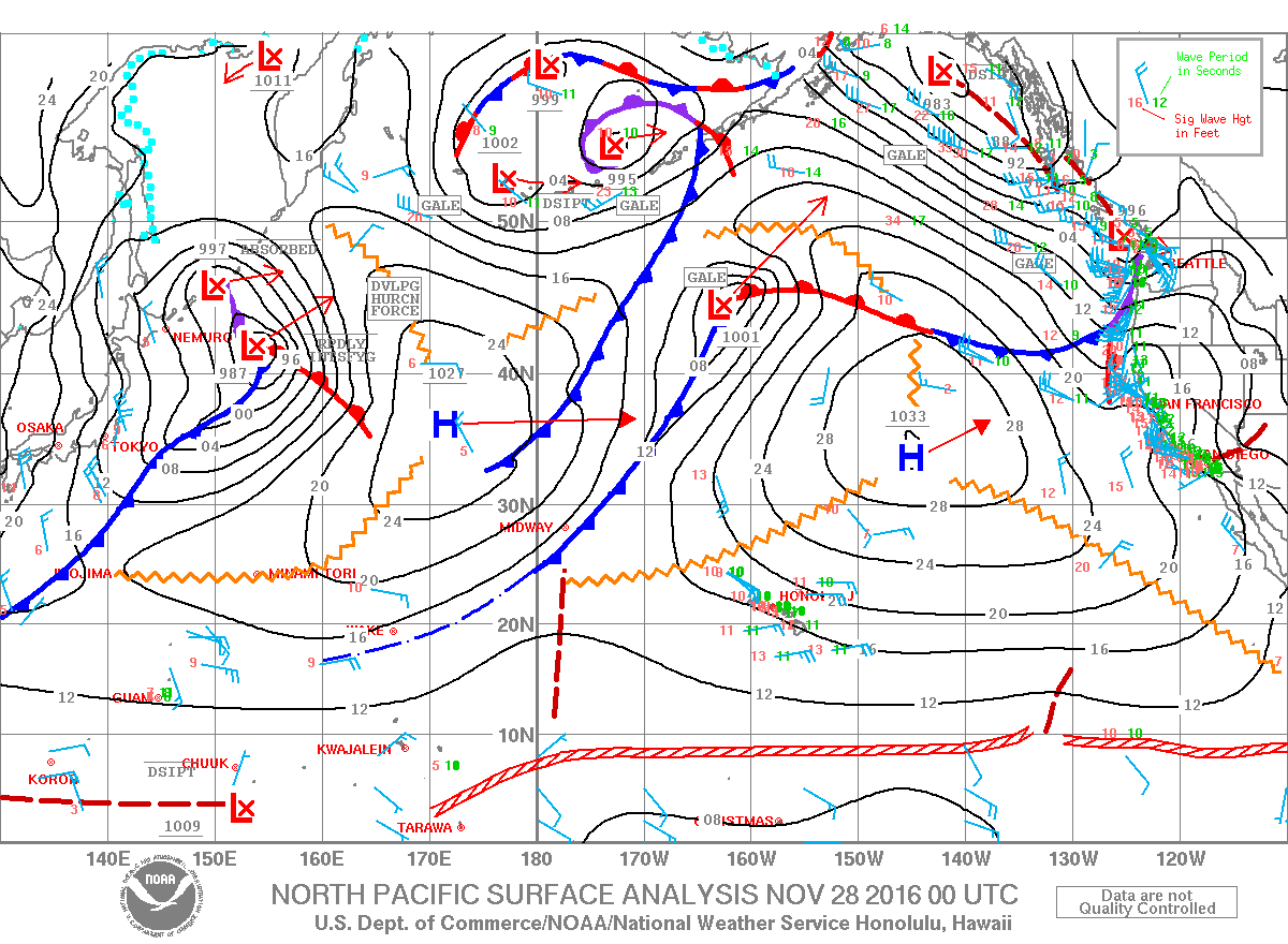
Image: NOAA
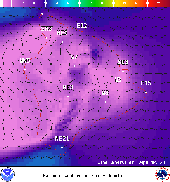
Image: NOAA
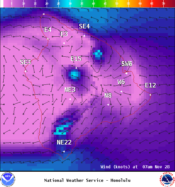
Image: NOAA
Sponsored Content


