

NNW Fills in Today, Choppy Trade Swell

Image: James Grenz
Alerts (as of 1:00 a.m.)
A Wind Advisory is posted through 6 p.m. Wednesday for east winds from 20 to 30 mph, gusting to 50 mph.
A Gale Warning is posted for the ʻAlenuihāhā channel and waters to the south of the Big Island through 6 p.m. Thursday.
A Small Craft Advisory is posted for all other Hawaii County waters through 6 p.m. Thursday.
A High Surf Advisory is posted for east facing shores until 6 p.m. Friday.
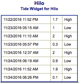
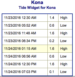
**Click directly on the images below to make them larger. Charts include: Big Island projected winds, tides, swell direction & period and expected wave heights.**
 Big Island Surf Forecast
Hilo side: Wave heights are forecast from overhead to double overhead today for the best breaks.
Kona side: Wave heights are expected to be pretty flat today but better than yesterday. Some spots could catch wrap of about knee/thigh high.
South: Wave heights are expected to be ankle/knee high today. Spots that are more open to the wrap will be bigger.
 Our current small north-northwest is filling in Wednesday. The Big Island will be heavily shadowed from this swell. East-northeast trades are creating a trade wind swell for the Hilo side, but it will be sloppy and pretty blown out.
Nothing significant is expected out of the SPAC this week. A southwest swell is expected for the 27th to around the 2nd.
Keep in mind, surf heights are measured on the face of the wave from trough to crest. Heights vary from beach to beach, and at the same beach, from break to break.
**Click here for your detailed Big Island weather report.**

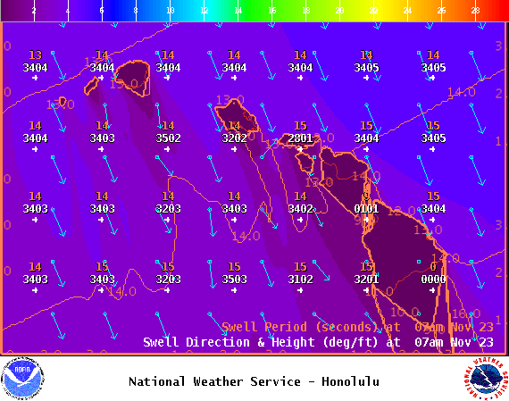
Image: NOAA
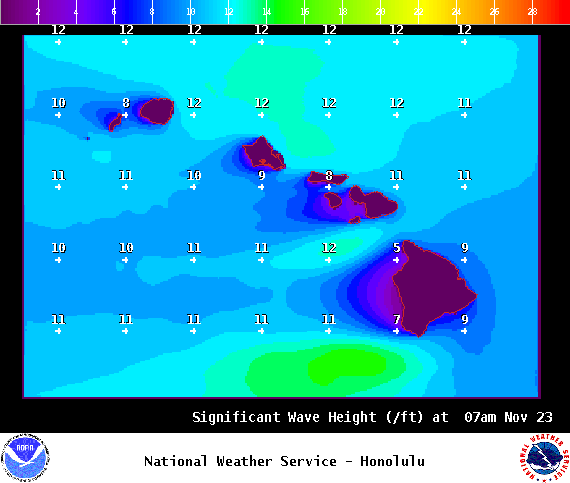
Image: NOAA
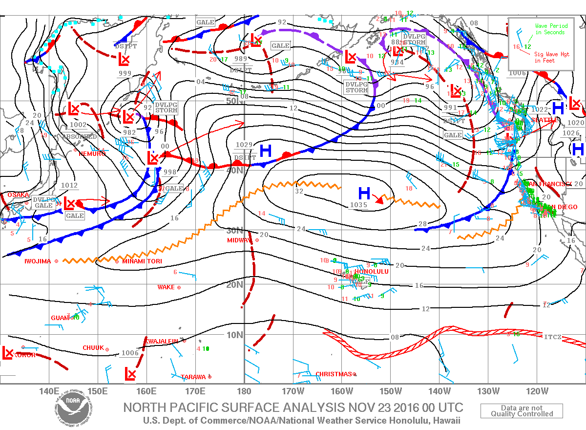
Image: NOAA
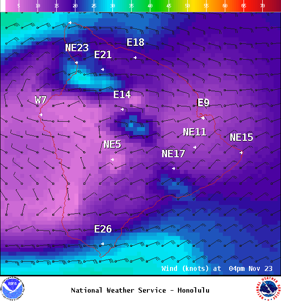
Image: NOAA
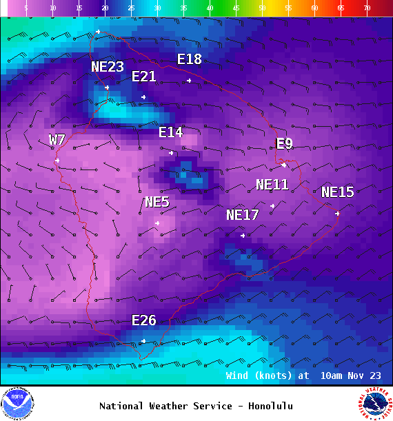
Image: NOAA
Sponsored Content


