

Breezy Trade Winds up to 35 mph Today

Image: James Grenz
Alerts (as of 1:00 a.m.)
A High Surf Advisory is posted for the north shore of the Big Island from 6 a.m. Friday through 6 a.m. Saturday.
A Small Craft Advisory is posted for our usual windiest Hawaii County waters through 6 p.m. Sunday.
**Click directly on the images below to make them larger. Charts include: Big Island high/low forecasted temperatures, projected winds, chance of cloud cover, projected localized weather conditions, vog/SO2 forecast and expected wave heights.**
Looking Ahead
Breezy trade winds are expected to continue across the islands into next week. Clouds and showers carried on the trades will focus over windward and mauka areas. Some of the showers could reach leeward spots from time to time on our strong trades. Showers will increase over the weekend as an old frontal boundary moves through.
Today
Partly cloudy for windward spots with scattered morning showers. Hazy for the Kona side with with clear skies in the morning and building clouds in the afternoon and isolated showers. High temperatures from 81° to 86°. Winds will be out of the northeast from 10 to 25 mph with higher gusts.
UV index at 7 (“high” exposure level)
Tonight
Winds will be northeasterly from 10 to 25 mph with higher gusts. Mostly cloudy with scattered windward showers. Kona side should be clearing as the night goes on. Low temperatures from 69° to 74°.
Our Big Island Now Weather homepage always includes daily: Sunrise | Sunset | Moonrise | Moonset | Moon Phase | Live Weather Cams | 5-day Forecast | Current Temperature & Conditions
**Click here for your detailed Big Island surf report.**
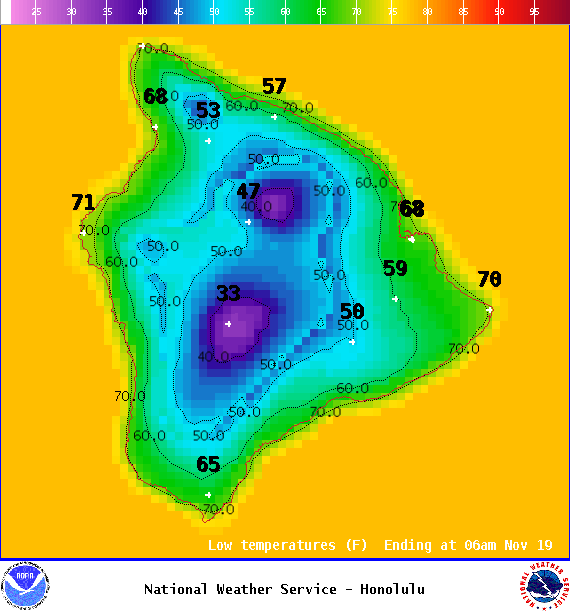
Image: NOAA
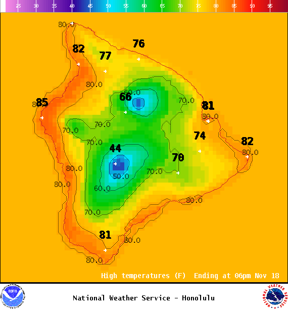
Image: NOAA
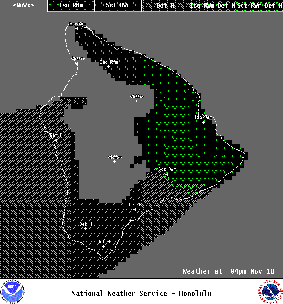
Image: NOAA
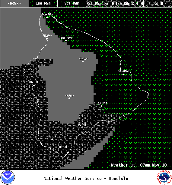
Image: NOAA
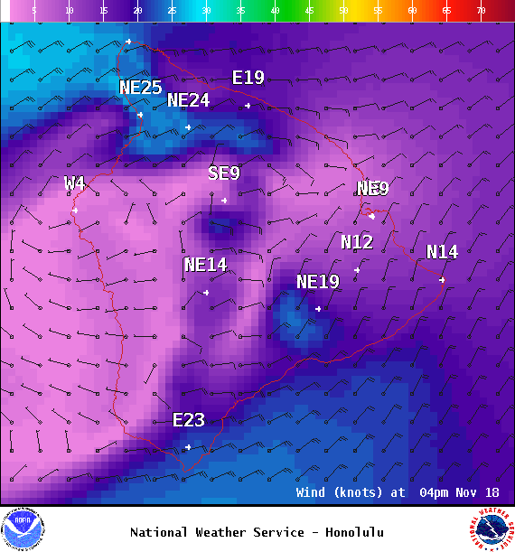
Image: NOAA
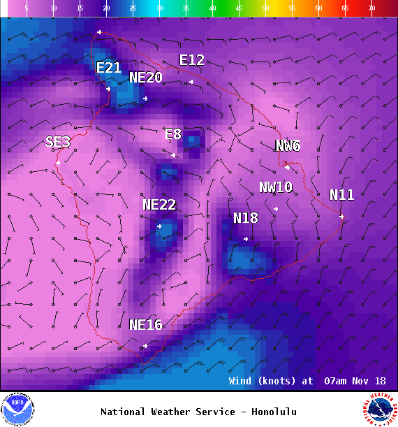
Image: NOAA
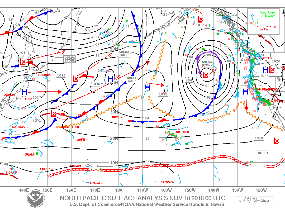
Image: NOAA
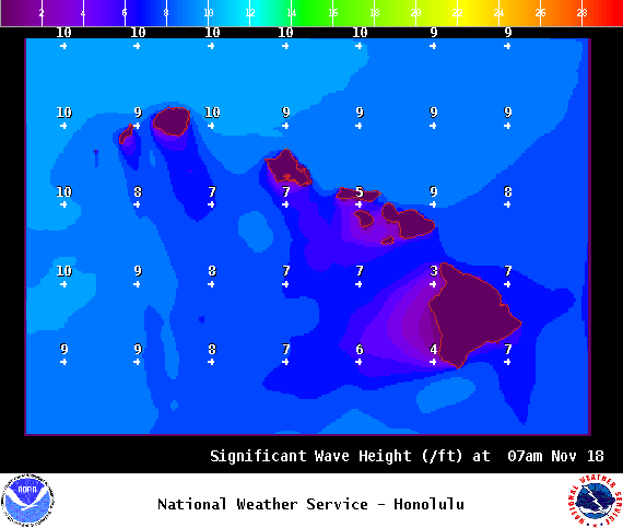
Image: NOAA
Sponsored Content


