

Weekend Weather Forecast Calls for Sunshine, Haze

Image: James Grenz
Alerts (as of 1:00 a.m.)
A High Surf Advisory is posted for the north shore of the Big Island through 6 a.m. Saturday.
**Click directly on the images below to make them larger. Charts include: Big Island high/low forecasted temperatures, projected winds, chance of cloud cover, projected localized weather conditions, vog/SO2 forecast and expected wave heights.**
Looking Ahead
Generally light winds are forecast to continue through Saturday. A stable and dry airmass is expected so afternoon clouds and showers will be limited. Breezy to strong trade winds are expected for the first half of next week.
Today & Sunday
Mostly sunny morning with clouds building for interior and leeward areas of the Big Island in the afternoon. Areas of haze islandwide. Isolated afternoon showers. High temperatures from 80° to 85° but feeling warmer due to the heat index. Winds will be variable from 5 to 10 mph with local sea breezes developing in the afternoon.
UV index at 7 (“high” exposure level)
Tonight & Sunday Night
Winds will be variable up to 10 mph. Partly cloudy with isolated windward showers. Kona side should be clearing as the night goes on and the land breeze kicks up. Low temperatures from 65° to 70°.
Our Big Island Now Weather homepage always includes daily: Sunrise | Sunset | Moonrise | Moonset | Moon Phase | Live Weather Cams | 5-day Forecast | Current Temperature & Conditions
**Click here for your detailed Big Island surf report.**

Image: NOAA

Image: NOAA

Image: NOAA
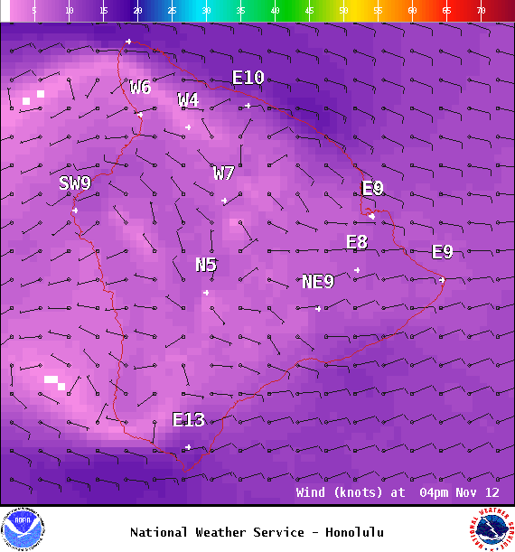
Image: NOAA
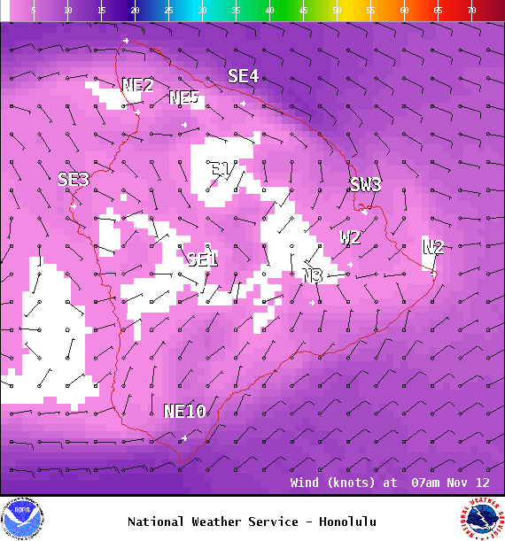
Image: NOAA

Image: NOAA
Image: NOAA
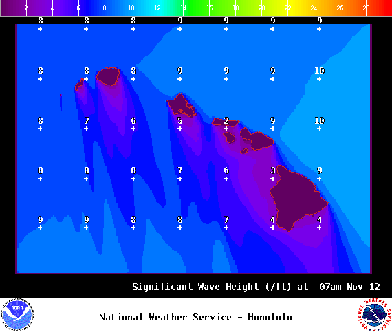
Image: NOAA
Sponsored Content


