

High Surf Advisory Posted for North Shores

Image: James Grenz
Alerts (as of 1:00 a.m.)
A Small Craft Advisory is posted for all island waters through 6 p.m. Friday.
A High Surf Advisory is posted for north shores of the Big Island through 6 p.m. Thursday.
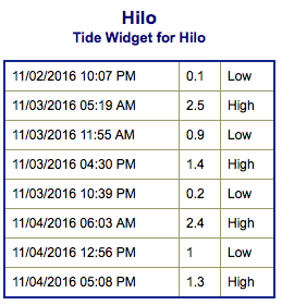
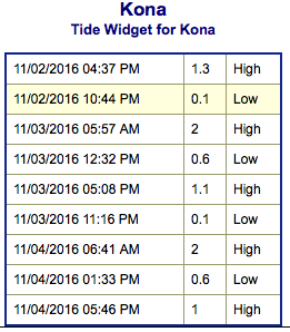
**Click directly on the images below to make them larger. Charts include: Big Island projected winds, tides, swell direction & period and expected wave heights.**
 Big Island Surf Forecast
Hilo side: Wave heights are forecast from overhead to double overhead + today for the best breaks.
Kona side: Wave heights are expected to fill in to about knee/waist high today, some spots could get sneaky sets up to chest high.
South: Wave heights are expected to be knee/waist high today from the northwest wrap with sets into the chest high range. Trade swell spots will continue to see blustery overhead + waves.
 Multiple pulses of swell energy out of the northwest are expected for this week. Kona side will be heavily shadowed from these swells. A bigger swell is forecast to build Wednesday into Thursday with another pulse expected Friday and into the weekend.
Northeast trade swell with north-northeast mix for Tuesday but winds will be onshore.
Nothing significant is expected out of the SPAC with minimal leftovers expected this week.
Keep in mind, surf heights are measured on the face of the wave from trough to crest. Heights vary from beach to beach, and at the same beach, from break to break.
**Click here for your detailed Big Island weather report.**
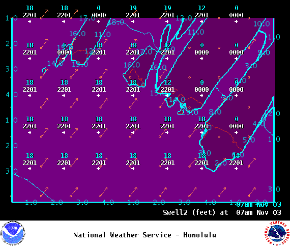
Image: NOAA
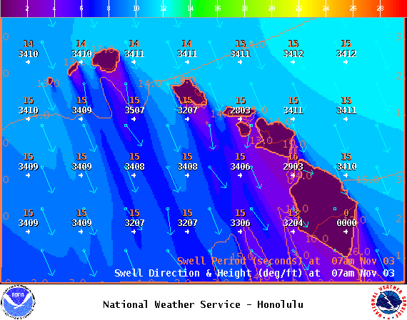
Image: NOAA
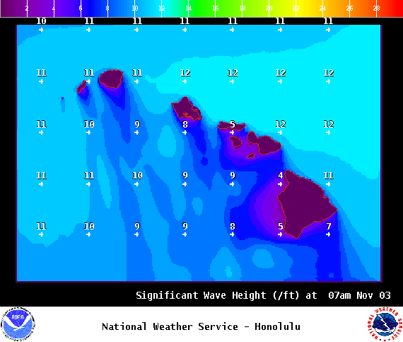
Image: NOAA
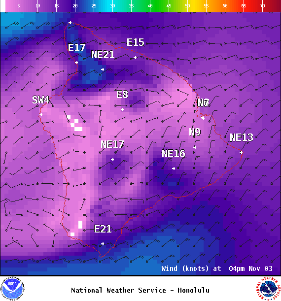
Image: NOAA
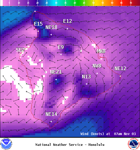
Image: NOAA
Image: NOAA
Sponsored Content


