

New Round of NW Energy Expected This Week

Image: James Grenz
Alerts (as of 1:00 a.m.)
A Small Craft Advisory is posted for our usual windy coastal channels and waters through Tuesday at 6 a.m.
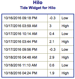
**Click directly on the images below to make them larger. Charts include: Big Island projected winds, tides, swell direction & period and expected wave heights.**
 Big Island Surf Forecast
Hilo side: Wave heights are forecast from knee/chest high, sometimes more at the best exposures today.
Kona side: Wave heights are expected to be knee/thigh high or less.
South: Wave heights are expected to be knee/thigh high or less. Otherwise, it should be pretty flat out of the south.
 Mix of northwest swells are fading Monday through the middle of the week. Another round of northwest swell is forecast Thursday / Friday with some northeast energy due in shortly thereafter.
A modest trade swell will continue for north and east exposures.
Nothing significant is expected out of the SPAC with minimal leftovers expected going into the new week.
Keep in mind, surf heights are measured on the face of the wave from trough to crest. Heights vary from beach to beach, and at the same beach, from break to break.
**Click here for your detailed Big Island weather report.**
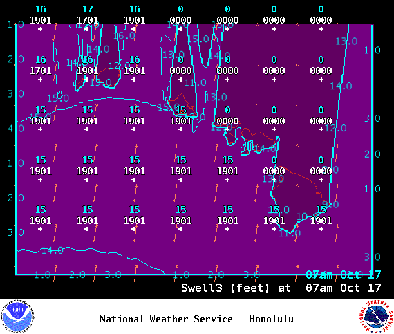
Image: NOAA
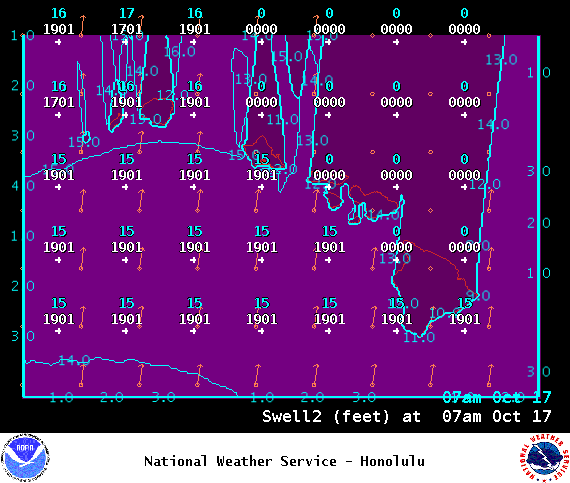
Image: NOAA
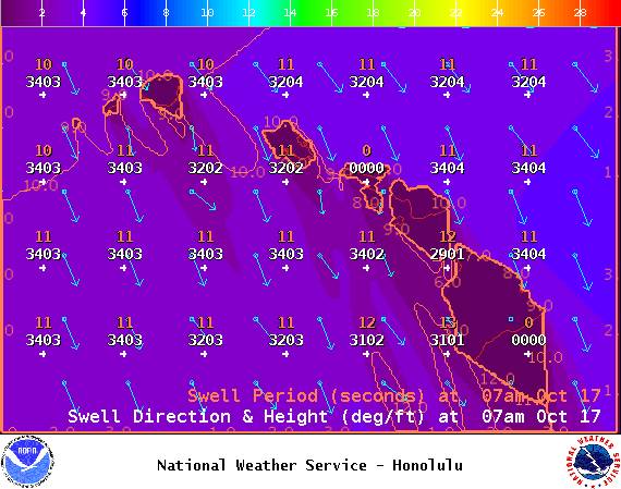
Image: NOAA
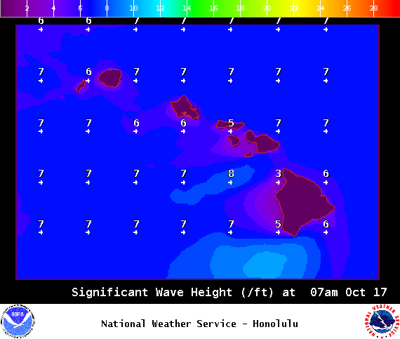
Image: NOAA
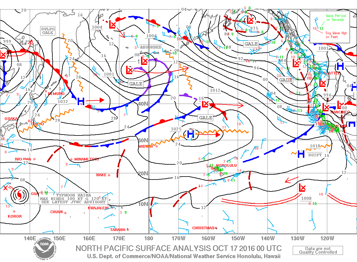
Image: NOAA
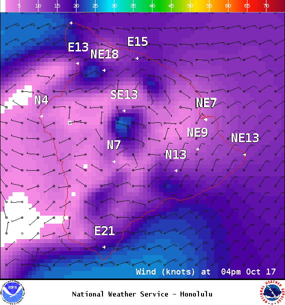
Image: NOAA
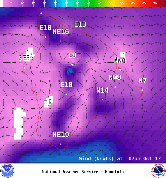
Image: NOAA
Sponsored Content


