

SSW Swell Holds Today, Trade Swell Continues
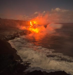
Image: Chris Archer
Alerts (as of 1:00 a.m.)
A Small Craft Advisory is posted for our usual windy areas through 6 a.m. Saturday for east winds from 20 to 25 knots.
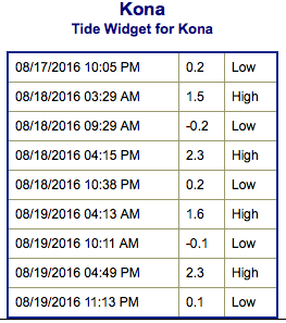
**Click directly on the images below to make them larger. Charts include: Big Island projected winds, tides, swell direction & period and expected wave heights.**
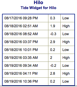 Big Island Surf Forecast
Hilo side: Wave heights for spots exposed to the trade swell are expected to be knee/waist/chest high today.
Kona side: Wave heights are expected to be knee/waist high today, some spots could get up to belly/chest high on the sets at the best exposures near sunset.
South: Wave heights are expected to be knee/thigh high today, some spots could get up to belly/chest high on the sets at the best exposures near sunset. Spots catching trade swell could get up to knee/waist/chest high.
 Our current south-southwest swell is holding Thursday before slowly fading through the weekend.
Trade swell will hold for the next few days with onshore conditions for windward sides.
Pre-season north-northwest swell is expected for Friday and Saturday. The Big Island will be heavily shadowed from this swell.
Models are showing activity in the West Pacific so there is potential for swell energy out of that region in the future.
Keep in mind, surf heights are measured on the face of the wave from trough to crest. Heights vary from beach to beach, and at the same beach, from break to break.
**Click here for your detailed Big Island weather report.**
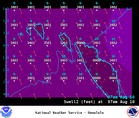
Image: NOAA
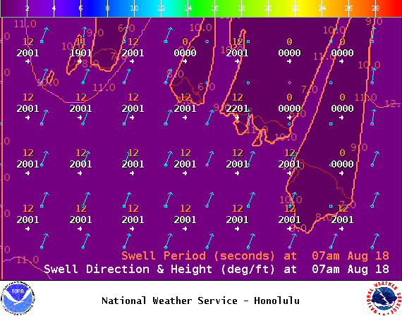
Image: NOAA
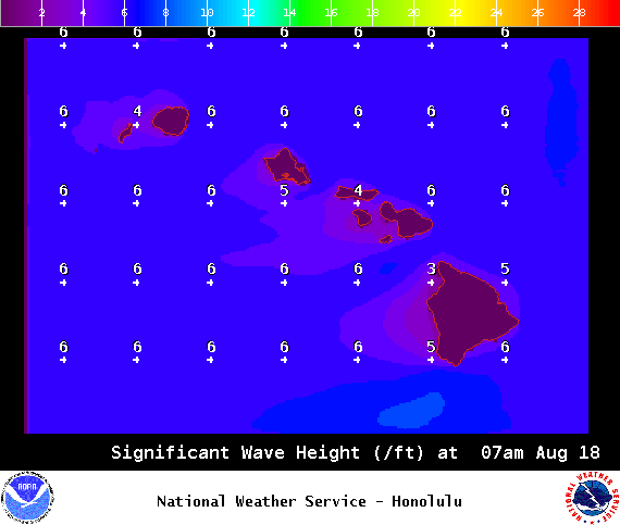
Image: NOAA
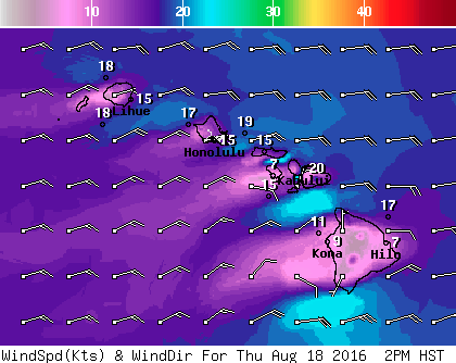
Image: NOAA
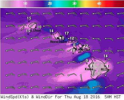
Image: NOAA
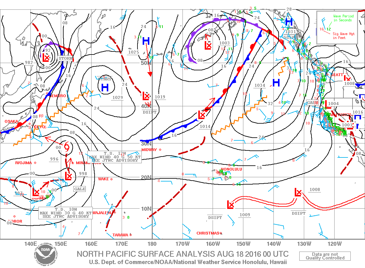
Image: NOAA
Sponsored Content


