

Increase in Showers & Cloud Cover Expected

Image: James Grenz
Alerts (as of 1:00 a.m.)
A Small Craft Advisory is posted for our usual windy areas through 6 a.m. Saturday for east winds from 20 to 25 knots.
**Click directly on the images below to make them larger. Charts include: Big Island high/low forecasted temperatures, projected winds, chance of cloud cover, projected localized weather conditions, vog/SO2 forecast and expected wave heights.**
Looking Ahead
Breezy trade winds are forecast to strengthen slightly Thursday through Friday, then slowly weaken again over the weekend. An area of enhanced moisture will cause showers to increase over windward areas Thursday and Thursday night, followed by a drier pattern on Friday. Showers are forecast to increase again during the weekend as a disturbance moves slowly westward over the islands. Winds are forecast to weaken again early next week, with a very warm and humid land and sea breeze pattern prevailing.
Today
Partly to mostly cloudy with scattered showers for windward areas. Hazy skies for the Kona side with sunny skies in the morning, then building cloud cover in the afternoon and scattered showers. High temperatures from 84° to 89°. Winds will be northeasterly around 15 mph.
UV index at 13 (“extreme” exposure level)
Tonight
Winds will be northeasterly around 15 mph. Mostly cloudy with numerous showers for windward spots. Mostly cloudy for lee areas and clearing as the night goes on. Low temperatures from 72° to 77°.
Our Big Island Now Weather homepage always includes daily: Sunrise | Sunset | Moonrise | Moonset | Moon Phase | Live Weather Cams | 5-day Forecast | Current Temperature & Conditions
**Click here for your detailed Big Island surf report.**

Image: NOAA
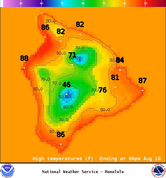
Image: NOAA

Image: NOAA
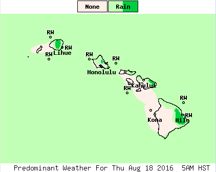
Image: NOAA
Image: NOAA
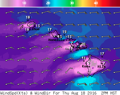
Image: NOAA
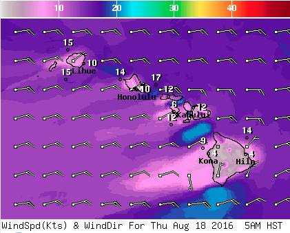
Image: NOAA
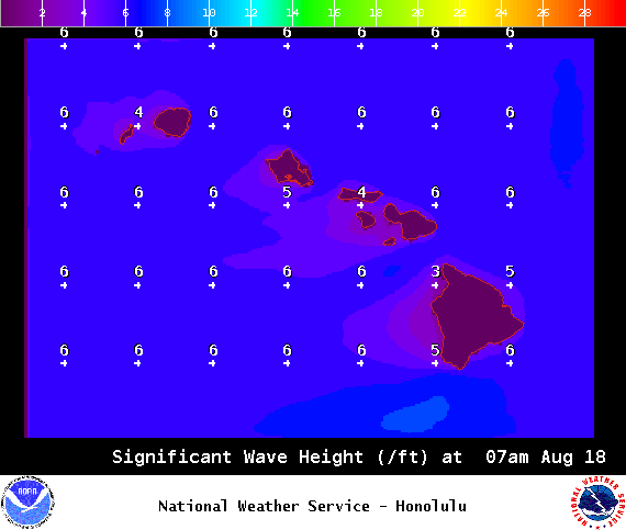
Image: NOAA
daily weather report, daily forecast, 5-day forecast, 5-day weather, big island weather, hawaii county weather, kona weather report, hilo weather report, waimea weather report, surf report, big island surf, sunrise and sunset times, uv index report, wind gusts, tonight’s forecast, weather slideshow
Sponsored Content


