

New Swell Expected to Build Late Today

Image: James Grenz
Alerts (as of 1:00 a.m.)
There are no weather alerts posted at this time.
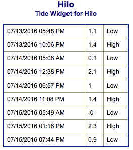
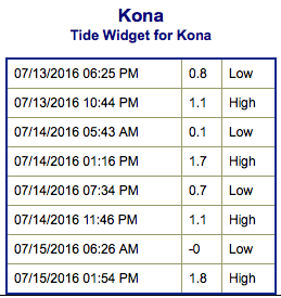
**Click directly on the images below to make them larger. Charts include: Big Island projected winds, tides, swell direction & period and expected wave heights.**
 Big Island Surf Forecast
Hilo side: Wave heights for spots exposed to the trade swell are expected to be around knee/waist/chest high.
Kona side: Wave heights are expected to be knee/thigh high today with the best breaks catching maybe a waist high wave on the sets right before dark.
South: Wave heights are expected to be knee/thigh high today with the best breaks catching maybe a waist high wave on the sets right before dark.
 A new south-southwest swell is forecast to build in and peak late Thursday into Friday.
Quiet in the North Pacific at this time.
East swell from Blas continues but begins to fade today. Hurricane Celia will generate more swell. For now, east swell is expected to build Friday into Saturday and peak Sunday. Darby is also likely to generate swell for us. Will keep an eye on the development and bring you details as they become clearer.
Keep in mind, surf heights are measured on the face of the wave from trough to crest. Heights vary from beach to beach, and at the same beach, from break to break.
**Click here for your detailed Big Island weather report.**
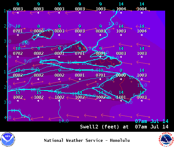
Image: NOAA
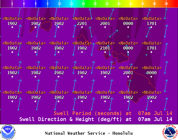
Image: NOAA
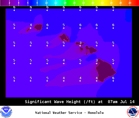
Image: NOAA
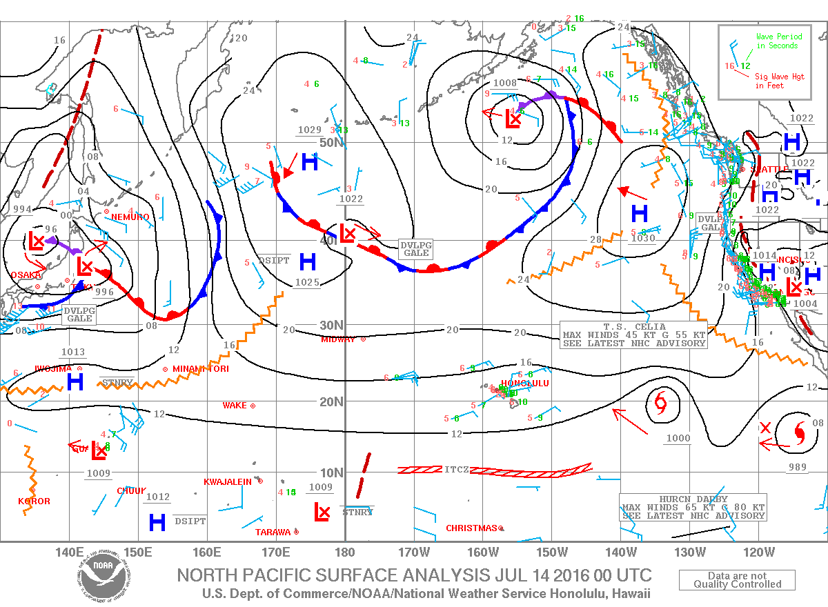
Image: NOAA
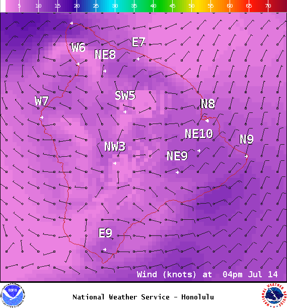
Image: NOAA
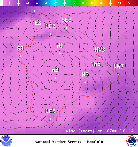
Image: NOAA
Sponsored Content


