

High Surf Advisory Posted for Rising Surf

Image: James Grenz
Alerts (as of 1:00 a.m.)
A High Surf Advisory is in effect for the south shores of all islands through 6 a.m. Sunday.
A Small Craft Advisory is in effect through 6 p.m. Friday for all Big Island coastal waters (except windward waters).
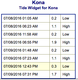
**Click directly on the images below to make them larger. Charts include: Big Island projected winds, tides, swell direction & period and expected wave heights.**
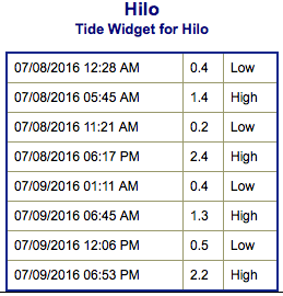 Big Island Surf Forecast
Hilo side: Wave heights for spots exposed to the trade swell are expected to be around waist/head high.
Kona side: Wave heights are expected to be waist/shoulder high today with the best breaks hitting head high on the sets.
South: Wave heights are expected to be waist/shoulder high today with the best breaks hitting head high on the sets.
 Building swell today peaking late Friday into Saturday morning up to a couple feet overhead for the best breaks. Sunday surf begins a slow downward trend.
Trade swell will bring surf to northeast exposures but onshore breeze will pick up quickly during the day to chop it up.
Quiet in the North Pacific at this time. A possible swell may be generated in the Eastern Pacific later this weekend or early next week by hurricane Blas. If everything stays on track we could see some energy building around Sunday or Monday. Surf potential is also possible from another system developing off of Mexico.
Keep in mind, surf heights are measured on the face of the wave from trough to crest. Heights vary from beach to beach, and at the same beach, from break to break.
**Click here for your detailed Big Island weather report.**
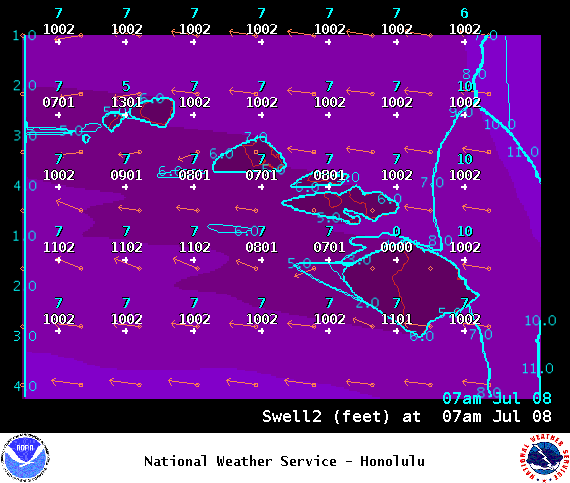
Image: NOAA
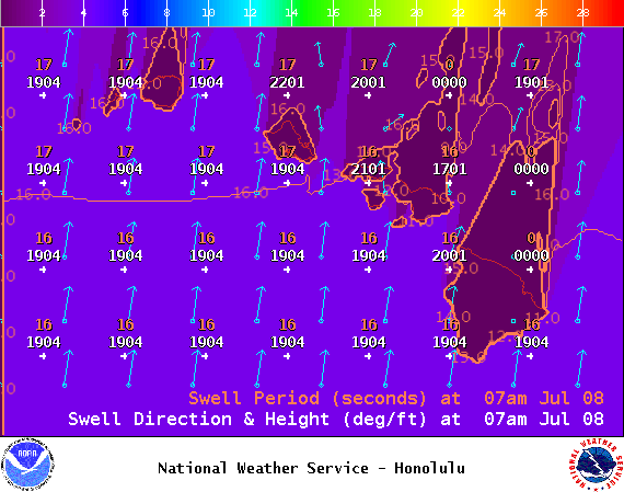
Image: NOAA
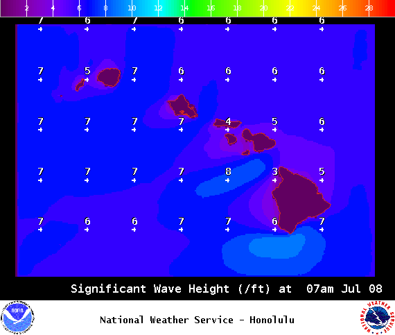
Image: NOAA
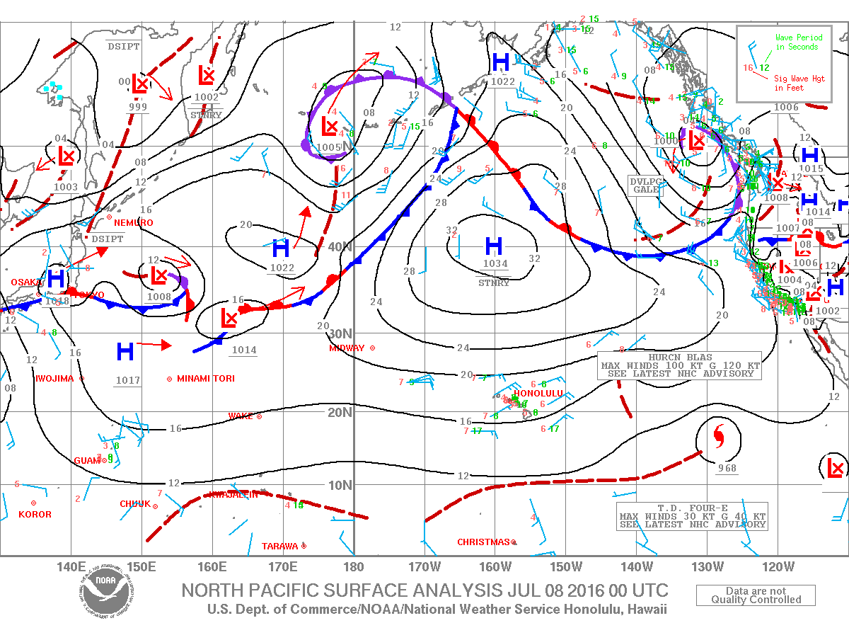
Image: NOAA
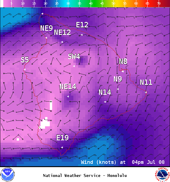
Image: NOAA
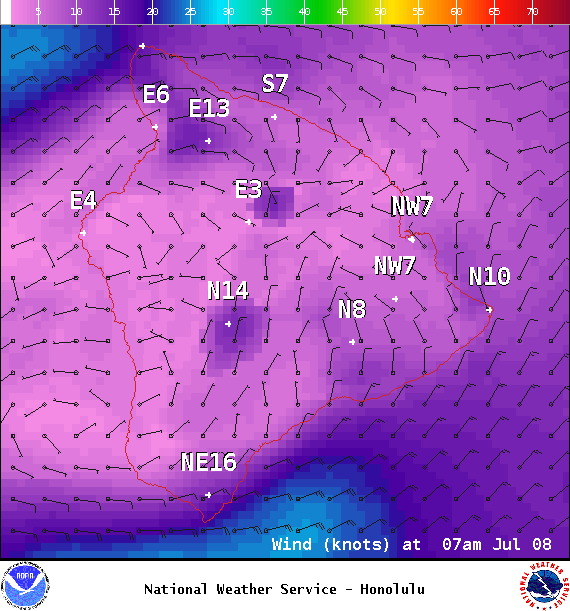
Image: NOAA
Sponsored Content


