

Fourth of July Surf Forecast

Image: James Grenz
Alerts (as of 1:00 a.m.)
A High Surf Advisory is posted for east facing showers through 6 a.m. Monday but could be extended if conditions persist.
A Small Craft Advisory is in effect through 6 a.m. Monday for all Big Island coastal waters (except windward waters).
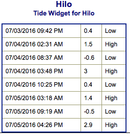
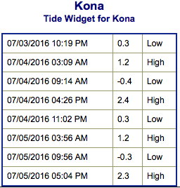
**Click directly on the images below to make them larger. Charts include: Big Island projected winds, tides, swell direction & period and expected wave heights.**
 Big Island Surf Forecast
Hilo side: Wave heights for spots exposed to the trade swell are expected to be around waist/head high.
Kona side: Wave heights are expected to be knee/thigh high today or even flat.
South: Wave heights are expected to be waist high or less today. Strongest around South Point with trade swell filling in.
 Very small southerly swells are showing for the next few days. South-southeast spots will get the most action with up to chest high waves. Looking farther out, we may see another round of swell starting around July 7th.
Trade swell will bring surf to northeast exposures but onshore breeze will pick up quickly during the day to chop it up.
Quiet in the North Pacific at this time. A possible swell may be generated in the Eastern Pacific later this weekend or early next week. If everything stays on track we could see some energy building around the 9th and 10th.
Keep in mind, surf heights are measured on the face of the wave from trough to crest. Heights vary from beach to beach, and at the same beach, from break to break.
**Click here for your detailed Big Island weather report.**
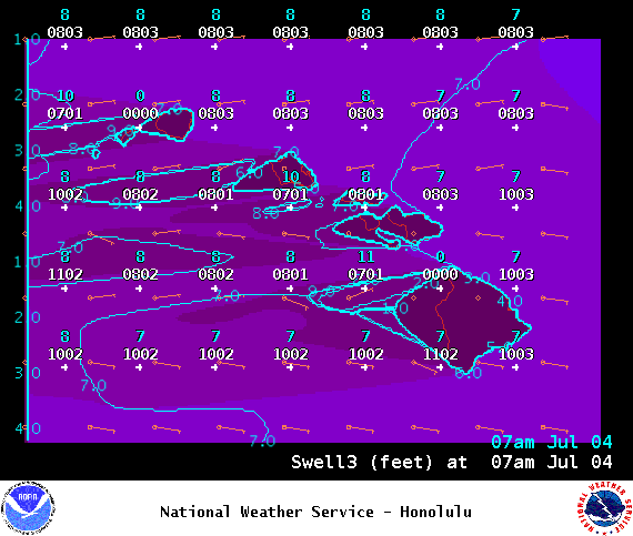
Image: NOAA /NWS

Image: NOAA /NWS
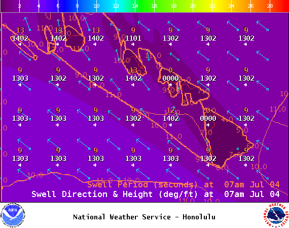
Image: NOAA /NWS
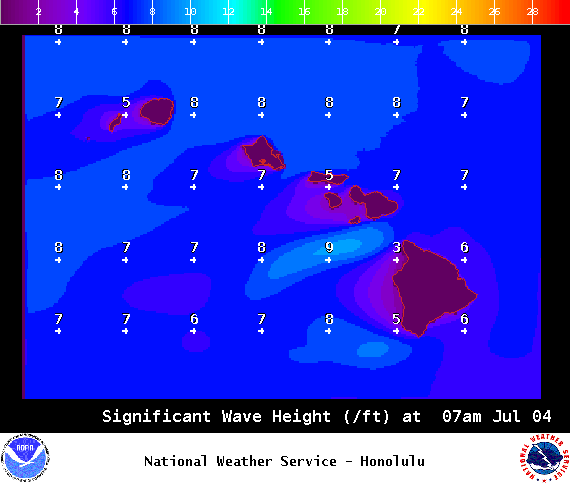
Image: NOAA /NWS
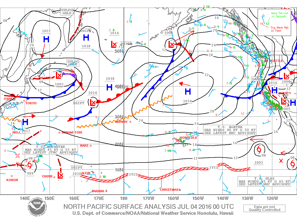
Image: NOAA /NWS
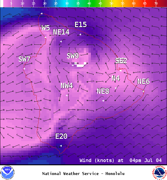
Image: NOAA /NWS
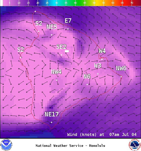
Image: NOAA /NWS
Sponsored Content


