

Holiday Weekend Forecast

Image: James Grenz
Alerts (as of 1:00 a.m.)
A Gale Warning is posted for the Alenuihaha channel and leeward waters. Winds out of the east from 25 to 35 knots and seas of 8 to 12 feet are expected.
A Small Craft Advisory is in effect through 6 p.m. Saturday for the rest of our coastal waters.
A Wind Advisory is posted through 6 p.m. Saturday. Northeast to east winds from 15 to 30 mph are forecast with gusts getting up to 50 mph or more. Winds will be strongest over mauka areas and ridges and downslope of the mountains. Over the summit of Haleakalā winds could gust up to 60 mph.
**Click directly on the images below to make them larger. Charts include: Big Island high/low forecasted temperatures, projected winds, chance of cloud cover, projected localized weather conditions, vog/SO2 forecast and expected wave heights.**
Looking Ahead
Strong and gusty trade winds will affect the state through Saturday, with a slight drop in winds expected for the rest of the holiday weekend. Dry and stable conditions are expected with very little rainfall through Saturday. The airmass will gradually moisten from the east leading to increased showers that could pass to leeward areas on the smaller islands from time to time.
Today & Sunday
Partly cloudy skies with a slight chance of windward showers. Windy conditions with northeast winds expected from 15 to 30 mph, gusting to 50 mph. Areas of haze are forecast for the Kona side. High temperatures from 83° to 88°. On Sunday, winds will drop slightly to 15 to 25 mph. Showers are likely for windward and mauka spots with scattered afternoon showers for the Kona side.
UV index at 13 (“extreme” exposure level)
Tonight
Northeast winds tonight from 15 to 25 mph or more. Partly cloudy and windy with a slight chance of windward showers. Low temperatures from 73° to 78°. On Sunday, showers will increase for windward spots and winds will be slightly weaker.
Our Big Island Now Weather homepage always includes daily: Sunrise | Sunset | Moonrise | Moonset | Moon Phase | Live Weather Cams | 5-day Forecast | Current Temperature & Conditions
**Click here for your detailed Big Island surf report.**
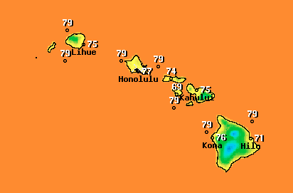
Image: NOAA /NWS
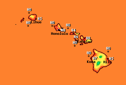
Image: NOAA /NWS
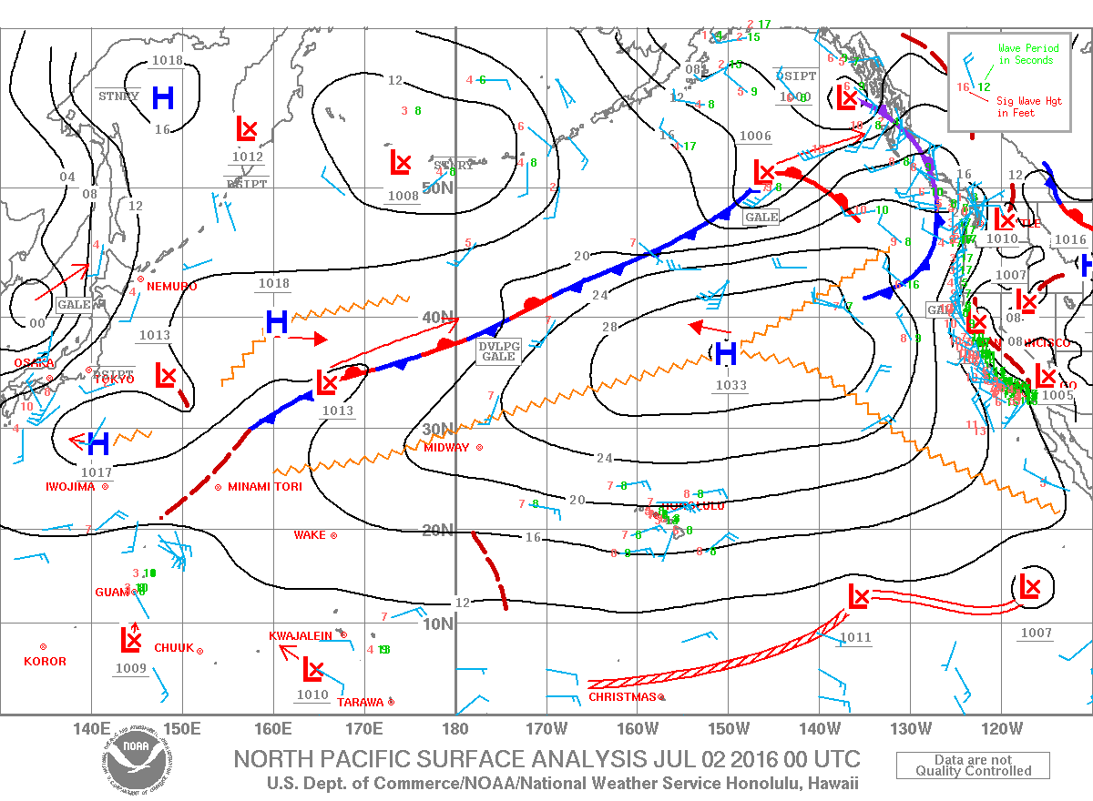
Image: NOAA /NWS
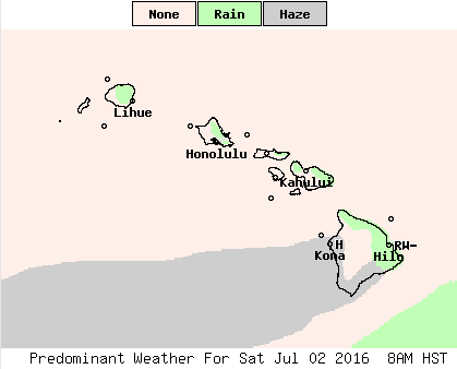
Image: NOAA /NWS
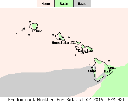
Image: NOAA /NWS
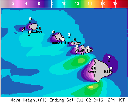
Image: NOAA /NWS
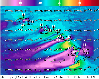
Image: NOAA /NWS
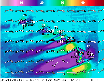
Image: NOAA /NWS
Sponsored Content


