

SSW Swell Holds Through Today

Image: James Grenz
Alerts (as of 1:00 a.m.)
A High Surf Advisory is posted through 6 a.m. Thursday for all south facing shores and could be extended past that if conditions persist.
A Small Craft Advisory is posted through 6 a.m. Friday for east winds increasing to 25 knots.
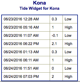
**Click directly on the images below to make them larger. Charts include: Big Island projected winds, tides, swell direction & period and expected wave heights.**
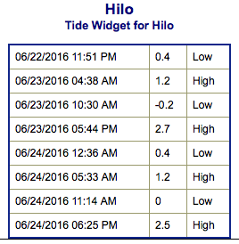 Big Island Surf Forecast
Hilo side: Wave heights for spots exposed to the swell are expected to be around chest/head high today for spots exposed to the trade swell.
Kona side: Wave heights are expected to be waist/shoulder high today with the best breaks getting head high on the sets.
South: Wave heights are expected to be waist/shoulder high today with the best breaks up to head high on the sets. Strongest around South Point.
 South-southwest holds steady into Thursday before fading Friday into the weekend. We may get a few southerly swells for the first week of July.
Trade swell will bring choppy surf to northeast exposures and pick up some Thursday into Friday.
Quiet in the North Pacific at this time with nothing of note generating swell energy for the foreseeable future.
Keep in mind, surf heights are measured on the face of the wave from trough to crest. Heights vary from beach to beach, and at the same beach, from break to break.
**Click here for your detailed Big Island weather report.**
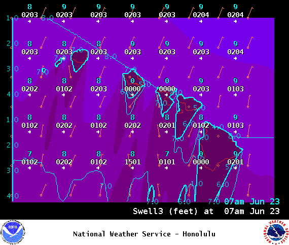
Image: NOAA / NWS
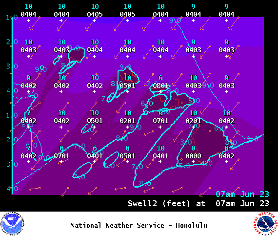
Image: NOAA / NWS
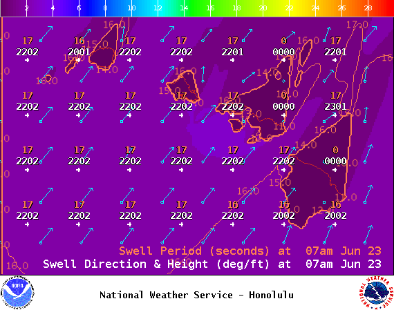
Image: NOAA / NWS
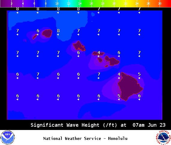
Image: NOAA / NWS
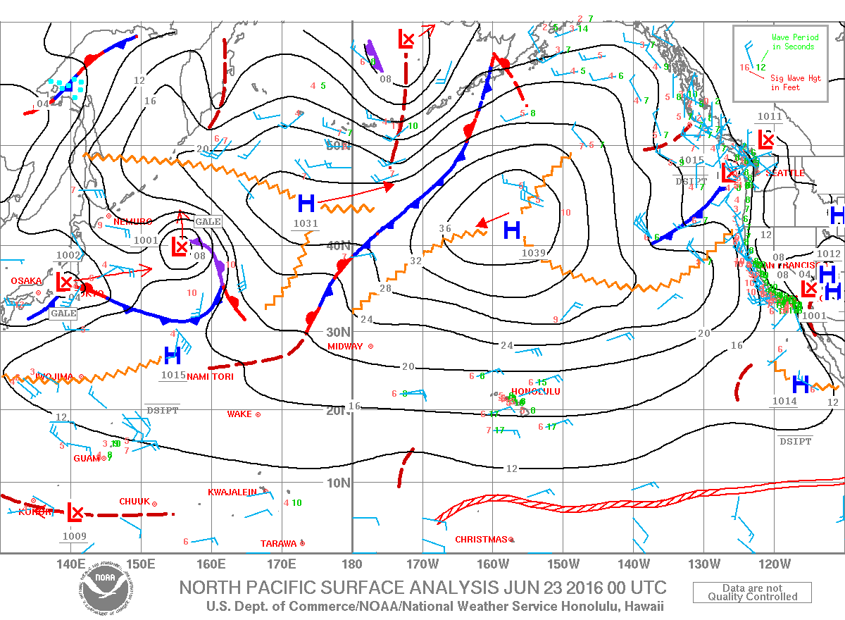
Image: NOAA / NWS
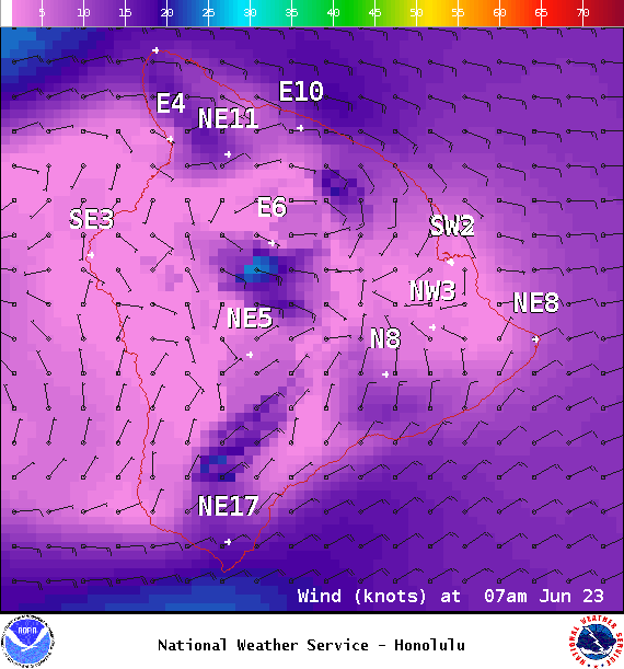
Image: NOAA / NWS
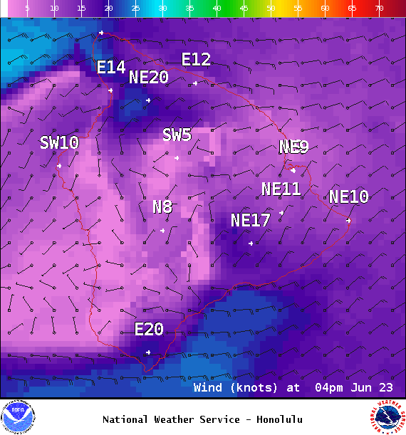
Image: NOAA / NWS
Sponsored Content


