

SSW Slowly Fades Through Work Week
 Alerts (as of 1:00 a.m.)
A High Surf Advisory is posted for the south facing shores of all islands through 6 p.m. Monday.
A Small Craft Advisory is posted for leeward waters and the Alenuihaha channel through 6 p.m. Tuesday.
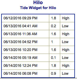
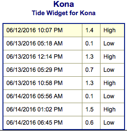
**Click directly on the images below to make them larger. Charts include: Big Island projected winds, tides, swell direction & period and expected wave heights.**
 Big Island Surf Forecast
Hilo side: Wave heights for spots exposed to the swell are expected to be around shoulder high today for spots exposed to the trade swell.
Kona side: Wave heights are expected to be chest/head high today with a slow decrease through the day.
South: Wave heights are expected to be chest/head high with occasional overhead sets today with a decrease through the day.
 Our current south-southwest swell is expected to slowly decrease through the week. A reinforcement out of the south is expected to keep the swell from fading too quickly.
Quiet in the North Pacific at this time with nothing of note generating swell energy for the foreseeable future.
Keep in mind, surf heights are measured on the face of the wave from trough to crest. Heights vary from beach to beach, and at the same beach, from break to break.
**Click here for your detailed Big Island weather report.**
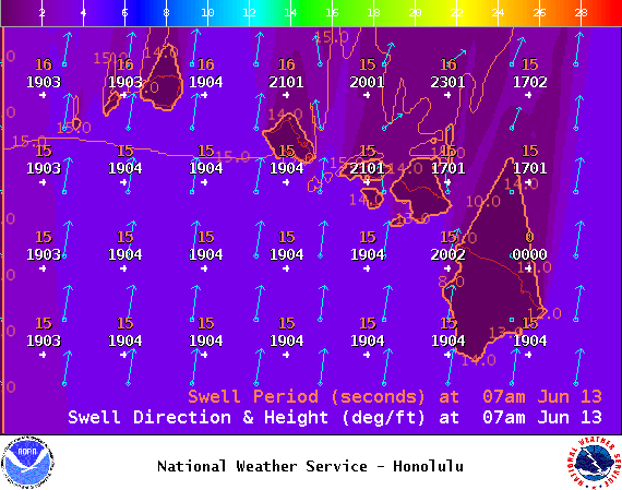
Image: NOAA / NWS
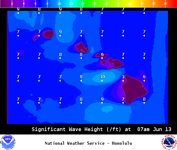
Image: NOAA / NWS
Image: NOAA / NWS
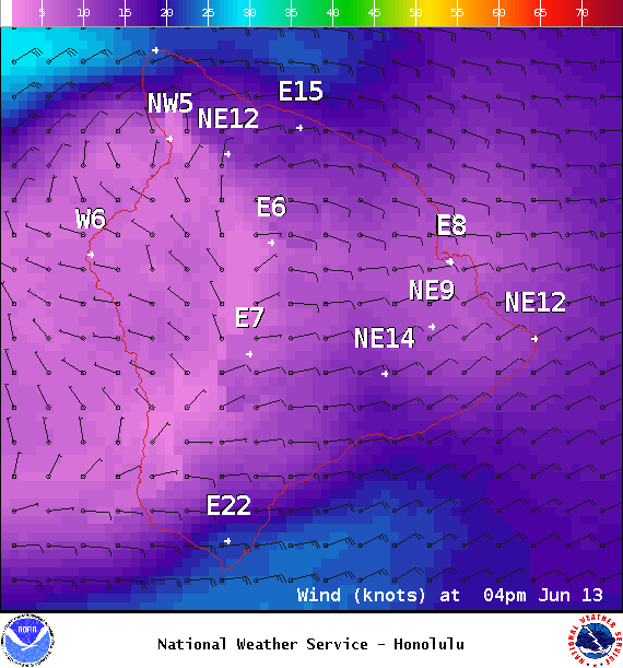
Image: NOAA / NWS
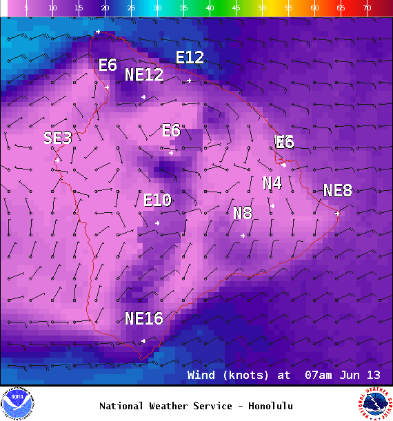
Image: NOAA / NWS
Sponsored Content


