

Afternoon Clouds & Showers Expected Today

Image: James Grenz
Alerts (as of 1:00 a.m.)
There are no weather alerts posted at this time.
**Click directly on the images below to make them larger. Charts include: Big Island high/low forecasted temperatures, projected winds, chance of cloud cover, projected localized weather conditions, vog/SO2 forecast and expected wave heights.**
Looking Ahead
Light winds will prevail through the weekend, with breezy trade winds returning early next week. Increasing clouds and showers are expected Saturday with the potential for locally heavy rainfall and isolated thunderstorms. Light winds Sunday will allow sea breezes to drive afternoon clouds and showers over the islands after a mostly sunny morning. Trade winds will return next week, bringing showers to windward areas.
Today & Sunday
We expect a mostly clear morning with cloudy skies building in the afternoon and evening. Scattered showers are expected during that time. Hazy skies are also expected. Variable winds are forecast up to 15 mph. High temperatures from 80° to 85° and sticky.
UV index at 9 (“very high” exposure level)
Tonight & Sunday Night
Variable winds are expected up to 15 mph. Mostly cloudy skies are forecast with scattered windward showers. For the Kona side mostly cloudy with scattered showers to start and clearing skies as the night goes on. Low temperatures from 68° to 73°.
Our Big Island Now Weather homepage always includes daily: Sunrise | Sunset | Moonrise | Moonset | Moon Phase | Live Weather Cams | 5-day Forecast | Current Temperature & Conditions
**Click here for your detailed Big Island surf report.**
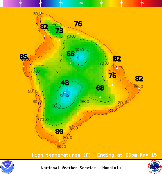
Image: NOAA / NWS
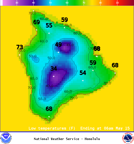
Image: NOAA / NWS
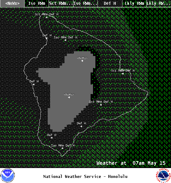
Image: NOAA / NWS
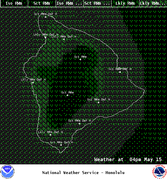
Image: NOAA / NWS

Image: NOAA / NWS
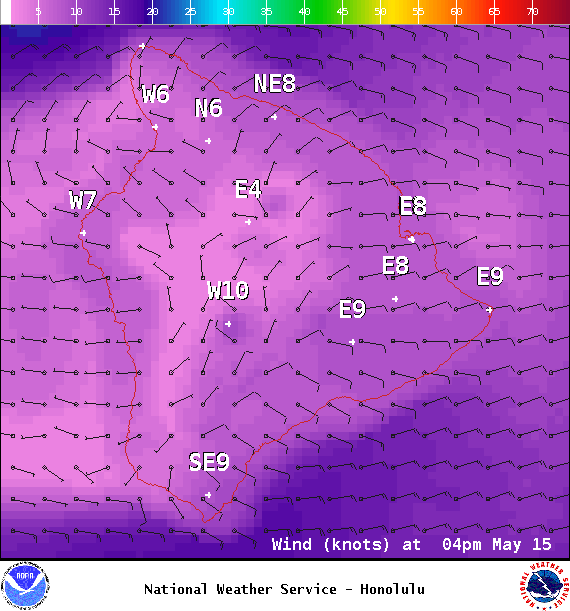
Image: NOAA / NWS
Image: NOAA / NWS
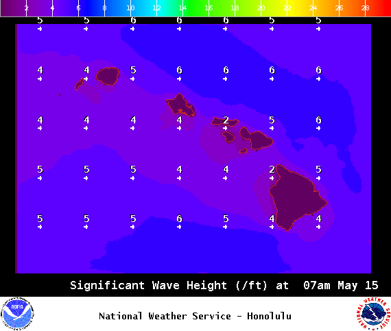
Image: NOAA / NWS
Sponsored Content


