

Weaker Winds Expected Today

Image: James Grenz
Alerts (as of 1:00 a.m.)
A High Surf Advisory is posted for east facing shores of the Big Island through 6 p.m. Thursday.
A Small Craft Advisory is posted through 6 a.m. Thursday for all Big Island coastal waters.
**Click directly on the images below to make them larger. Charts include: Big Island high/low forecasted temperatures, projected winds, chance of cloud cover, projected localized weather conditions, vog/SO2 forecast and expected wave heights.**
Looking Ahead
Weaker trades are expected Thursday into Friday. Little change in the rainfall pattern is expected through Thursday. An upper level disturbance could usher in an uptick in trade showers Friday afternoon into Saturday. Stronger trades returns briefly early next week.
Today
Today we expect mostly cloudy skies in the morning with scattered windward showers. The Kona side will be partly sunny to start with clouds building in the afternoon and isolated showers. Hazy skies are expected. Northeast winds are forecast from 15 mph. High temperatures from 80° to 85°.
UV index at 12 (“extreme” exposure level)
Tonight
Northeast winds are expected around 15 mph. Mostly cloudy skies are forecast with numerous showers in windward areas. For the Kona side clearing skies as the night goes on. Low temperatures from 67° to 72°.
Our Big Island Now Weather homepage always includes daily: Sunrise | Sunset | Moonrise | Moonset | Moon Phase | Live Weather Cams | 5-day Forecast | Current Temperature & Conditions
**Click here for your detailed Big Island surf report.**
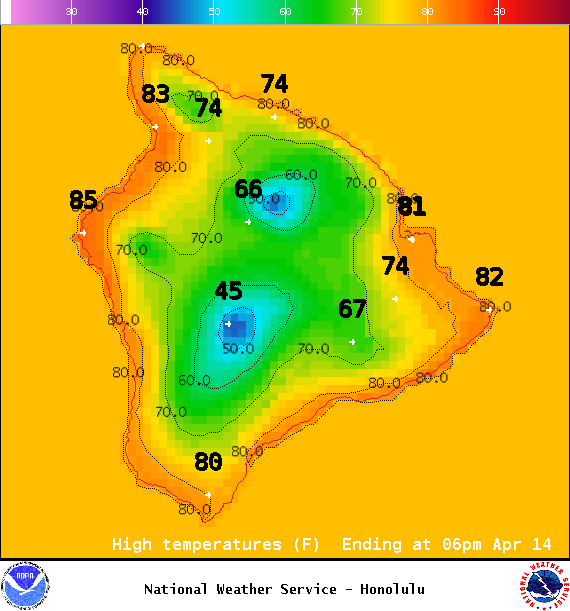
Image: NOAA / NWS
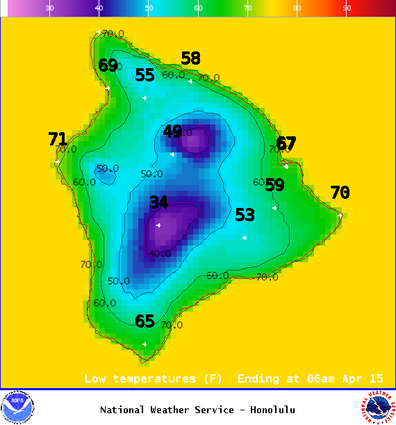
Image: NOAA / NWS
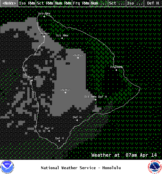
Image: NOAA / NWS
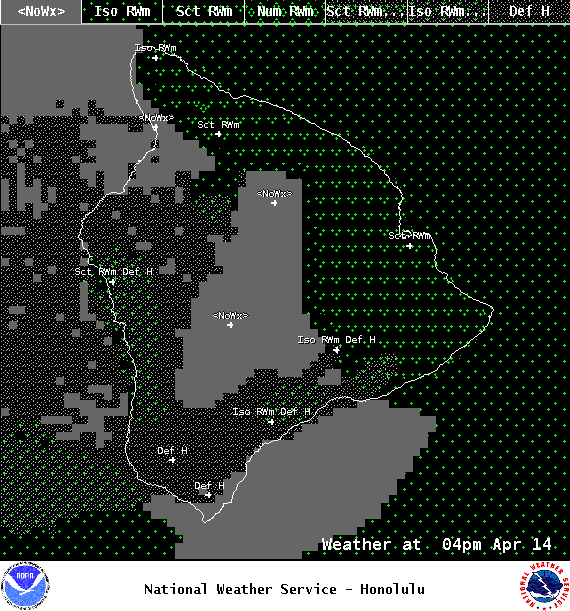
Image: NOAA / NWS
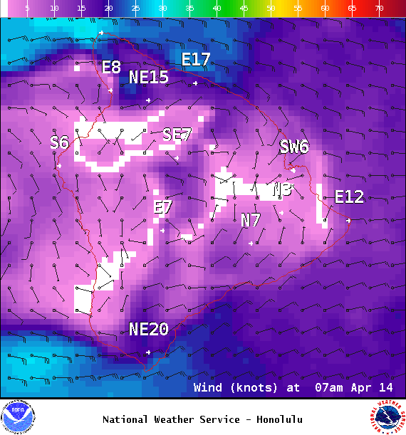
Image: NOAA / NWS
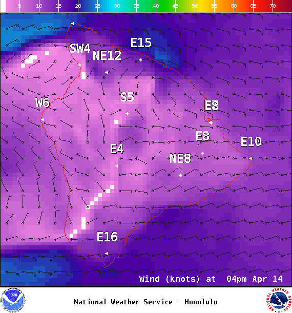
Image: NOAA / NWS
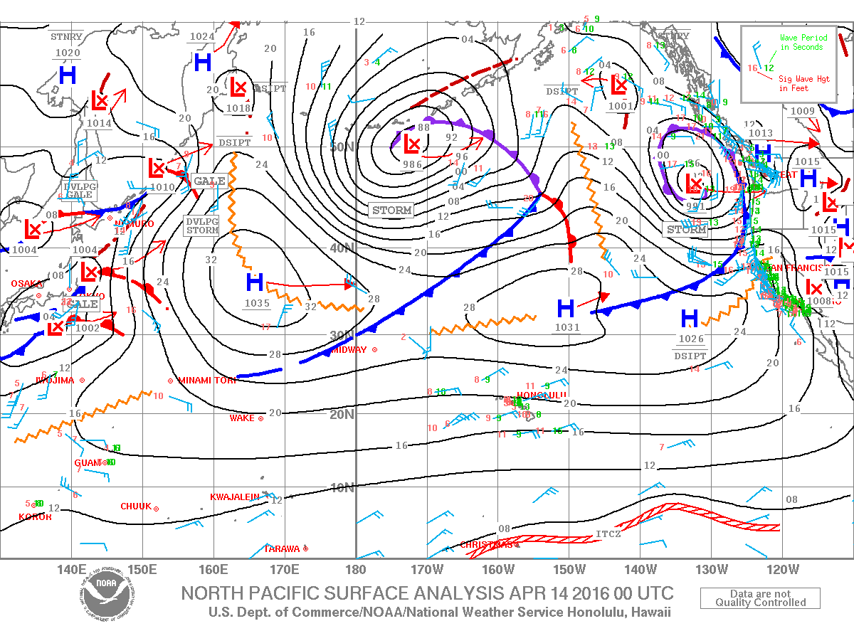
Image: NOAA / NWS
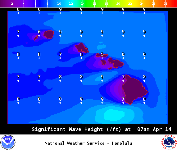
Image: NOAA / NWS
Sponsored Content


