

Solid NW Swell Expected to Build Friday

Image: Rod Miller / Honoli’i
Alerts (as of 1:00 a.m.)
A High Surf Advisory is posted for east facing shores of the Big Island through 6 p.m. Thursday.
A Small Craft Advisory is posted through 6 a.m. Thursday for all Big Island coastal waters.
**Click directly on the images below to make them larger. Charts include: Big Island projected winds, tides, swell direction & period and expected wave heights.**
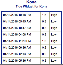 Big Island Surf Forecast
Hilo side: Wave heights for spots exposed to the swell are expected to be head high / overhead or more today. Smaller for spots without direct exposure to the swell.
Kona side: Wave heights are expected to be waist high or less today.
South: Wave heights are expected to be waist high or less today. Spots with exposure to the northwest swell could be bigger.
 Our current swell continues to fade. Another solid northwest swell is expected Friday and Saturday. The Big Island’s Kona side will be heavily shadowed once again. The swell is forecast to build late Friday and peak on Saturday shoulder / head high at the best breaks.
Not much expected out of the SPAC anytime soon. Minimal southerly swells will trickle in over the next several days. There is the possibility of a little something around April 18th or so.
Keep in mind, surf heights are measured on the face of the wave from trough to crest. Heights vary from beach to beach, and at the same beach, from break to break.
**Click here for your detailed Big Island weather report.**
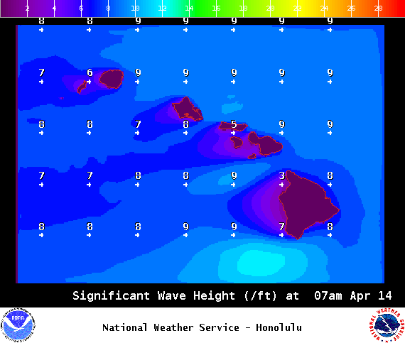
Image: NOAA / NWS
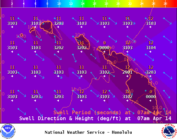
Image: NOAA / NWS
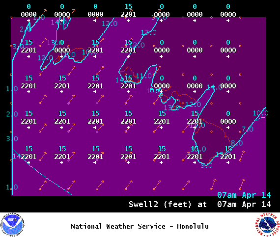
Image: NOAA / NWS
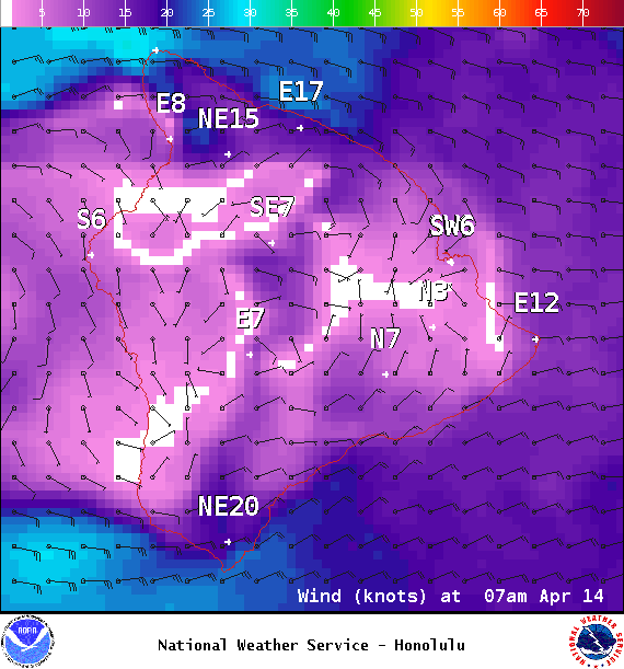
Image: NOAA / NWS
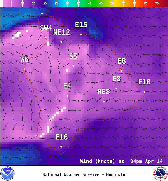
Image: NOAA / NWS
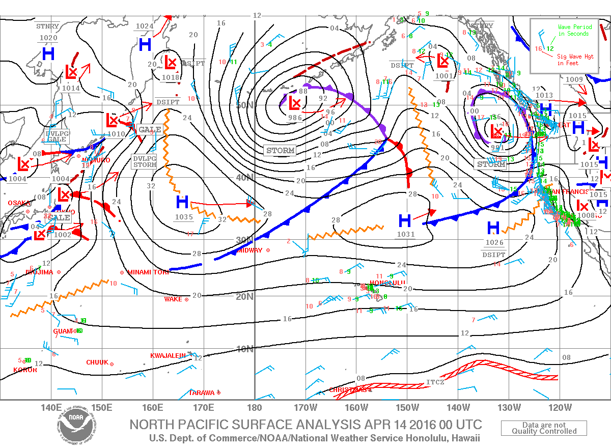
Image: NOAA / NWS
Sponsored Content


