

NW Swell Peaks Today at Advisory Levels

Image: James Grenz
Alerts (as of 1:00 a.m.)
A High Surf Advisory is posted for the west side of the Big Island until 6 p.m. Wednesday.
A Small Craft Advisory remains in effect until 6 a.m. Thursday for the Alenuihaha channel and windward waters.
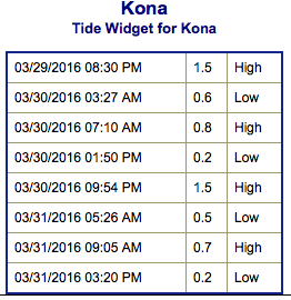
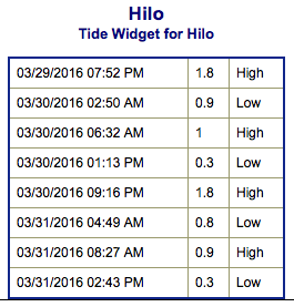
**Click directly on the images below to make them larger. Charts include: Big Island projected winds, tides, swell direction & period and expected wave heights.**
 Big Island Surf Forecast
Hilo side: Wave heights for spots exposed to the swell are expected to be shoulder/head high today. Spots without direct exposure will be smaller.
Kona side: Wave heights are expected to be chest/head high today. The best breaks could get up to overhead or more on the sets.
South: Wave heights are expected to be chest/head high today with plusses in the overhead range.
 Our current long period south-southwest swell is expected to fill in further and peak on Wednesday up to shoulder high at the best spots. Not much expected out of the SPAC anytime soon.
Our current large northwest swell will continue to build Wednesday and peak in the afternoon. The Big Island will largely be blocked from this swell but some size will still filter in up to about overhead at the best exposures. This has prompted a High Surf Advisory to be issued. This swell is expected to slowly trend down Thursday into Friday.
Models are showing another northwest swell around April 6th. Will keep an eye on the progress.
Keep in mind, surf heights are measured on the face of the wave from trough to crest. Heights vary from beach to beach, and at the same beach, from break to break.
**Click here for your detailed Big Island weather report.**
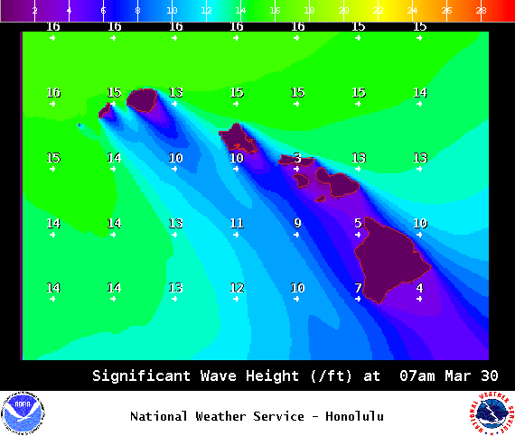
Image: NOAA / NWS
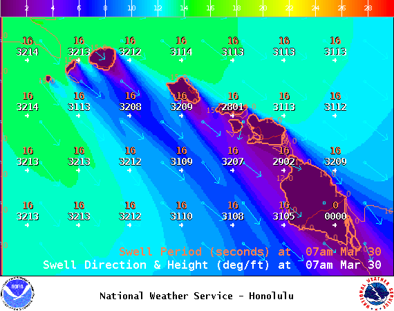
Image: NOAA / NWS
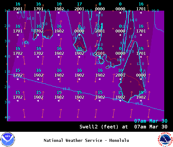
Image: NOAA / NWS
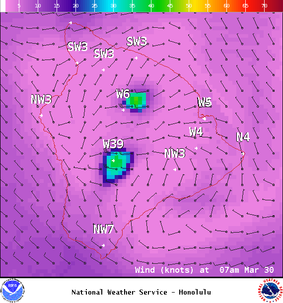
Image: NOAA / NWS
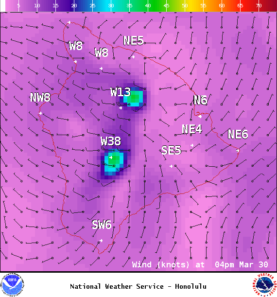
Image: NOAA / NWS
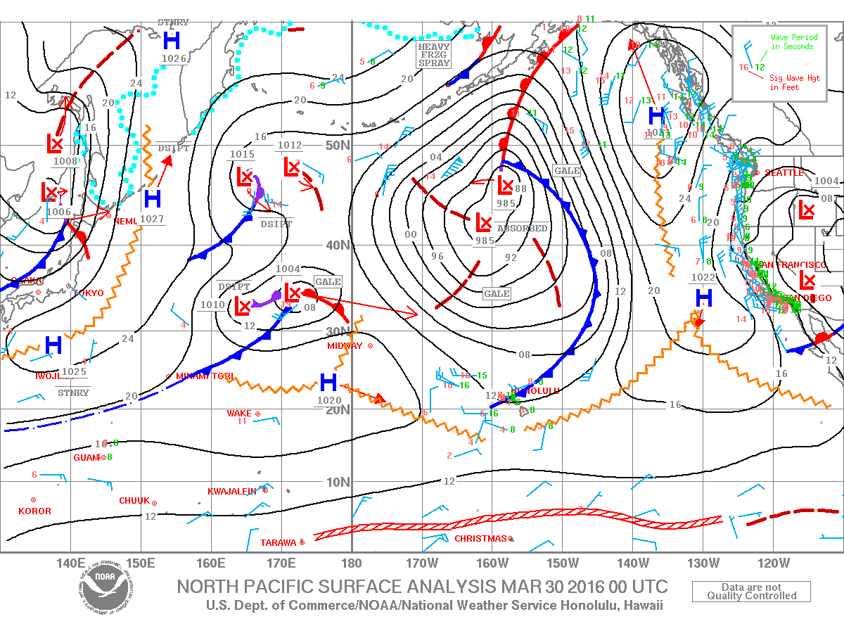
Image: NOAA / NWS
Sponsored Content


