

NW Building Into Wednesday for Exposed Spots

Image: Gary Petrison / Honolii
Alerts (as of 1:00 a.m.)
There are no marine alerts posted at this time.
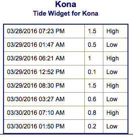
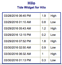
**Click directly on the images below to make them larger. Charts include: Big Island projected winds, tides, swell direction & period and expected wave heights.**
 Big Island Surf Forecast
Hilo side: Wave heights for spots exposed to the swell are expected to be knee/shoulder high today. Spots without direct exposure will be smaller.
Kona side: Wave heights are expected to be ankle/waist high today. Gradual rise late in the day.
South: Wave heights are expected to be knee/shoulder high today.
 Our current long period south-southwest swell is expected to fill in Tuesday and peak on Wednesday up to shoulder high at the best breaks. Not much expected out of the SPAC anytime soon.
Looks like a large northwest swell will build Tuesday into Wednesday. The Big Island will largely be blocked from this swell but some size will still filter in up to about overhead at the best exposures. This swell is expected to peak late Wednesday before fading Thursday. Models are showing another northwest swell around April 5th. Will keep an eye on the progress.
Keep in mind, surf heights are measured on the face of the wave from trough to crest. Heights vary from beach to beach, and at the same beach, from break to break.
**Click here for your detailed Big Island weather report.**
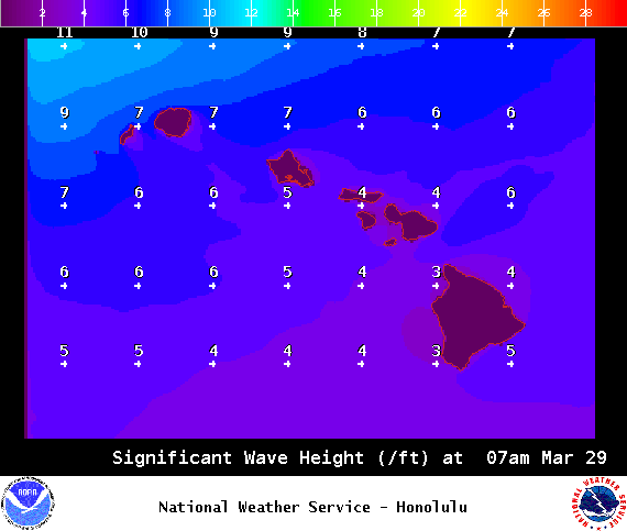
Image: NOAA / NWS
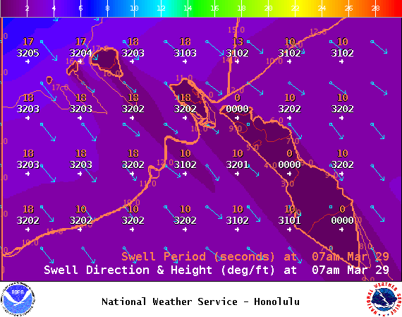
Image: NOAA / NWS
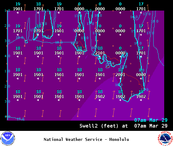
Image: NOAA / NWS
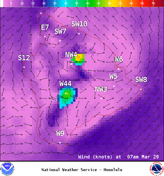
Image: NOAA / NWS
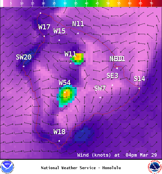
Image: NOAA / NWS
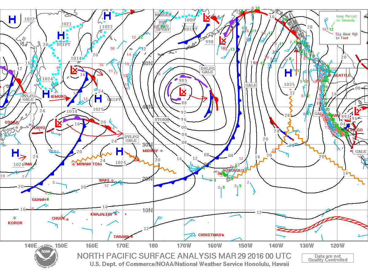
Image: NOAA / NWS
Sponsored Content


