

Thunderstorms, Heavy Rain Possible Today

Image: James Grenz
Alerts (as of 1:00 a.m.)
There are no weather alerts posted at this time.
**Click directly on the images below to make them larger. Charts include: Big Island high/low forecasted temperatures, projected winds, chance of cloud cover, projected localized weather conditions, vog/SO2 forecast and expected wave heights.**
Looking Ahead
A weak trough of low pressure west of the state this afternoon, will slowly push eastward across the island chain tonight through Saturday. An unstable airmass is expected to accompany the weather feature as it moves through, bringing unsettled weather along with the potential for heavy rainfall and thunderstorms. The trough will shift east of the state on Sunday with a drier airmass moving back over the islands. A cold front will then approach from the northwest on Monday and slowly push southeastward through the state Monday night through Tuesday night. High pressure will then build north of the state during the middle to latter part of next week, with light to moderate trades along with a cooler and drier airmass returning to the islands.
Today
Today we expect partly sunny skies. The windward side will have scattered showers in the morning then scattered showers and thunderstorms likely in the afternoon. Kona side is forecast to get isolated showers in the morning then scattered showers and thunderstorms in the afternoon. Locally heavy rainfall is possible. Southeast winds are forecast around 15 mph. High temperatures from 79° to 85°.
UV index at 10 (“very high” exposure level)
Tonight
Variable winds are expected from 5 to 15 mph. Mostly cloudy skies are forecast in the evening becoming partly cloudy. Scattered showers and thunderstorms are in the forecast with locally heavy rainfall possible. Low temperatures from 68° to 73°.
Our Big Island Now Weather homepage always includes daily: Sunrise | Sunset | Moonrise | Moonset | Moon Phase | Live Weather Cams | 5-day Forecast | Current Temperature & Conditions
**Click here for your detailed Big Island surf report.**
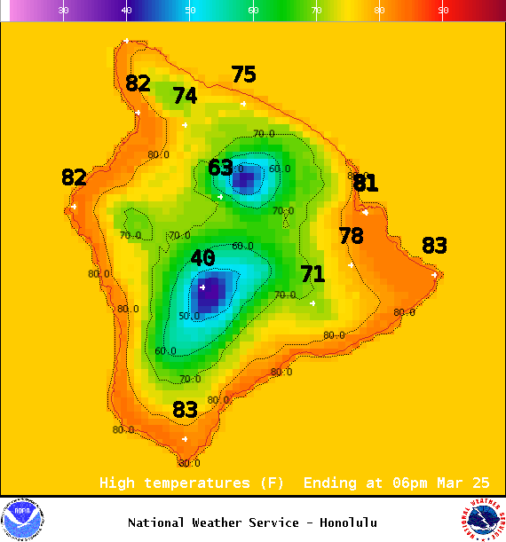
Image: NOAA / NWS
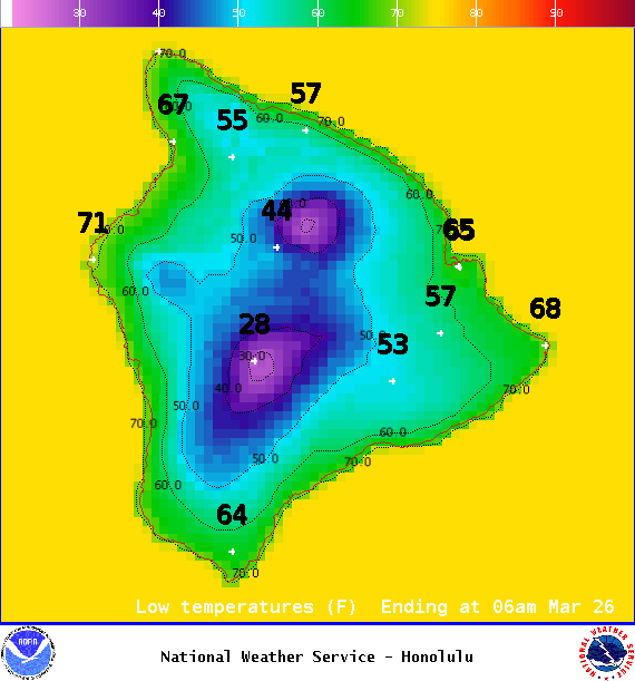
Image: NOAA / NWS
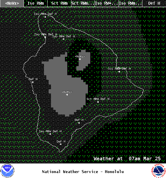
Image: NOAA / NWS
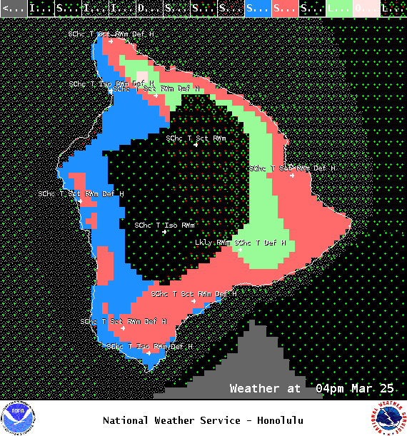
Image: NOAA / NWS
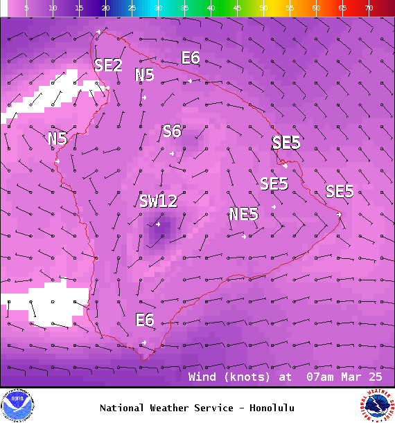
Image: NOAA / NWS
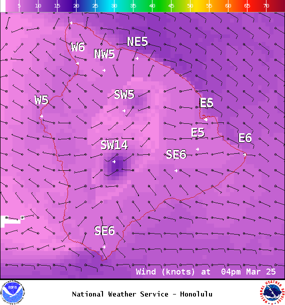
Image: NOAA / NWS
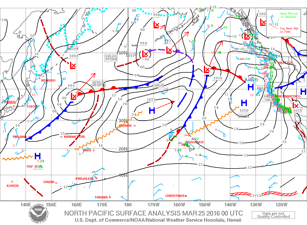
Image: NOAA / NWS
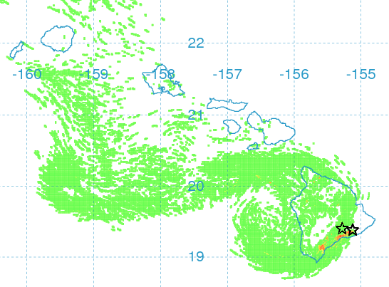
Image: UHSOEST
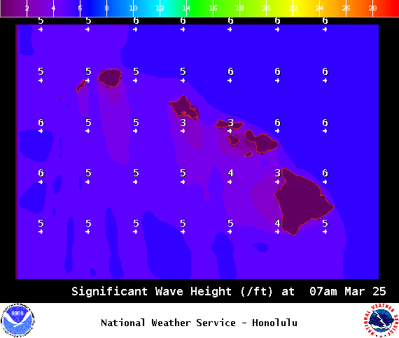
Image: NOAA / NWS
Sponsored Content


