

Mix of NNE and NNW Swells Today

Image: James Grenz / Makalawena
Alerts (as of 1:00 a.m.)
A Small Craft Advisory is posted for all island waters through 6 p.m Friday.
A High Surf Advisory is posted through 6 p.m. Friday for rising surf along north shores of the Big Island.
A Marine Weather Statement has been issued by the National Weather Service for a large north-northwest swell and strong northeast winds. Waves will likely produce moderate surges and large breaking waves at Hilo Harbor.
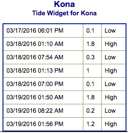
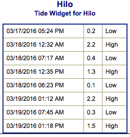
**Click directly on the images below to make them larger. Charts include: Big Island projected winds, tides, swell direction & period and expected wave heights.**
 Big Island Surf Forecast
Hilo side: Wave heights for spots exposed to the swell are expected to be overhead to double overhead today at the best breaks. Spots without direct exposure will be smaller.
Kona side: Wave heights are expected to be knee/waist high today. The best breaks could get up to tummy/chest high.
South: Wave heights are expected to be knee/waist high today.
 Our current south-southwest bump continues to fade as a new small south-southwest swell fills in Friday and into the weekend. Sunday this swell will begin a fading trend.
A short period north-northwest swell is in the water now. The period is forecast to become longer from Friday into Saturday and the swell will shift more northerly as well. This swell energy should continue through the weekend. Another dose of northwest swell is expected to move in late Saturday and peak Sunday before fading out early next week.
Keep in mind, surf heights are measured on the face of the wave from trough to crest. Heights vary from beach to beach, and at the same beach, from break to break.
**Click here for your detailed Big Island weather report.**
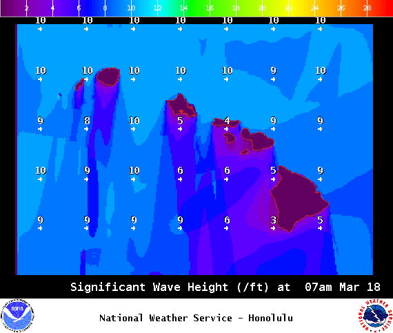
Image: NOAA / NWS
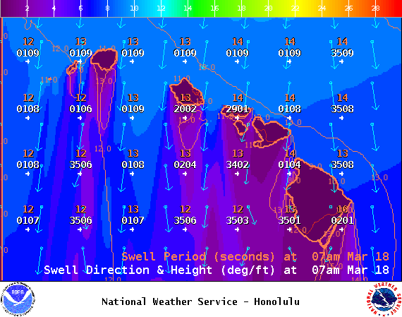
Image: NOAA / NWS
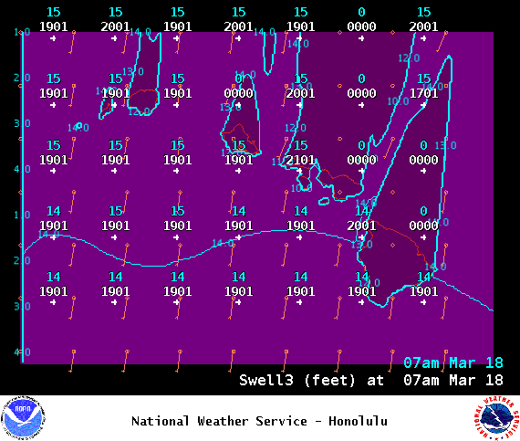
Image: NOAA / NWS

Image: NOAA / NWS
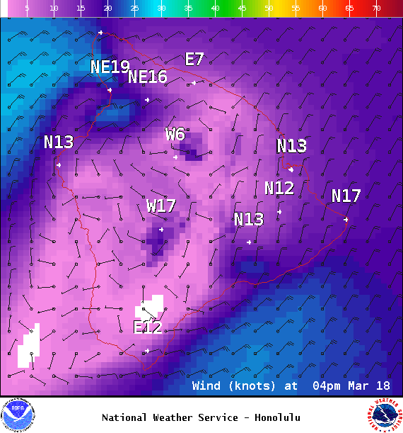
Image: NOAA / NWS
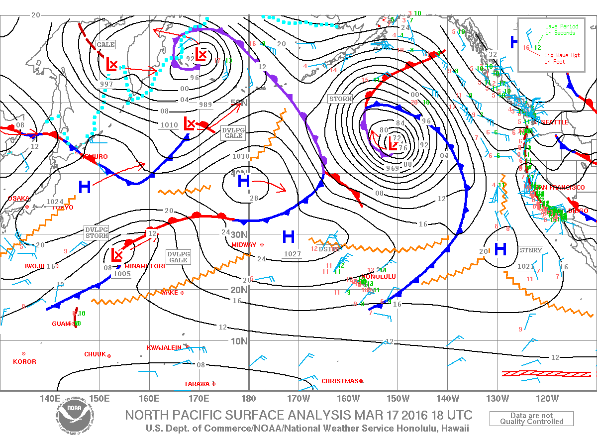
Image: NOAA / NWS
Sponsored Content


