

NNE Swell Fills in Today, New Swells for Weekend

Image: James Grenz
Alerts (as of 1:00 a.m.)
A Small Craft Advisory is posted for all island waters through 6 p.m Friday.
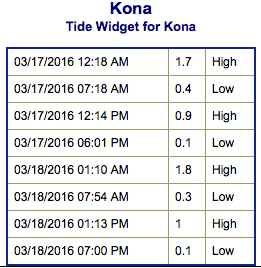
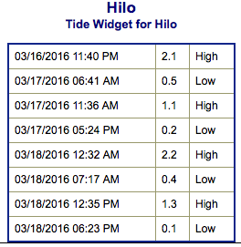
**Click directly on the images below to make them larger. Charts include: Big Island projected winds, tides, swell direction & period and expected wave heights.**
 Big Island Surf Forecast
Hilo side: Wave heights for spots exposed to the swell are expected to be shoulder high to slightly overhead today at the best breaks. Spots without direct exposure will be smaller.
Kona side: Wave heights are expected to be waist high or less today.
South: Wave heights are expected to be waist high or less today.
 Our current south-southwest bump is fading Thursday. A new small south-southwest swell is expected for Friday and into the weekend. Sunday this swell will begin a fading trend.
A short period north-northeast swell is expected to fill in Thursday and peak late Thursday and Friday. The period is forecast to become longer from Friday into Saturday and the swell will shift. This swell energy should continue through the weekend.
Keep in mind, surf heights are measured on the face of the wave from trough to crest. Heights vary from beach to beach, and at the same beach, from break to break.
**Click here for your detailed Big Island weather report.**
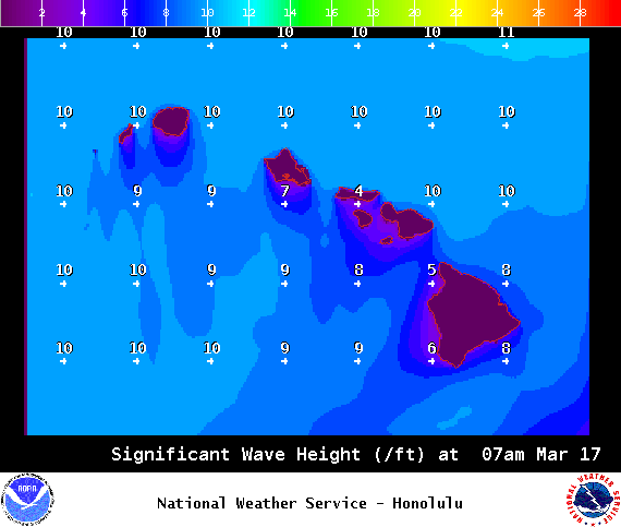
Image: NOAA / NWS
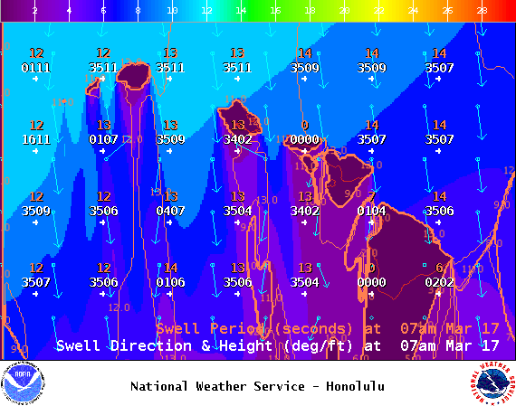
Image: NOAA / NWS
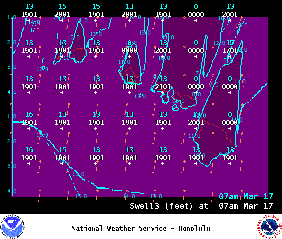
Image: NOAA / NWS
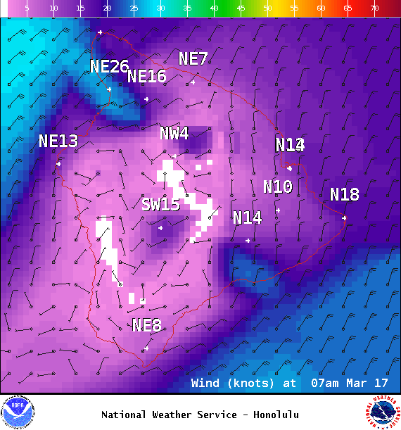
Image: NOAA / NWS
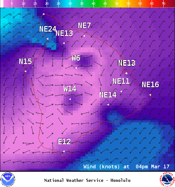
Image: NOAA / NWS
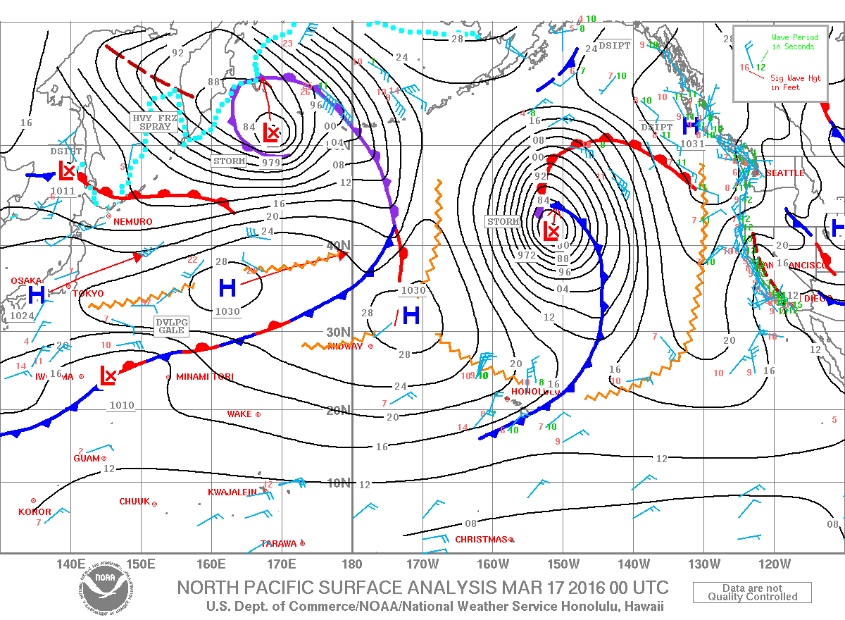
Image: NOAA / NWS
Sponsored Content


