

Winds Weaken, Front Expected This Week

Image: Tim Bryan
Alerts (as of 1:00 a.m.)
A Small Craft Advisory is posted for all Big Island waters through 6 a.m. Monday.
A High Surf Advisory is posted for the north facing shores of the Big Island through 6 a.m. Monday.
**Click directly on the images below to make them larger. Charts include: Big Island high/low forecasted temperatures, projected winds, chance of cloud cover, projected localized weather conditions, vog/SO2 forecast and expected wave heights.**
Looking Ahead
Trades winds will gradually weaken Monday. Clouds and passing showers will favor windward and mauka areas especially over the Big Island slopes. Winds will become light out ahead of a front that is expected to pass across the state late Tuesday and and into Wednesday. Another round of cool and breezy weather is expected to follow in the fronts wake.
Today
Today we expect partly sunny skies with scattered showers in windward spots especially in the morning. The Kona side can expect a clear morning with isolated afternoon showers. East winds are forecast around 15 mph. High temperatures from 80° to 85°.
UV index at 10 (“very high” exposure level)
Tonight
Variable winds are expected up to 15 mph. Scattered windward and mauka showers are forecast with just isolated leeward showers. Low temperatures from 67° to 73°.
Our Big Island Now Weather homepage always includes daily: Sunrise | Sunset | Moonrise | Moonset | Moon Phase | Live Weather Cams | 5-day Forecast | Current Temperature & Conditions
**Click here for your detailed Big Island surf report.**
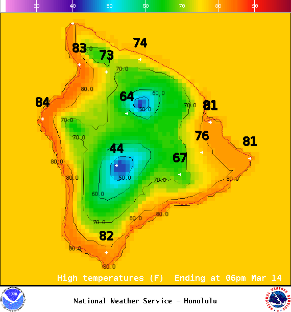
Image: NOAA / NWS
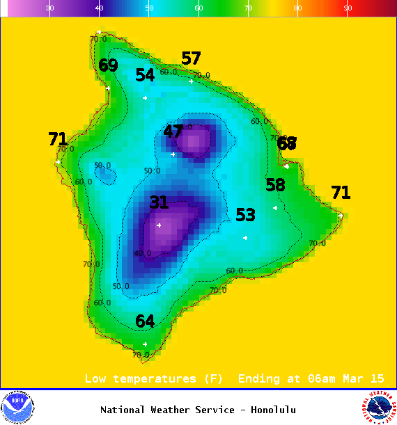
Image: NOAA / NWS
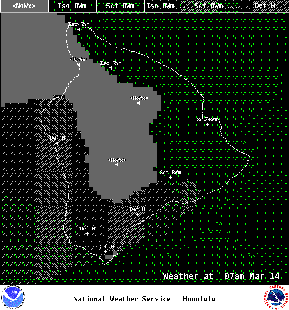
Image: NOAA / NWS
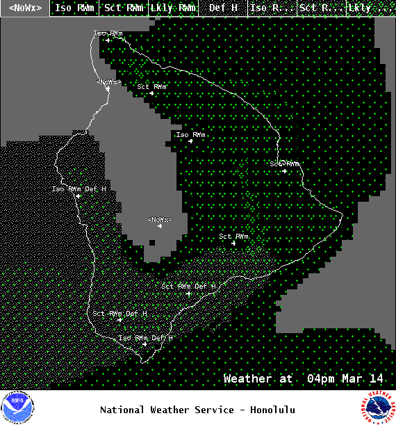
Image: NOAA / NWS
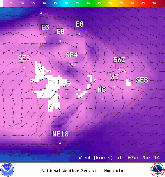
Image: NOAA / NWS
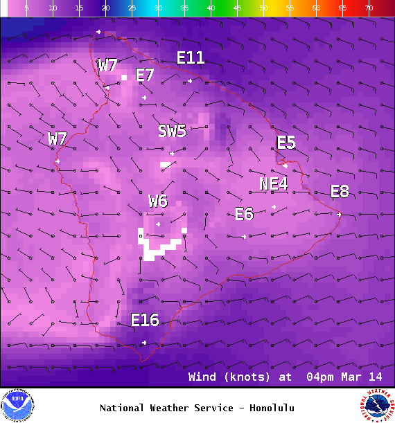
Image: NOAA / NWS
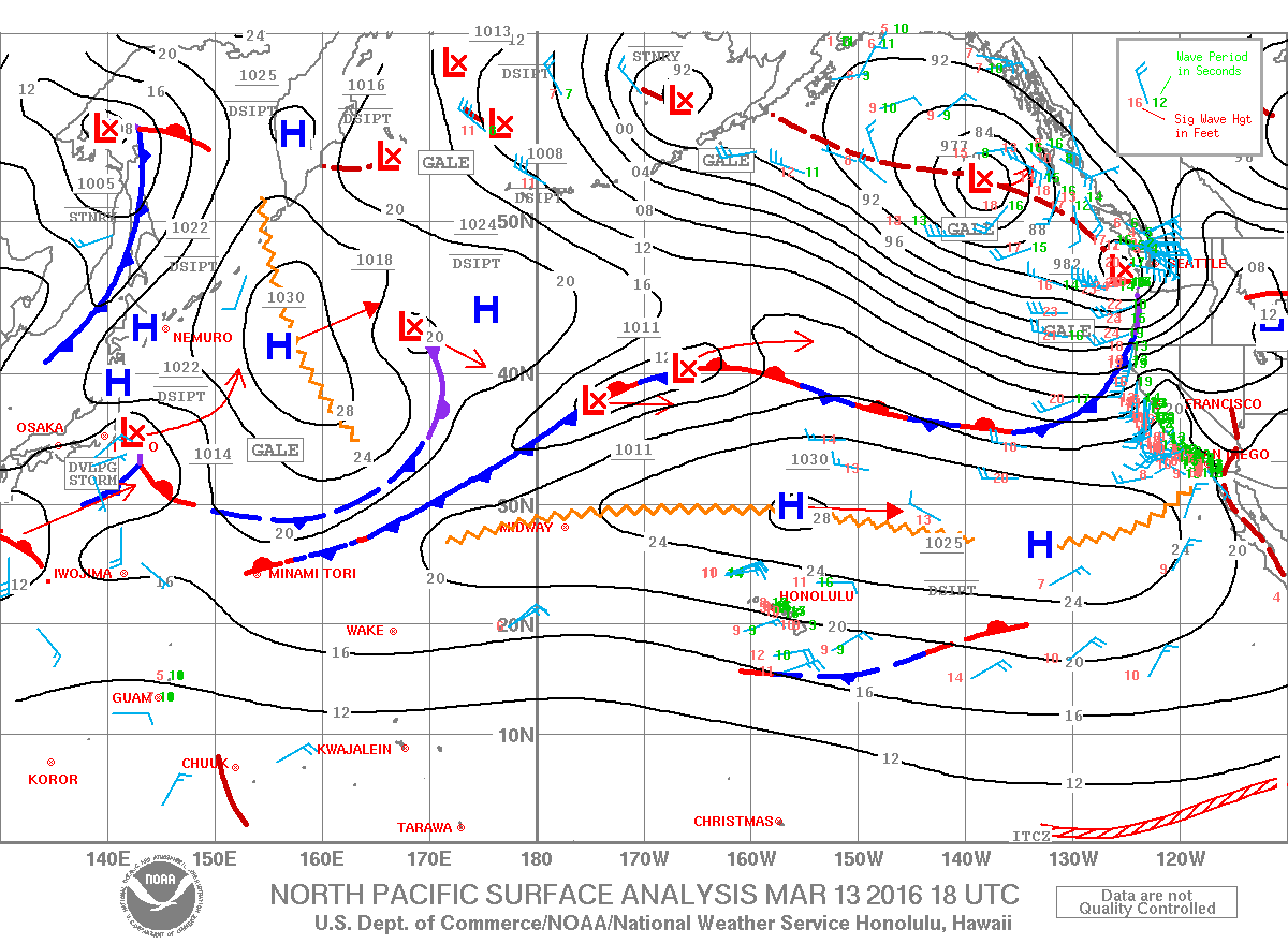
Image: NOAA / NWS

Image: NOAA / NWS
Sponsored Content


