

Swells Peaking Then Fading Today

Image: Rod Miller
Alerts (as of 1:00 a.m.)
A Small Craft Advisory is posted for all Big Island waters through 6 a.m. Monday.
A High Surf Advisory is posted for the north facing shores of the Big Island through 6 a.m. Monday.
**Click directly on the images below to make them larger. Charts include: Big Island projected winds, tides, swell direction & period and expected wave heights.**
 Big Island Surf Forecast
Hilo side: Wave heights for spots exposed to the swell are expected to be chest/overhead today at the best breaks. Spots without direct exposure will be smaller.
Kona side: Wave heights are expected to be waist/chest high today with the best breaks pulling in shoulder high sets.
South: Wave heights are expected to be waist/chest high today with the best breaks pulling in shoulder high sets.
 A new south-southwest bump is peaking Monday at about shoulder high before a slow fading trend begins through mid week. A new swell is expected this weekend.
Our current north-northwest swell is expected to begin fading today. The Kona side will be mostly blocked. Later this week a north-northeast swell is expected to fill in.
Keep in mind, surf heights are measured on the face of the wave from trough to crest. Heights vary from beach to beach, and at the same beach, from break to break.
**Click here for your detailed Big Island weather report.**

Image: NOAA / NWS

Image: NOAA / NWS

Image: NOAA / NWS

Image: NOAA / NWS
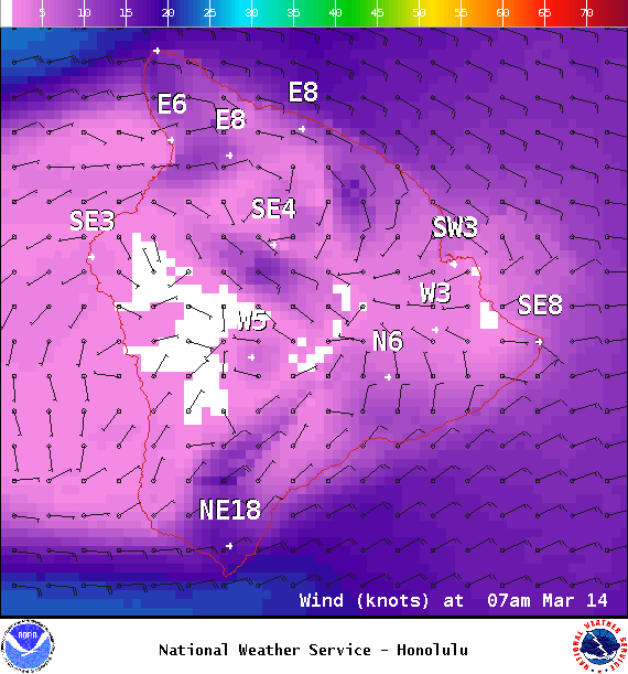
Image: NOAA / NWS
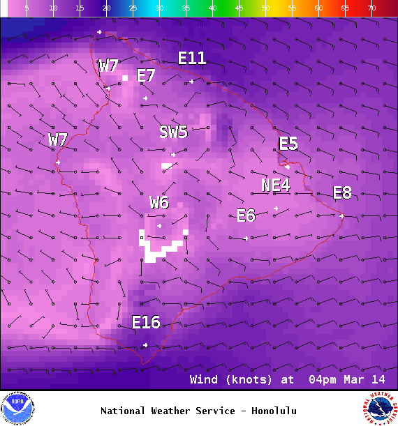
Image: NOAA / NWS
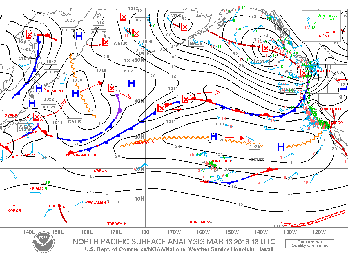
Image: NOAA / NWS
Sponsored Content


