

New Swells Filling in on Sunday

Image: James Grenz
Alerts (as of 1:00 a.m.)
A Small Craft Advisory is posted for leeward waters of the Big Island through 6 p.m. Saturday. The ʻAlenuihāhā channel and windward waters are under a more urgent Gale Warning.
A High Surf Advisory is posted for the east facing shores of the Big Island through 6 a.m. Saturday.
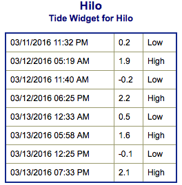
**Click directly on the images below to make them larger. Charts include: Big Island projected winds, tides, swell direction & period and expected wave heights.**
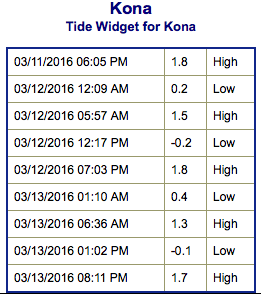 Big Island Surf Forecast
Hilo side: Wave heights for spots exposed to the swell are expected to be head high or more today at the best breaks. Spots without direct exposure will be smaller.
Kona side: Wave heights are expected to be knee/waist high today or less.
South: Wave heights are expected to be knee/waist high today or less.
 Our early season south-southwest bump is all but gone with waves waist high or less today. Another swell is on its heels for Sunday and peaking Monday at about shoulder high.
Our current small short to mid period swell for northwest exposures is fading into Saturday. Another swell is expected to build Sunday and peak in the afternoon at about overhead. The Kona side will be mostly blocked.
Keep in mind, surf heights are measured on the face of the wave from trough to crest. Heights vary from beach to beach, and at the same beach, from break to break.
**Click here for your detailed Big Island weather report.**
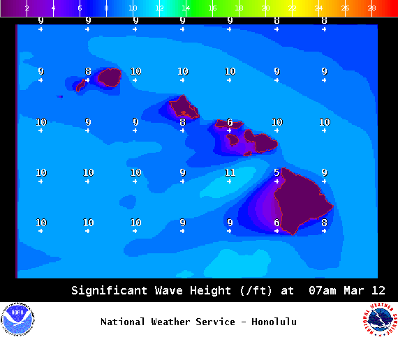
Image: NOAA / NWS
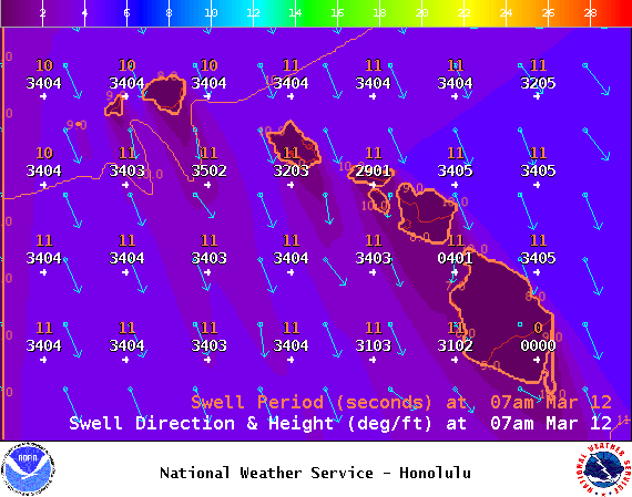
Image: NOAA / NWS
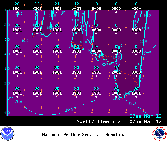
Image: NOAA / NWS

Image: NOAA / NWS
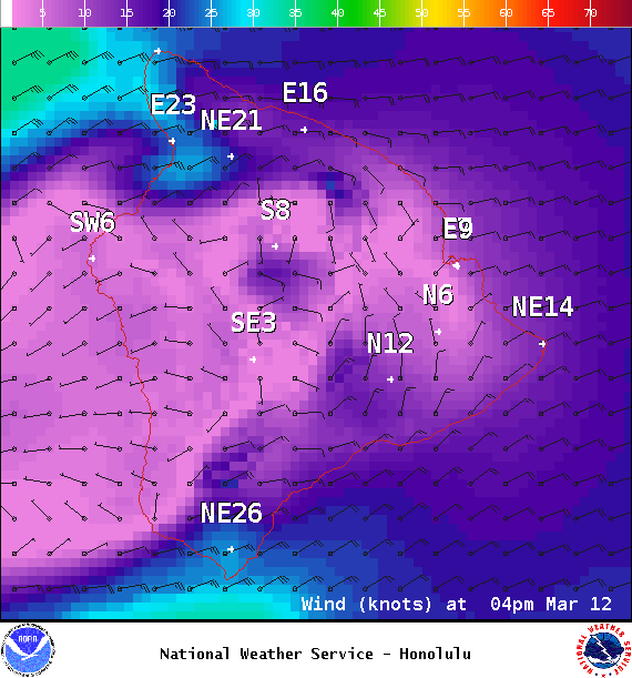
Image: NOAA / NWS
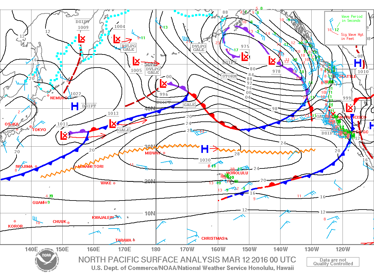
Image: NOAA / NWS
Sponsored Content


