

High Surf Warning Extended Again

Image: James Grenz
Alerts (as of 1:00 a.m.)
A Marine Weather Statement has been issued. A very large northwest A High Surf Warning is posted for the north and west shore of the Big Island through 6 p.m. Friday.
A Small Craft Advisory is in effect through 6 a.m. Friday for all Big Island waters.
**Click directly on the images below to make them larger. Charts include: Big Island projected winds, tides, swell direction & period and expected wave heights.**
 Big Island Surf Forecast
Hilo side: Wave heights for spots exposed to the large swell are expected to be overhead or more at the best breaks. Spots without direct exposure will be smaller.
Kona side: Wave heights are expected to be waist/head high today. The best breaks could get slightly overhead.
South: Wave heights are expected to be waist/head high with the best spots getting bigger on the sets.
Our current large northwest swell is expected to hold pretty steady today and begin to slowly fade over the weekend.
 Solid swells are expected to continue for our northern exposures through the first few days of March. The Big Island will be heavily shadowed but will still see wave heights climbing.
A very small southwest swell is expected to continue through Saturday before fading. A fun size bump could fill in around March 6 – 9 as well.
Keep in mind, surf heights are measured on the face of the wave from trough to crest. Heights vary from beach to beach, and at the same beach, from break to break.
**Click here for your detailed Big Island weather report.**
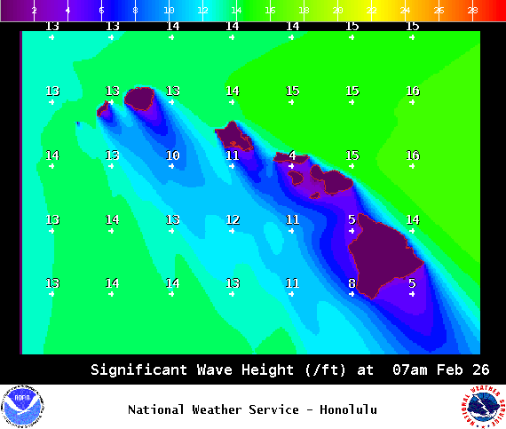
Image: NOAA /NWS
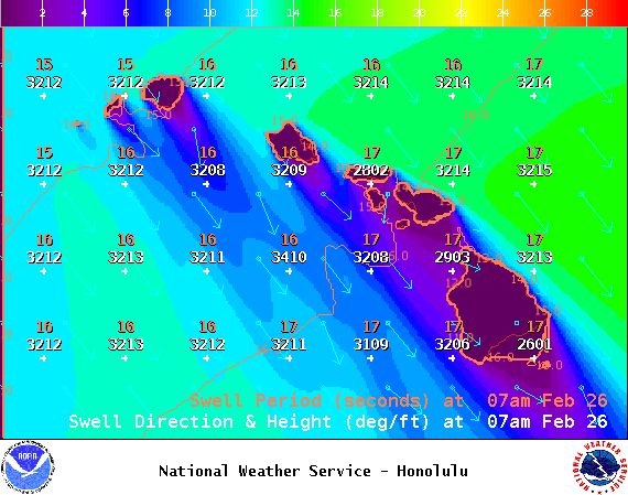
Image: NOAA /NWS
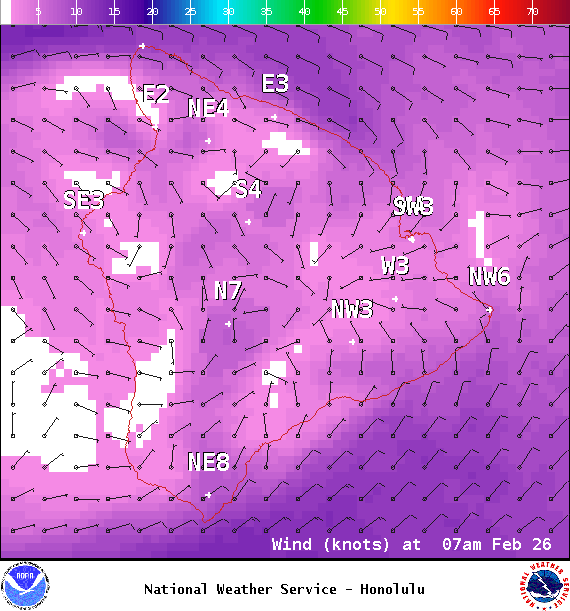
Image: NOAA /NWS

Image: NOAA /NWS
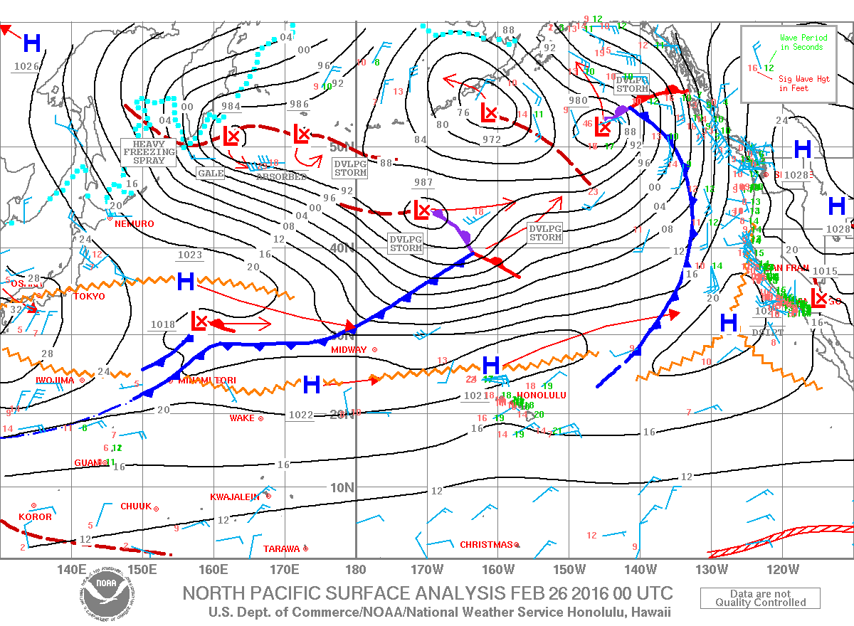
Image: NOAA /NWS
Sponsored Content


