

WNW Shifting, High Surf Advisory Posted

Image: James Grenz
Alerts (as of 1:00 a.m.)
A Small Craft Advisory is in effect for most Big Island waters through 6 p.m. Wednesday. A Gale Warning is posted for waters to the south of the Big Island and the Alenuihaha channel.
A High Surf Advisory is posted for the west side of the Big Island through 6 p.m. Wednesday.
A Gale Warning is posted for all off shore waters.
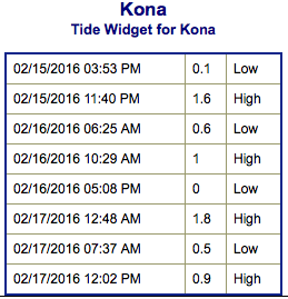
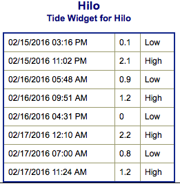
**Click directly on the images below to make them larger. Charts include: Big Island projected winds, tides, swell direction & period and expected wave heights.**
 Big Island Surf Forecast
Hilo side: Wave heights for spots exposed to the shifting swell are expected to be head high today. The best breaks will be a bit overhead on the sets.
Kona side: Wave heights are expected to be waist/shoulder high. The best breaks could get up to head high on the sets.
South: Wave heights shoulder high or more today. The best spots could get head high on the sets.
 Our current west-northwest swell is bringing advisory level surf to the west side of the Big Island. The swell shifts direction and begins to fade Tuesday. Thursday we’re down to just leftovers.
Another fun size west-northwest is possible next weekend.
Not much expected from the SPAC. Just background southern hemi surf expected.
Keep in mind, surf heights are measured on the face of the wave from trough to crest. Heights vary from beach to beach, and at the same beach, from break to break.
**Click here for your detailed Big Island weather report.**
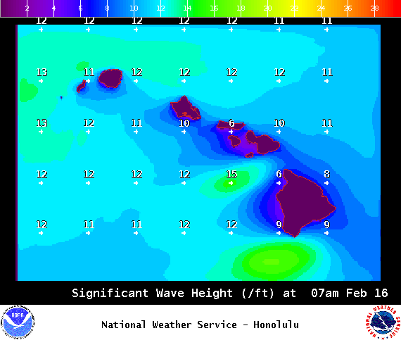
Image: NOAA /NWS
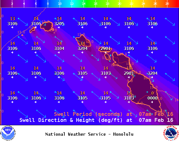
Image: NOAA /NWS
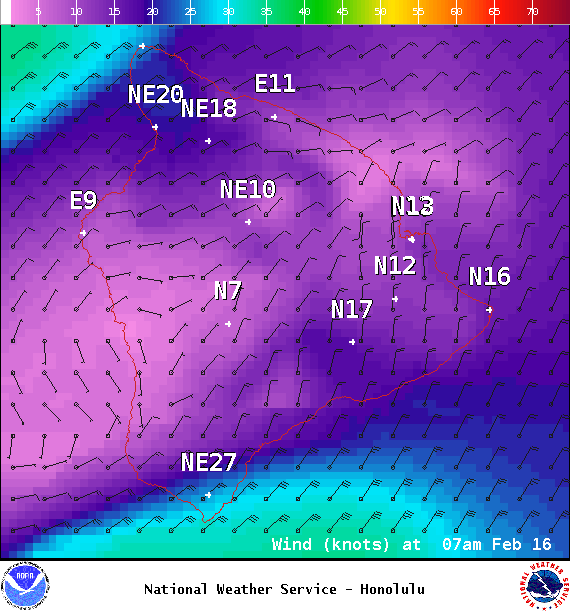
Image: NOAA /NWS
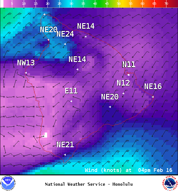
Image: NOAA /NWS
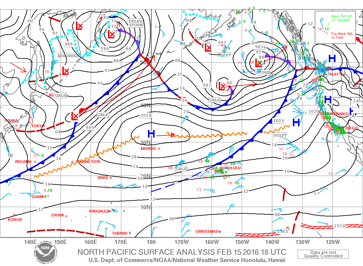
Image: NOAA /NWS
Sponsored Content


