

Breezy Winds, Increased Windward Showers Today

Image: James Grenz
Alerts (as of 1:00 a.m.)
A Small Craft Advisory is in effect for most Big Island waters through 6 p.m. Wednesday. A Gale Warning is posted for waters to the south of the Big Island and the Alenuihaha channel.
A High Surf Advisory is posted for the west side of the Big Island through 6 p.m. Wednesday.
A Gale Warning is posted for all off shore waters.
**Click directly on the images below to make them larger. Charts include: Big Island high/low forecasted temperatures, projected winds, chance of cloud cover, projected localized weather conditions, vog/SO2 forecast and expected wave heights.**
Looking Ahead
A rather breezy trade wind weather pattern can be expected over the next few days. Moisture associated with a weakening frontal boundary will cause an increase in showers through Wednesday especially for windward and mauka areas. The trade winds will be sufficiently strong to blow some showers over to leeward areas at times. Drier weather and lighter trade winds are expected later in the week and on into the weekend.
Today
Today we expect mostly cloudy skies. Showers are likely for windward spots with partly cloudy skies and isolated showers for the Kona side. Winds are out of the northeast from 15 to 25 mph with gusts up to 40mph. High temperatures from 78° to 83°.
UV index at 10 (“very high” exposure level)
Tonight
Northeast winds are expected from 15 to 25 mph tonight with higher gusts. Low temperatures from 65° to 70° with mostly cloudy skies and showers likely for windward areas.
Our Big Island Now Weather homepage always includes daily: Sunrise | Sunset | Moonrise | Moonset | Moon Phase | Live Weather Cams | 5-day Forecast | Current Temperature & Conditions
**Click here for your detailed Big Island surf report.**

Image: NOAA /NWS

Image: NOAA /NWS

Image: NOAA /NWS

Image: NOAA /NWS
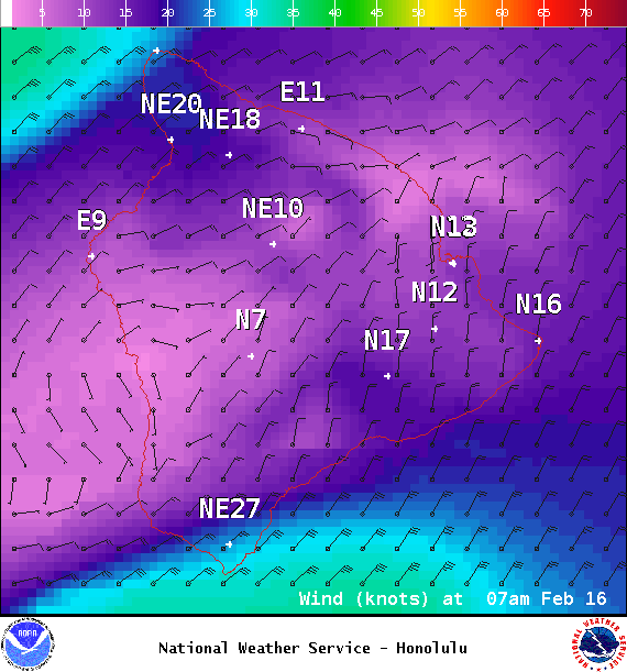
Image: NOAA /NWS
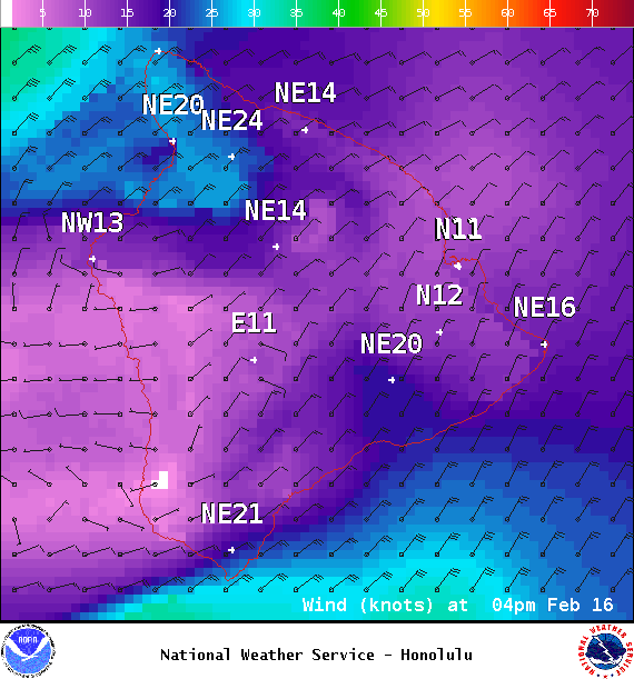
Image: NOAA /NWS
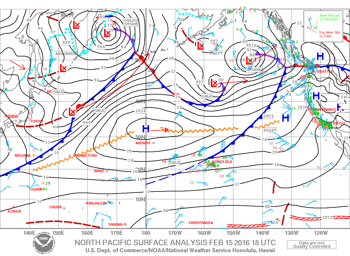
Image: NOAA /NWS
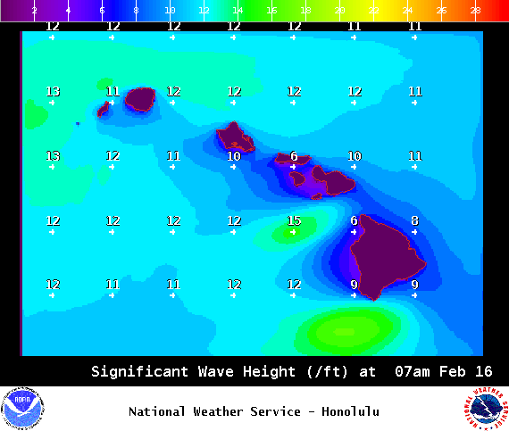
Image: NOAA /NWS
Sponsored Content


