

NW Fading, New Swell Sunday

Image: Lanbert Rudolf
Alerts (as of 1:00 a.m.)
Special Weather Statement – A fast-moving cold front is expected to sweep across the islands this weekend. Late Saturday the front will reach Kauai then progress down the island chain by Sunday morning bringing periods of showers. Very cool, dry and gusty north winds are expected in the wake of the front. Take precautions if you live downwind of high terrain and secure any loose outdoor objects.
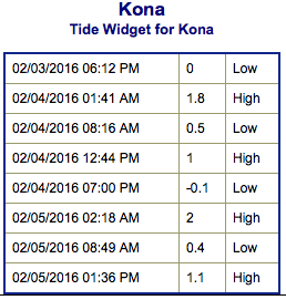
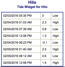
**Click directly on the images below to make them larger. Charts include: Big Island projected winds, tides, swell direction & period and expected wave heights.**
 Big Island Surf Forecast
Hilo side: Wave heights for spots exposed to the wrap are expected to be waist/chest high with the best breaks getting up to head high on the sets.
Kona side: Wave heights are expected to be knee/thigh high today with waist high waves on the sets in the morning.
South: Some spots on the Kona side may get wrap out of the west-northwest up to knee/thigh high.
 The northwest reinforcement is expected to continue fading today. Another swell is expected to fill in Sunday and hold through early next week. A large northwest swell is expected around Thursday the 11th of February.
Not much expected out of the SPAC the next few days. A possible small swell could fill in starting February 9th.
Keep in mind, surf heights are measured on the face of the wave from trough to crest. Heights vary from beach to beach, and at the same beach, from break to break.
**Click here for your detailed Big Island weather report.**
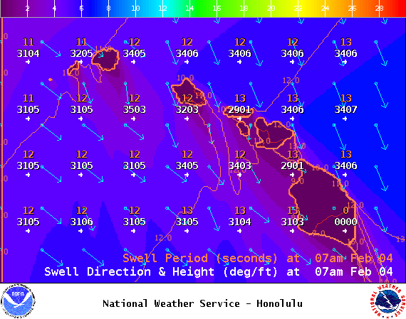
Image: NOAA / NWS
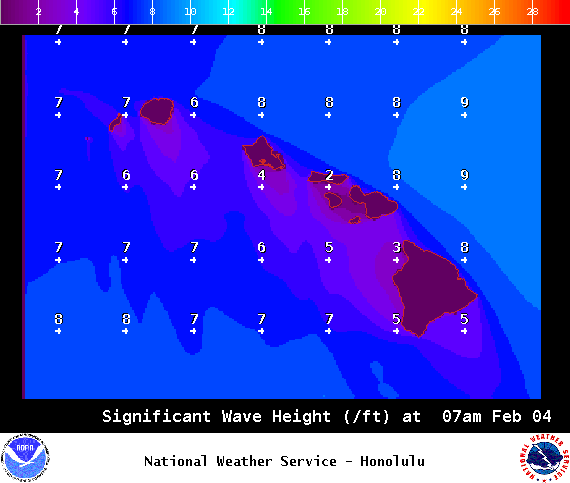
Image: NOAA / NWS
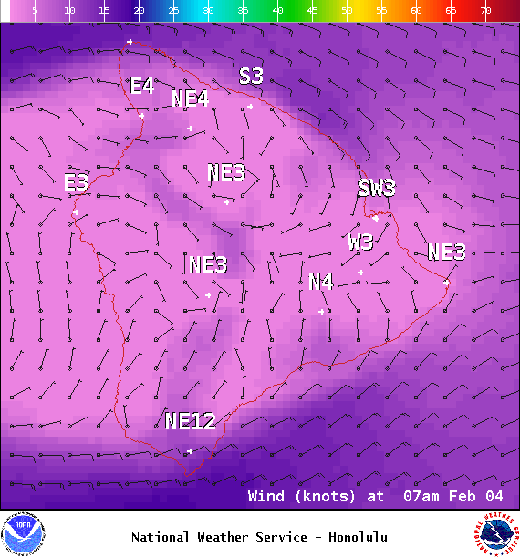
Image: NOAA / NWS
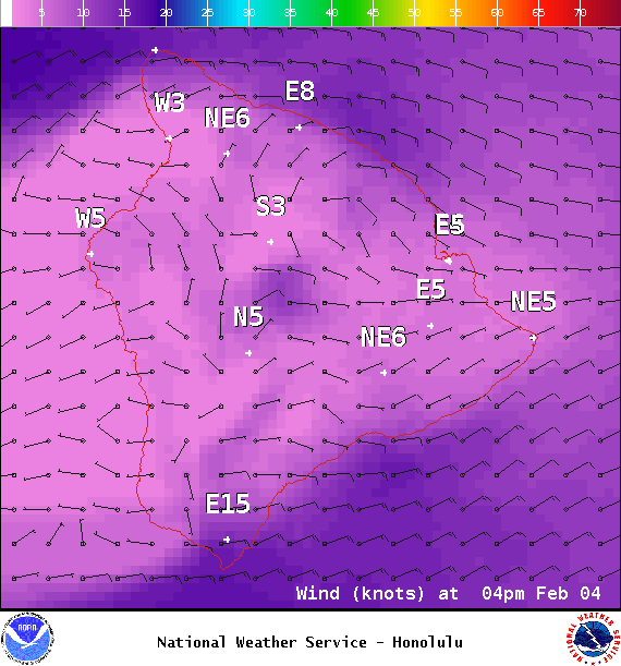
Image: NOAA / NWS
Sponsored Content


