

WNW Peaks Today, New Swell Fills in Late

Image: James Grenz
Alerts (as of 1:00 a.m.)
A Small Craft Advisory is posted through 6 a.m. Wednesday for windward coastal waters of the Big Island.
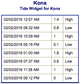
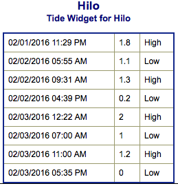
**Click directly on the images below to make them larger. Charts include: Big Island projected winds, tides, swell direction & period and expected wave heights.**
 Big Island Surf Forecast
Hilo side: Wave heights for spots exposed to the wrap are expected to be waist/chest/head high.
Kona side: Wave heights are expected to be waist/chest high today.
South: Some spots on the Kona side may get wrap out of the west-northwest up to waist/chest high.
 Our current west-northwest swell is expected to peak Tuesday before fading. A northwest reinforcement is expected late Tuesday with most of the energy coming through Wednesday.
Not much expected out of the SPAC the next few days. A possible small swell could fill in starting February 8th.
Keep in mind, surf heights are measured on the face of the wave from trough to crest. Heights vary from beach to beach, and at the same beach, from break to break.
**Click here for your detailed Big Island weather report.**

Image: NOAA / NWS
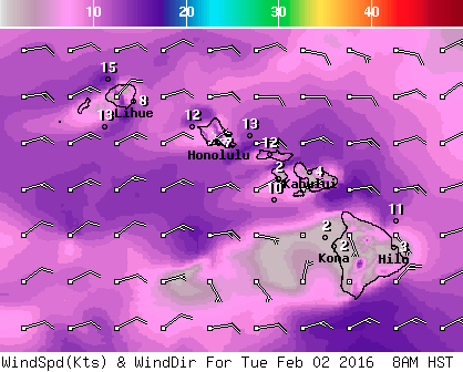
Image: NOAA / NWS
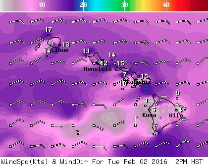
Image: NOAA / NWS
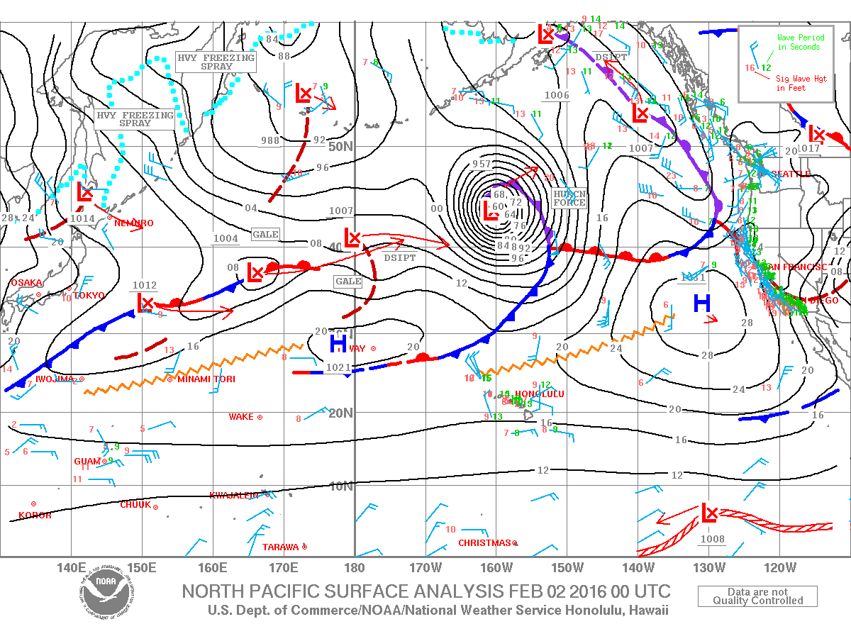
Image: NOAA / NWS
Sponsored Content


