

High Surf Advisory in Effect for Kona Side

Image: James Grenz
Alerts (as of 1:00 a.m.)
A High Surf Advisory is posted through 6 p.m. Friday for the west side of the Big Island.
A Small Craft Advisory is in effect for the Alenuihaha channel and windward waters through 6 a.m. Friday.
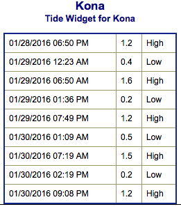
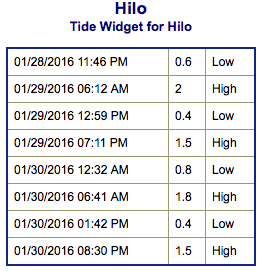
**Click directly on the images below to make them larger. Charts include: Big Island projected winds, tides, swell direction & period and expected wave heights.**
 Big Island Surf Forecast
Hilo side: Wave heights for spots exposed to the wrap are expected to be waist/shoulder high. We could see head high waves on the sets at the best breaks.
Kona side: Wave heights are expected to be waist / chest high today. On the sets the best spots with west-northwestern exposure could see waves in the shoulder high range.
South: Some spots on the Kona side may get wrap out of the west-northwest up to waist/chest high and standout spots will see shoulder high waves from time to time.
 A High Surf Advisory remains in effect for west facing shores of the Big Island. The northwest swell will continue to gradually fade and should drop below advisory levels by late Friday. Another large northwest swell is expected to arrive Sunday night and likely pushing surf heights back into advisory levels for north and west facing shores of most islands through early next week.
Not much expected out of the SPAC the next few days. A possible small swell could fill in February 8th.
Keep in mind, surf heights are measured on the face of the wave from trough to crest. Heights vary from beach to beach, and at the same beach, from break to break.
**Click here for your detailed Big Island weather report.**
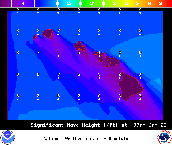
Image: NOAA / NWS
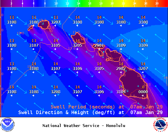
Image: NOAA / NWS
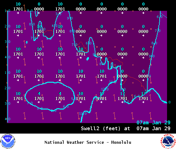
Image: NOAA / NWS
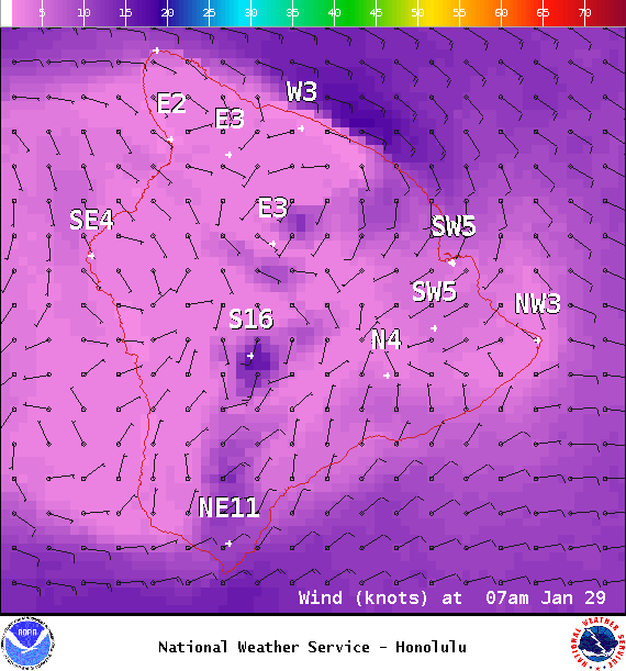
Image: NOAA / NWS
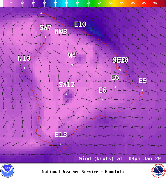
Image: NOAA / NWS
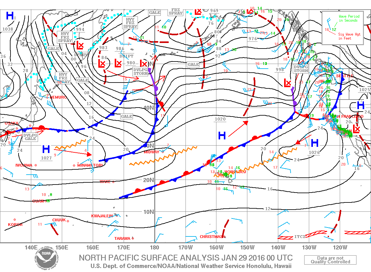
Image: NOAA / NWS
Sponsored Content


