High Surf Advisory Posted for Kona Side
Alerts (as of 1:00 a.m.)
A High Surf Advisory is posted through 6 a.m. Tuesday for the west side of the Big Island.
A Small Craft Advisory is in effect for the Alenuihaha channel and windward waters through 6 a.m. Tuesday.
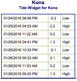
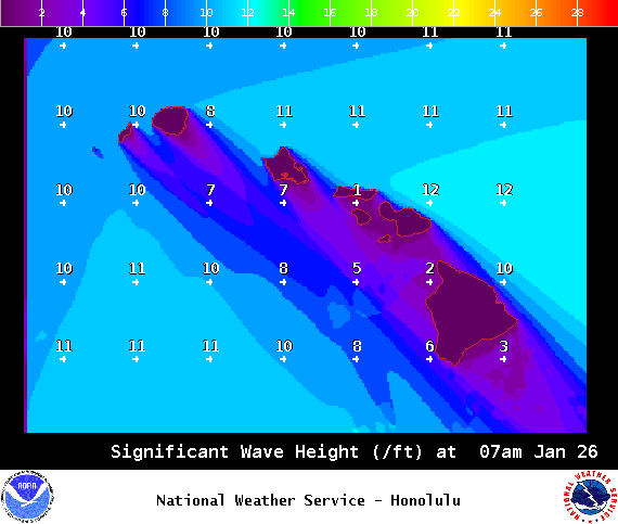
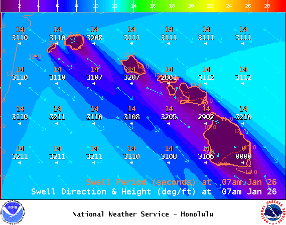
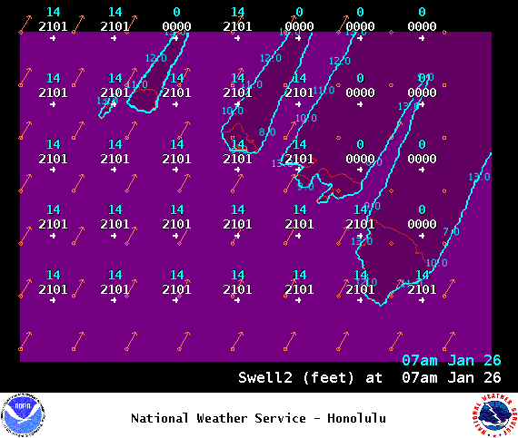
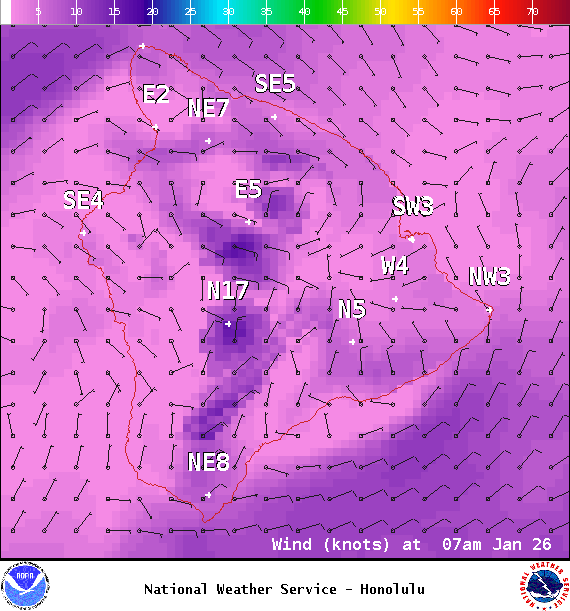
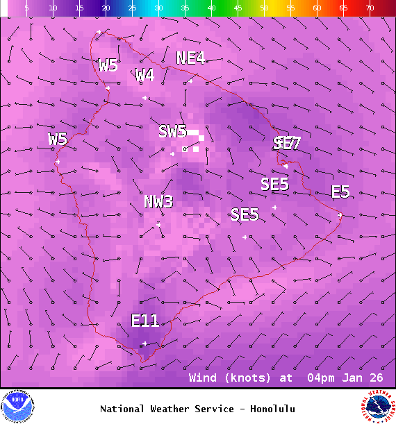
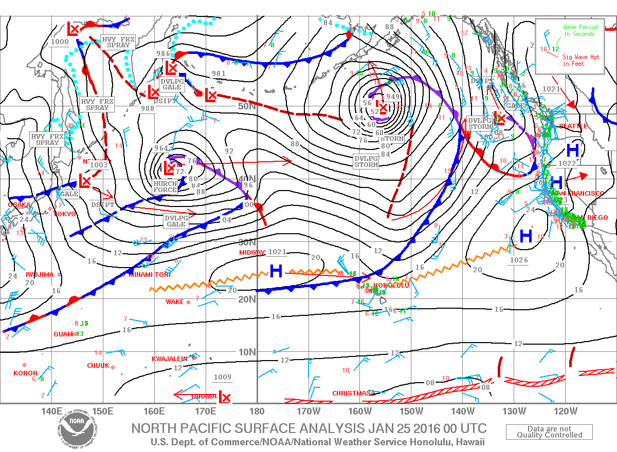
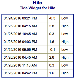
**Click directly on the images below to make them larger. Charts include: Big Island projected winds, tides, swell direction & period and expected wave heights.**
Hilo side: Wave heights for spots exposed to the wrap are expected to be overhead to double overhead at the best breaks on the sets.
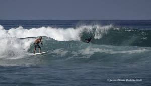
Kona side: Wave heights are expected to be well overhead on the sets for the best spots with west-northwestern exposure. Out of the south-southwest ankle/thigh high waves.
South: Out of the southwest knee/thigh high today. Some spots around South Point may get wrap out of the west-northwest.
 Our current large west-northwest swell is building through Monday, resulting in warning-level surf along north and west facing shores, and advisory-level for the west facing shores of the Big Island. The swell begins to fade Tuesday.
Trade swell is expected to remain pretty small at waist high or less.
Our current south-southwest is easing early this week.
Keep in mind, surf heights are measured on the face of the wave from trough to crest. Heights vary from beach to beach, and at the same beach, from break to break.


